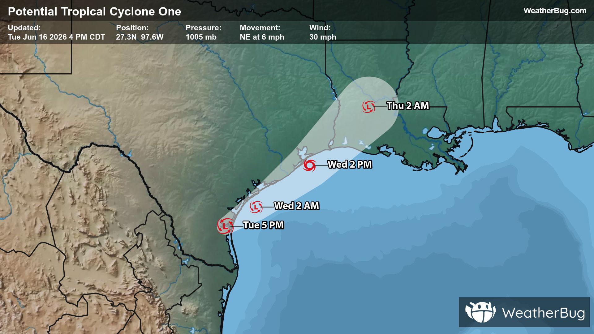
Potential Tropical Cyclone One May Become Atlantic's First Named Storm
A disorganized Potential Tropical Cyclone One may become the Atlantic season's first named storm on Wednesday.
Read More

Windy
Hi

Mostly cloudy with probable rain. Chance of precipitation 65%. High temperature around 72F. Dew point will be around 43F with an average humidity of 46%. Winds will be 18 mph from the W.
Lo

Windy cooler. Mostly cloudy in the evening then becoming partly cloudy. Chance of thunderstorms early in the evening then rain showers likely and slight chance of thunderstorms late in the evening. Slight chance of rain showers after midnight. Lows in the upper 40s. Northwest winds 20 to 30 mph decreasing to 10 to 15 mph after midnight. Gusts up to 45 mph. Chance of precipitation 70 percent.


Closest strike in the last 30 minutes:5.7 miles
Stay Alert!
A disorganized Potential Tropical Cyclone One may become the Atlantic season's first named storm on Wednesday.


