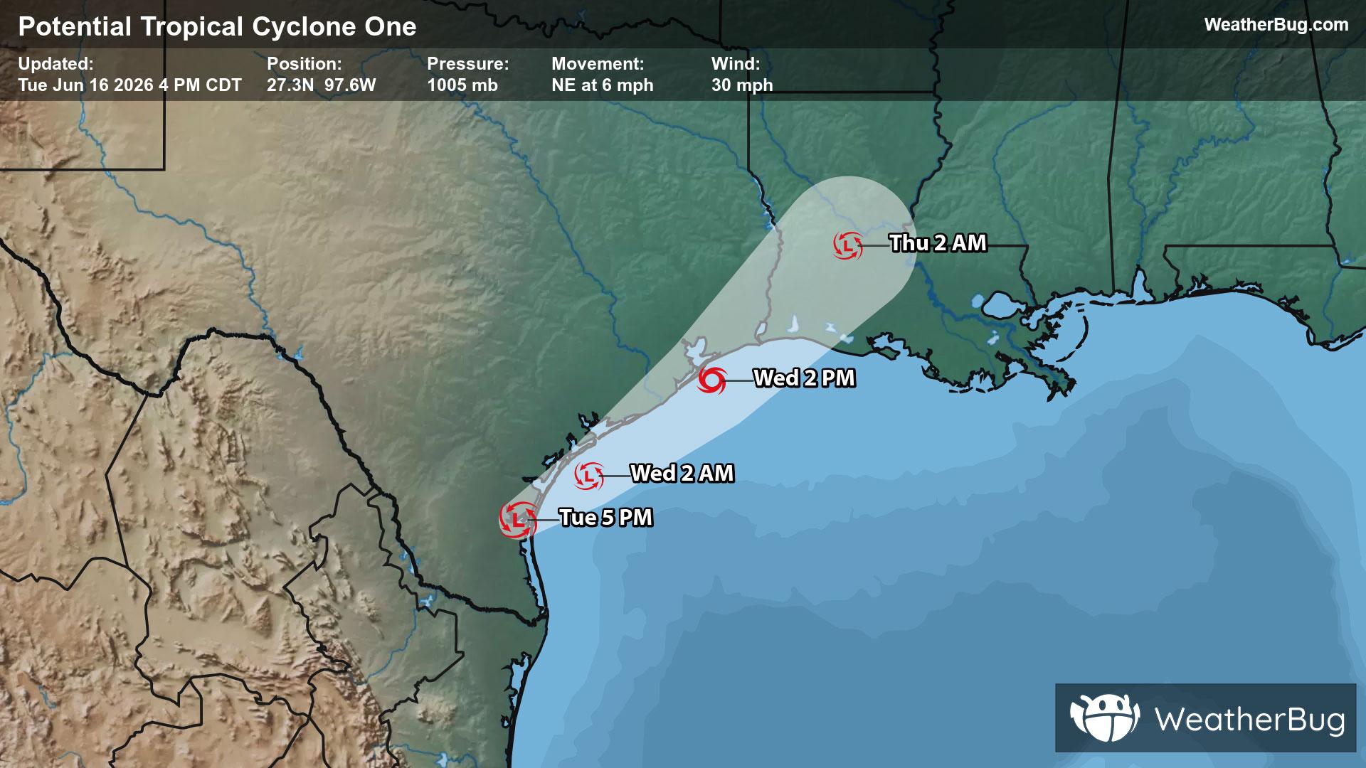
Potential Tropical Cyclone One May Become Atlantic's First Named Storm
A disorganized Potential Tropical Cyclone One may become the Atlantic season's first named storm on Wednesday.
Read More

Mostly Sunny
Hi

Mostly sunny and warmer. Near steady temperature in the lower 90s. Northwest winds 15 to 20 mph with gusts up to 30 mph.
Lo

Mostly clear. A slight chance of dry thunderstorms after midnight. Lows in the upper 50s. North winds 10 to 15 mph becoming west 15 to 20 mph after midnight.


Closest strike in the last 30 minutes:234.8 miles
No Lightning Nearby
A disorganized Potential Tropical Cyclone One may become the Atlantic season's first named storm on Wednesday.


