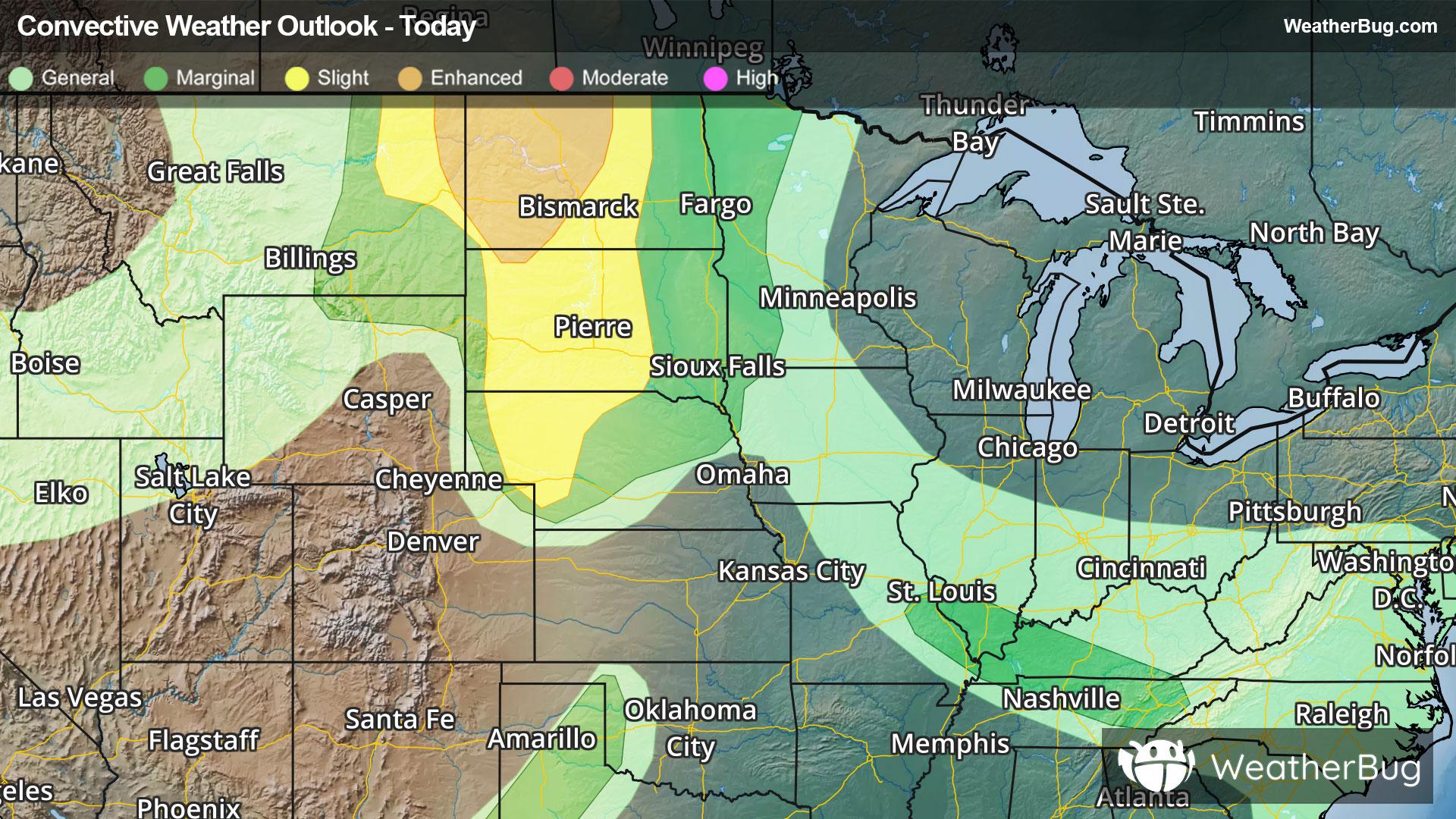
Storms Bring Flood and Severe Risk to High Plains
A robust low pressure system will continue to deliver severe weather to the High Plains tonight.
Read More
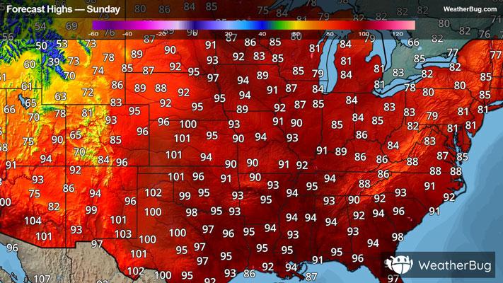
73degrees Fahrenheit

Feels like:73°
Hi:95°Lo:65°
Partly Cloudy
Lo

Mostly cloudy with a chance of showers and thunderstorms in the evening then mostly clear after midnight. Lows in the upper 50s. South winds 15 to 20 mph with gusts up to 30 mph becoming west 5 to 10 mph after midnight. Chance of rain 50 percent.
Hi

Sunny hot with highs in the upper 80s. West winds 10 to 15 mph becoming southwest in the afternoon.


Closest strike in the last 30 minutes:15.6 miles
Storms Approaching
A robust low pressure system will continue to deliver severe weather to the High Plains tonight.