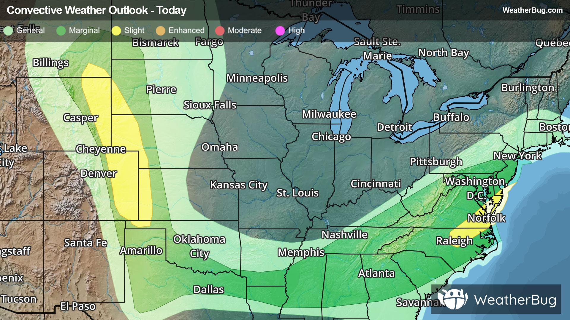
Drenching Rain, Powerful Storms Pepper Eastern U.S., Near Front Range
Heavy rainfall and big thunderstorms could pepper the Eastern U.S. to begin the work week, while similar acitivity may occur near the Front Range.
Read More
68degrees Fahrenheit

Feels like:68°
Hi:79°Lo:64°
70% Chance Rain Showers
Lo

Showers with thunderstorms likely this evening then showers likely with a slight chance of thunderstorms after midnight. Patchy fog after midnight. Lows in the lower 60s. Southwest winds 5 to 10 mph. Chance of rain 90 percent.
Hi

Patchy fog in the morning. Partly sunny with showers likely in the morning then mostly sunny in the afternoon. Highs in the upper 70s. Northwest winds 5 to 10 mph. Chance of rain 60 percent.

Closest strike in the last 30 minutes:212.3 miles
No Lightning Nearby


