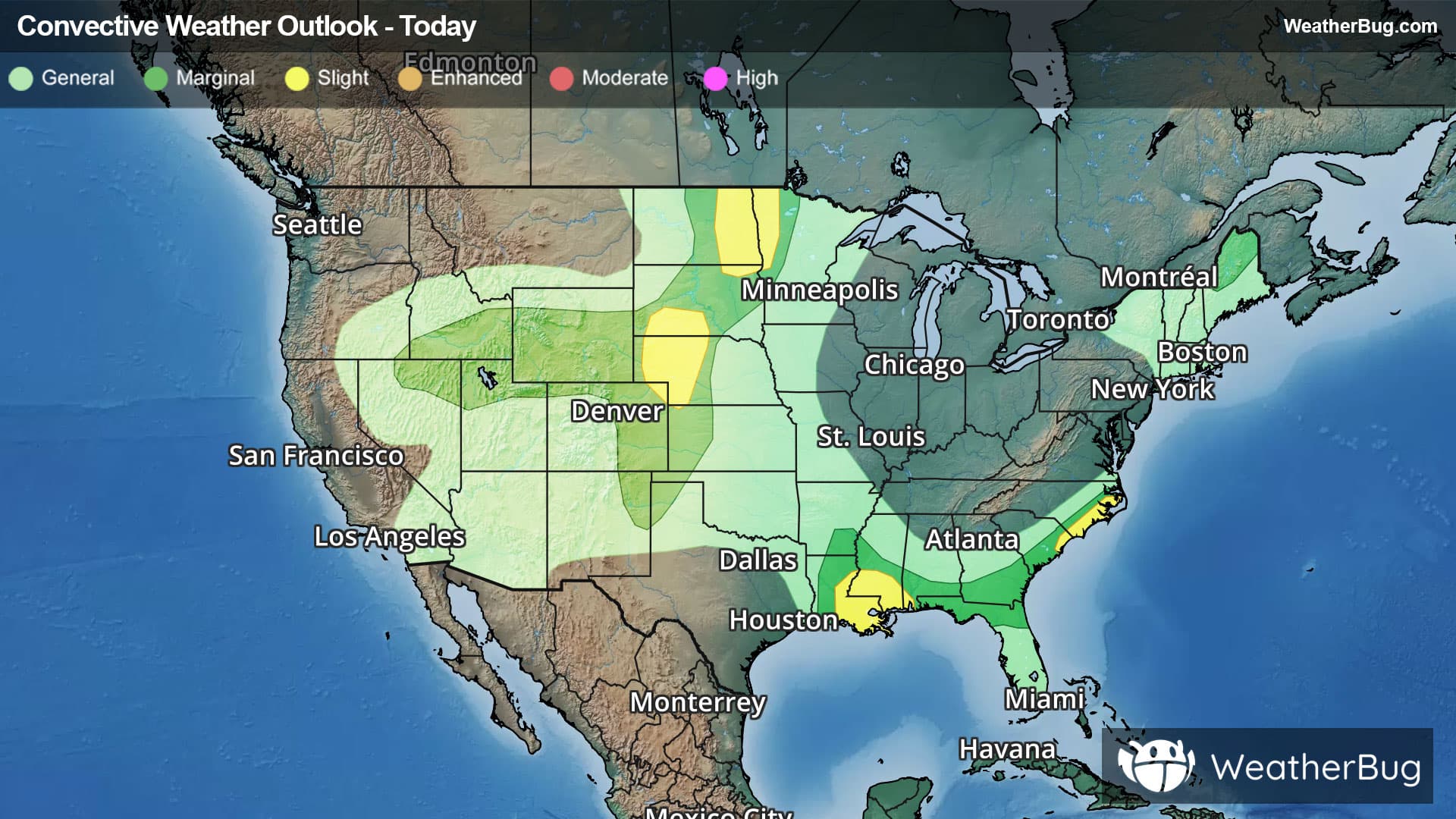
There is a Marginal Severe Storm Risk for your location. Continue reading for today's outlook from the National Weather Service's Storm Prediction Center.
--------------------
National Severe Storm Outlook
THERE IS A SLIGHT RISK OF SEVERE THUNDERSTORMS ACROSS PARTS OF THE MID MISSOURI AND MID MISSISSIPPI VALLEYS
SUMMARY
Thunderstorms with severe wind gusts and hail will be possible this afternoon and evening across parts of the mid Missouri and mid Mississippi Valleys. Isolated severe gusts will also be possible in parts of the central Plains and from the Ohio Valley to the Mid-Atlantic.
Mid Missouri and mid Mississippi Valleys
A broad anticyclonic flow pattern will be in place over much of the central U.S. today, as a subtle embedded shortwave trough moves through the mid Missouri Valley. Ahead of this feature, a quasi-stationary front will be in place from southern Iowa east-southeastward into north-central Illinois. This boundary will be the focus for convective development this afternoon. Surface dewpoints along the boundary will be in the 70s F, which will result in strong destabilization by afternoon. Surface-based convective initiation is expected along the instability gradient during the late afternoon to the south of Omaha. From these initial storms, a line is expected to organize and move eastward across south-central Iowa and far northern Missouri during the late afternoon and early evening.
RAP forecast soundings ahead of the line at 00Z from Des Moines southward into far northern Missouri have MLCAPE in the 2000 to 3500 J/kg range. Some directional shear is present in the low-levels, and 0-6 km shear is in the 30 to 35 knot range. This environment will be favorable for bowing line segments capable of severe wind gusts. An embedded supercell with a hail threat will also be possible. The severe threat is expected to move eastward into northwest and north-central Illinois during the evening.
Central Plains
Southwesterly mid-level flow will be in place today over much of the western and central U.S. A subtle shortwave trough will move northeastward into the central High Plains. Large-scale ascent associated with the trough and topographic lift in the foothills of the Rockies will be favorable for scattered convective initiation by early afternoon. Thunderstorms will move northeastward into the central High Plains and into a moderately unstable airmass. Some RAP forecast soundings in east-central Colorado during the late afternoon have 0-6 km shear around 25 knots with low to mid-level lapse rates exceeding 7 C/km. This will likely support isolated severe wind gusts and hail.
Ohio Valley/Central Appalachians/Mid-Atlantic
West-northwesterly mid-level flow will be in place today over much of the northeastern U.S. At the surface, an axis of moderate instability will develop by afternoon from the Ohio Valley east-southeastward into the Mid-Atlantic. Along and near the instability axis, low-level convergence will be the primary focus for convective initiation. Near and downstream of these pockets of convergence, isolated to scattered thunderstorms are expected to develop. The moderate instability with precipitable water values in the 2 to 2.2 inch range should support a threat for isolated severe wet downbursts.