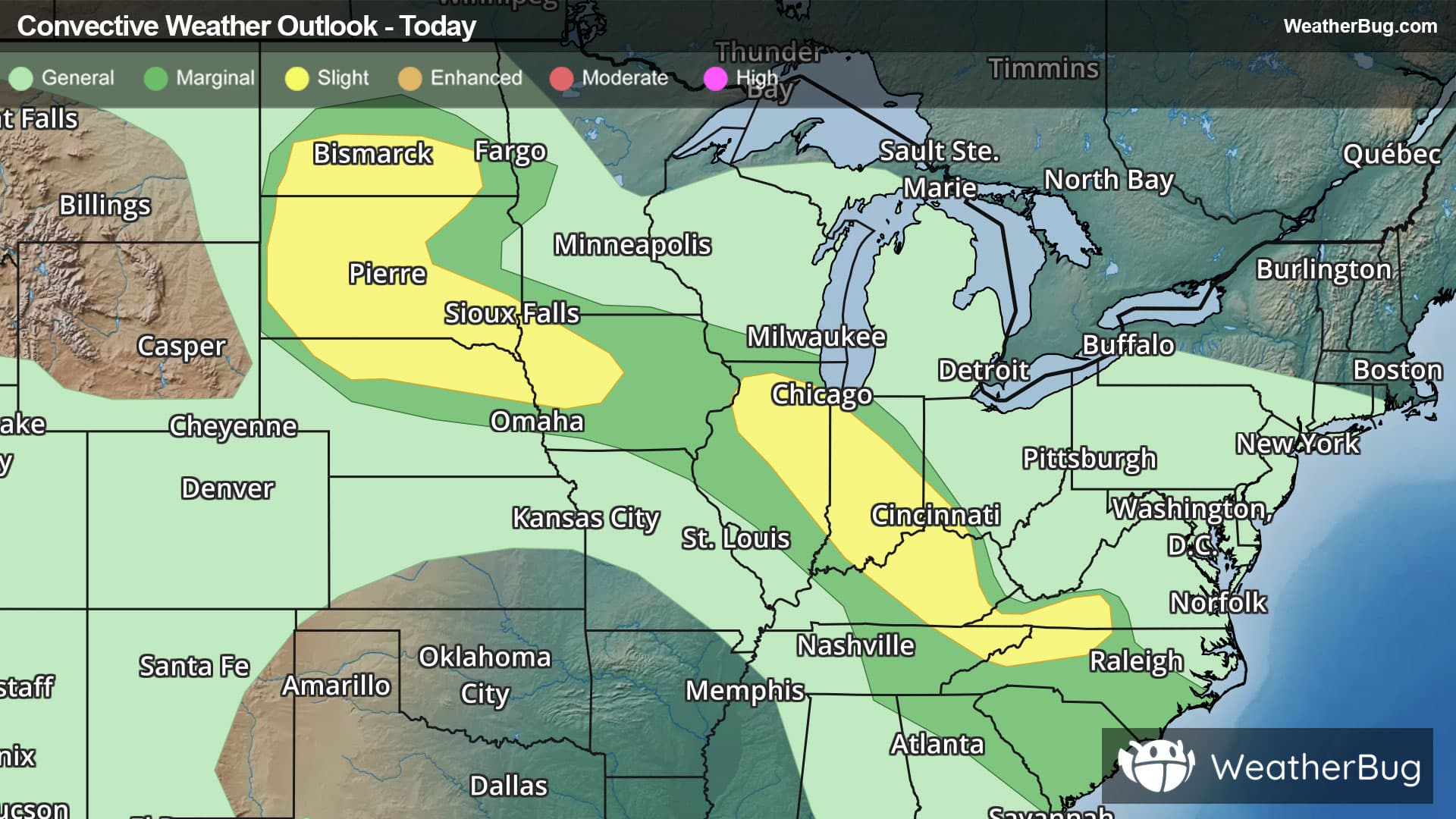
Severe Storms Thrash Great Plains to Mid-Atlantic
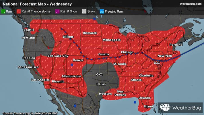
Multiple severe thunderstorm systems are expected to form today, running from the northern Plains to the Mid-Atlantic.
Read More
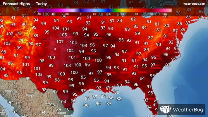
# HEADLINE -------------------- HEAT ADVISORY NOW IN EFFECT UNTIL 7 PM CDT /8 PM EDT/ FRIDAY # DETAILS -------------------- WHAT Very hot with peak heat index values up to near 110 degrees. WHERE All of southwest Indiana, western Kentucky, southeast Missouri, and southern Illinois excepting Perry County IL, where a Warning is in effect. WHEN Until 7 PM CDT /8 PM EDT/ Friday. IMPACTS Hot temperatures and high humidity may cause heat illnesses. ADDITIONAL DETAILS Daily heat index values will remain elevated in the triple digits into and through the weekend. ISSUED AT Wednesday, August 12, 2026 at 12:43 AM CDT ISSUED BY National Weather Service Paducah KY HEADER URGENT - WEATHER MESSAGE # PRECAUTIONARY/PREPAREDNESS ACTIONS -------------------- Drink plenty of fluids, stay in an air-conditioned room, stay out of the sun, and check up on relatives and neighbors. # AREAS AFFECTED -------------------- Bollinger, Calloway, Christian, Hickman, Pulaski, Scott, Williamson, Alexander, Ballard, Butler, Caldwell, Cape Girardeau, Carlisle, Carter, Crittenden, Daviess, Edwards, Franklin, Fulton, Gallatin, Gibson, Graves, Hamilton, Hardin, Henderson, Hopkins, Jackson, Jefferson, Johnson, Livingston, Lyon, Marshall, Massac, McCracken, McLean, Mississippi, Muhlenberg, New Madrid, Perry MO, Pike, Pope, Posey, Ripley, Saline, Spencer, Stoddard, Todd, Trigg, Union, Union KY, Vanderburgh, Wabash, Warrick, Wayne IL, Wayne MO, Webster, White Including the cities of Boonville, Van Buren, Shawneetown, Hickman, West Frankfort, Eddyville, Doniphan, Jonesboro, Cadiz, Fairfield, Morganfield, Smithland, Hopkinsville, Mount Vernon, Marble Hill, Jackson, McLeansboro, Henderson, Princeton, Albion, Metropolis, Elkton, Madisonville, Vienna, Bardwell, Poplar Bluff, Carmi, New Madrid, Harrisburg, Fort Branch, Poseyville, Murray, Charleston, Perryville, Petersburg, Greenville, Golconda, Cape Girardeau, Murphysboro, Mound City, Bloomfield, Carbondale, Piedmont, Mount Carmel, Clinton, Sikeston, Mayfield, Elizabethtown, Dixon, Evansville, Owensboro, Marion, Calhoun, Cairo, Rockport, Paducah, Benton, Herrin, and Wickliffe
There is a Marginal Severe Storm Risk for your location. Continue reading for today's outlook from the National Weather Service's Storm Prediction Center. -------------------- National Severe Storm Outlook THERE IS A SLIGHT RISK OF SEVERE THUNDERSTORMS ACROSS PORTIONS OF THE DAKOTAS AND NORTHERN NEBRASKA...AND FROM NORTHERN ILLINOIS TO WESTERN NORTH CAROLINA SUMMARY Severe storms posing a risk for large hail and damaging winds are possible into tonight from the Dakotas into the Midwest. IL to western NC A bowing line of storms from central KY into northeast TN/western VA will continue to develop southeast the next few hours. A damaging wind risk will continue with this activity in the short term. However, convection should begin to wane with southeast extent into the Appalachians as instability wanes and loss of daytime heating results in a cooling boundary layer. Convection across KY and perhaps portions of eastern TN may remain stronger into the evening given the large reservoir of instability ahead of storms, but overall expected is for a gradual weakening trend. Reference MCD 1939 for more short term details. Overnight, most CAMs guidance suggests convection will redevelop within a warm advection regime across parts of northern IL into IN and the Ohio Valley. The 00z DVN and ILX RAOBs depict an impressive thermodynamic and kinematic environment. Midlevel lapse rates near 8 C/km amid 40 kt effective shear and MUCAPE near 5000 J/kg with weak inhibition suggests any storms developing within this environment could be severe. Convection may develop along the instability gradient and large hail is possible. If sufficient clustering occurs, damaging wind also could be possible. As a result, the Slight (level 2 of 5) risk as been expanded back to the northwest across northern IL. Dakotas into IA Supercells across the western Dakotas and far northern NE will continue to pose a risk for very large hail and damaging gusts the next few hours. See MCD 1938 for short term information on severe risk. It is uncertain how convection will evolve longer-term during the overnight hours. Some guidance suggests clustering will occur and an MCS could develop, moving east/southeast across SD/northern NE and perhaps as far east as IA. Ample west/northwesterly flow aloft is in place, along with a very moist airmass with strong to extreme instability. If sufficient clustering can occur, MCS development/maintenance seems plausible. have expanded the Slight (level 2 of 5) risk eastward across SD/NE into western IA border vicinity for this possibility.
Pollen Index: 9 Pollen Level: medium-high Predominant Pollen: Grass and Nettle. Based on past pollen counts and expected weather conditions, pollen levels for Wednesday will be falling but will remain in the high range. This lowering of pollen concentrations is a result of falling temperatures, rising humidity, and expected precipitation in the morning and evening which tends to wash pollen out of the air.