Nor'easter Aftermath: What the East Coast Storm Left Behind
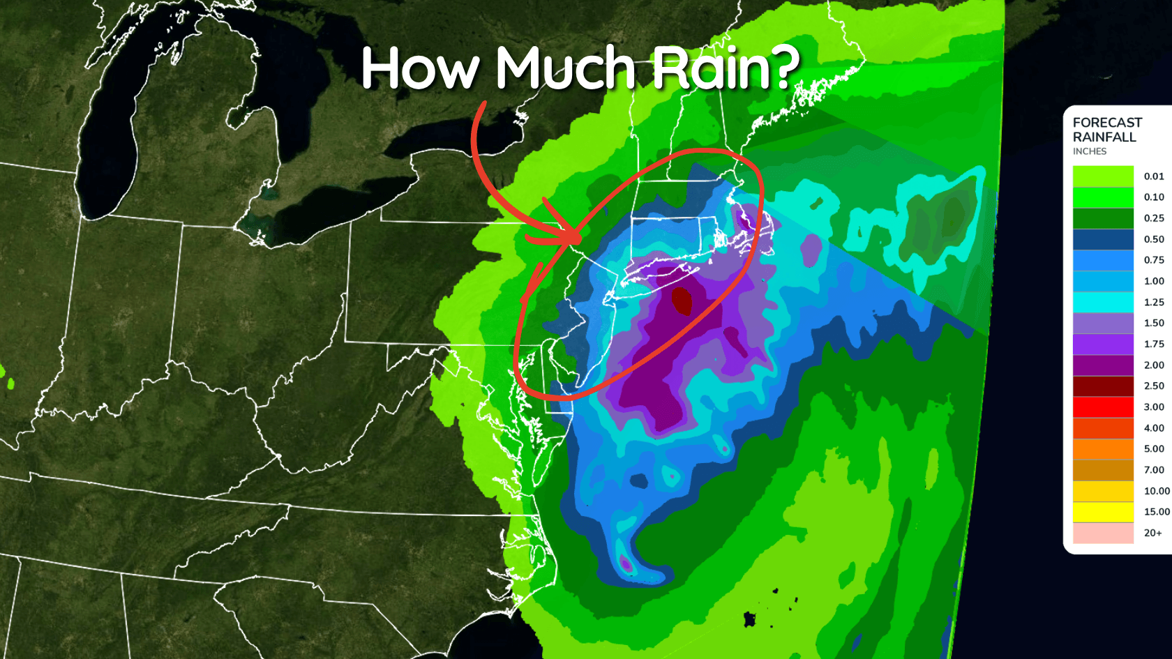
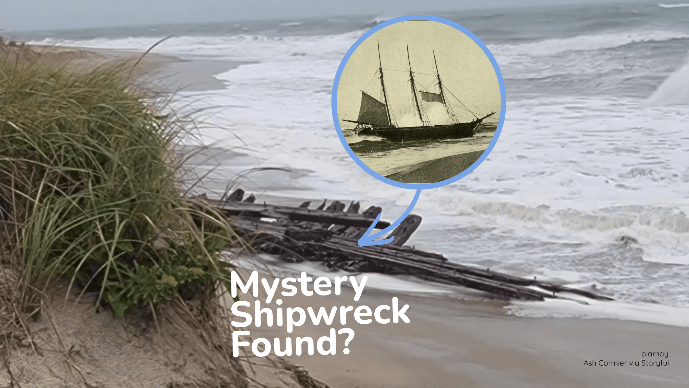
The September storm flooded communities, damaged a major coastal highway and uncovered a possible 1884 shipwreck.
Read More
A Weather Alert has been issued for a nearby area. While your current location is outside of the impacted area, please stay alert and monitor weather conditions. # HEADLINE -------------------- FLASH FLOOD WARNING REMAINS IN EFFECT UNTIL 345 AM MDT EARLY THIS MORNING FOR SOUTHEASTERN LEA COUNTY # SUMMARY -------------------- At 213 AM MDT, Doppler radar and automated rain gauges indicated thunderstorms producing heavy rain across the warned area. Between 0.5 and 2 inches of rain have fallen. Additional rainfall amounts up to 0.5 inches are possible in the warned area. Flash flooding is ongoing or expected to begin shortly. # DETAILS -------------------- HAZARD Flash flooding caused by thunderstorms. SOURCE Radar and automated gauges. IMPACT Flash flooding of small creeks and streams, urban areas, highways, streets and underpasses as well as other poor drainage and low-lying areas. SOME LOCATIONS THAT WILL EXPERIENCE FLASH FLOODING INCLUDE Eunice, Eunice Airport and Oil Center. ISSUED AT Tuesday, September 29, 2026 at 2:13 AM MDT ISSUED BY National Weather Service Midland/Odessa TX HEADER Flash Flood Statement # PRECAUTIONARY/PREPAREDNESS ACTIONS -------------------- Turn around, don't drown when encountering flooded roads. Most flood deaths occur in vehicles. Be especially cautious at night when it is harder to recognize the dangers of flooding. # AREAS AFFECTED -------------------- Lea NM
# HEADLINE -------------------- FLOOD WATCH REMAINS IN EFFECT THROUGH WEDNESDAY MORNING # DETAILS -------------------- WHAT Flash flooding caused by excessive rainfall continues to be possible. WHERE Portions of southeast New Mexico, including the following areas, Central Lea, Eddy County Plains, Guadalupe Mountains of Eddy County, Northern Lea and Southern Lea and southwest Texas, including the following areas, Eastern Culberson, Guadalupe Mountains Above 7000 Feet, Guadalupe and Delaware Mountains and Van Horn and Highway 54 Corridor. WHEN Through Wednesday morning. IMPACTS Excessive runoff may result in flooding of rivers, creeks, streams, and other low-lying and flood-prone locations. Flooding may occur in poor drainage and urban areas. Area creeks and streams are running high and could flood with more heavy rain. ADDITIONAL DETAILS - Tropical moisture from the remnants of Hurricane Polo will overspread the region, which will promote heavy rain across southeast New Mexico and far west Texas. Soils in these areas remain saturated following heavy rains from last week, which will further promote the risk for flash flooding. - http://www.weather.gov/safety/flood ISSUED AT Tuesday, September 29, 2026 at 12:33 AM MDT ISSUED BY National Weather Service Midland/Odessa TX HEADER Flood Watch # PRECAUTIONARY/PREPAREDNESS ACTIONS -------------------- You should monitor later forecasts and be prepared to take action should Flash Flood Warnings be issued. # AREAS AFFECTED -------------------- Eastern Culberson, Guadalupe and Delaware Mountains, Central Lea, Eddy County Plains, Guadalupe Mountains Above 7000 Feet, Guadalupe Mountains of Eddy County, Northern Lea, Southern Lea, Van Horn and Highway 54 Corridor Including the cities of Pine Springs, Van Horn, Guadalupe Mountains National Park, Queen, Carlsbad, Artesia, Carlsbad Caverns NP, Hobbs, Lovington, Jal, Tatum, and Eunice
Closest strike: 7.54 miles Stay Alert! Remain in a safe area until there has been no lightning within 10 miles of this location for 30 minutes. Please be aware that lightning activity can remain high even when a storm is moving away from your location. Even if rain has stopped, do not leave your safe area until WeatherBug indicates that lightning is more than 10 miles away from this selected location. IF OUTDOORS Avoid water, high ground, and open spaces. Avoid all metal objects including electric wires, fences, and machinery. Find a safe area in a building or in a fully enclosed vehicle with the windows completely shut. Unsafe places include underneath canopies, small picnic or rain shelters, convertibles, or near trees. IF INDOORS Avoid water and stay away from doors and windows. Avoid using a hard line telephone. Take off headphones. Turn off, unplug, and stay away from appliances, computers, power tools, and TV sets. Lightning may strike exterior electric and phone lines, inducing shocks to inside equipment.
Pollen Index: 8.2 Pollen Level: medium-high Predominant Pollen: Ragweed, Sagebrush/Sage and Chenopods. Based on past pollen counts and expected weather conditions, pollen levels for Tuesday will be falling into the extremely low range. Since the weather has a major influence on pollen dispersal, this decrease is due in part to falling temperatures, rising humidity, and heavy rains in the afternoon and evening which tend to wash pollen out of the air.