Florida Faces Another Round of Heavy Rain and Flash Flooding
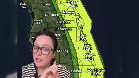
Parts of Florida's East Coast could see significant flooding this week as repeated rounds of heavy rain move through the state.
Read More
# HEADLINE -------------------- HIGH SURF ADVISORY REMAINS IN EFFECT UNTIL 9 PM PST FRIDAY COASTAL FLOOD ADVISORY REMAINS IN EFFECT FROM 3 AM TO 10 AM PST THURSDAY # DETAILS -------------------- WHAT For the High Surf Advisory, large breaking waves of 10- 19 feet, with local sets of 20-22 feet. Peak surf is expected from late Wednesday through Thursday night. Dangerous rip currents expected. For the Coastal Flood Advisory, minor coastal flooding expected. WHERE San Luis Obispo County Beaches and Santa Barbara County Central Coast Beaches. WHEN For the High Surf Advisory, until 9 PM PST Friday. For the Coastal Flood Advisory, from 3 AM to 10 AM PST Thursday. IMPACTS Moderate flooding of sea water is likely over some vulnerable low-lying coastal areas, especially around the time of high tide, including over beach parking lots, bike paths, and harbor walkways. Moderate to significant beach erosion is likely. Isolated damage is unlikely but possible, especially to Pismo and Cayucos piers. There is an increased risk for ocean drowning. Rip currents can pull swimmers and surfers out to sea. Large breaking waves can cause injury, wash people off beaches and rocks, and capsize small boats near shore. ADDITIONAL DETAILS There is a chance for the coastal flood advisory to be extended through later Thursday to cover the secondary high tide in the evening. ISSUED AT Tuesday, November 17, 2026 at 8:53 PM PST ISSUED BY National Weather Service Los Angeles/Oxnard CA HEADER Coastal Hazard Message # PRECAUTIONARY/PREPAREDNESS ACTIONS -------------------- Take the necessary actions to protect flood-prone property. Do NOT drive around barricades or through water of unknown depth. Remain out of the water due to dangerous surf conditions, or stay near occupied lifeguard towers. Rock jetties can be deadly in such conditions, stay off the rocks. # AREAS AFFECTED -------------------- Santa Barbara County Central Coast Beaches, San Luis Obispo County Beaches
# HEADLINE -------------------- FLOOD WATCH REMAINS IN EFFECT FROM WEDNESDAY AFTERNOON THROUGH LATE WEDNESDAY NIGHT # DETAILS -------------------- WHAT Flooding caused by excessive rainfall continues to be possible. WHERE San Luis Obispo County. WHEN From Wednesday afternoon through late Wednesday night. IMPACTS Excessive rainfall may result in significant flooding of roads and other low-lying areas, heavy flows in creeks and canyons, rockslides, mudslides, and debris flows in recent burn scars. ADDITIONAL DETAILS - Rain rates up to 1 inch per hour are expected, especially in the mountains. - http://www.weather.gov/safety/flood ISSUED AT Tuesday, November 17, 2026 at 3:46 PM PST ISSUED BY National Weather Service Los Angeles/Oxnard CA HEADER Flood Watch # PRECAUTIONARY/PREPAREDNESS ACTIONS -------------------- You should monitor later forecasts and be alert for possible Flood Warnings. Those living in areas prone to flooding should be prepared to take action should flooding develop. # AREAS AFFECTED -------------------- San Luis Obispo County Beaches, San Luis Obispo County Inland Central Coast, San Luis Obispo County Interior Valleys, San Luis Obispo County Mountains, Santa Lucia Mountains, Southern Salinas Valley Including the cities of Atascadero, Irish Hills, Arroyo Grande, La Panza Range, Nipomo, Cambria, San Miguel, Carrizo Plain, Paso Robles, Pismo Beach, Templeton, Lake Nacimiento, Shandon, Santa Margarita Lake, Lopez Lake, Creston, Caliente Range, San Luis Obispo, Avila Beach, Morro Bay, and Hearst Castle
# HEADLINE -------------------- WIND ADVISORY IN EFFECT FROM 1 PM THIS AFTERNOON TO 5 AM PST THURSDAY # DETAILS -------------------- WHAT South winds 20 to 30 mph with gusts up to 45 mph expected. WHERE San Luis Obispo County Beaches, San Luis Obispo County Inland Central Coast, Santa Barbara County Central Coast Beaches, Santa Barbara County Inland Central Coast, Santa Barbara County Southwestern Coast, and Santa Ynez Valley. WHEN From 1 PM this afternoon to 5 AM PST Thursday. IMPACTS Gusty winds will blow around unsecured objects. Tree limbs could be blown down and a few power outages may result. ISSUED AT Wednesday, November 18, 2026 at 12:09 AM PST ISSUED BY National Weather Service Los Angeles/Oxnard CA HEADER URGENT - WEATHER MESSAGE # PRECAUTIONARY/PREPAREDNESS ACTIONS -------------------- Winds this strong can make driving difficult, especially for high profile vehicles. Use extra caution. # AREAS AFFECTED -------------------- San Luis Obispo County Beaches, San Luis Obispo County Inland Central Coast, Santa Barbara County Central Coast Beaches, Santa Barbara County Inland Central Coast, Santa Barbara County Southwestern Coast, Santa Ynez Valley Including the cities of Nipomo, Lompoc, Refugio State Beach, Jalama Beach, Solvang, San Luis Obispo, Cambria, Morro Bay, Santa Ynez, Avila Beach, Los Olivos, Santa Maria, Arroyo Grande, Gaviota, Lopez Lake, Lake Cachuma, Buellton, Pismo Beach, Vandenberg Space Force Base, and El Capitan State Beach
# HEADLINE -------------------- HIGH SURF ADVISORY REMAINS IN EFFECT UNTIL 9 PM PST FRIDAY COASTAL FLOOD ADVISORY REMAINS IN EFFECT FROM 3 AM TO 10 AM PST THURSDAY # DETAILS -------------------- WHAT For the High Surf Advisory, large breaking waves of 10- 19 feet, with local sets of 20-22 feet. Peak surf is expected from late Wednesday through Thursday night. Dangerous rip currents expected. For the Coastal Flood Advisory, minor coastal flooding expected. WHERE San Luis Obispo County Beaches and Santa Barbara County Central Coast Beaches. WHEN For the High Surf Advisory, until 9 PM PST Friday. For the Coastal Flood Advisory, from 3 AM to 10 AM PST Thursday. IMPACTS Moderate flooding of sea water is likely over some vulnerable low-lying coastal areas, especially around the time of high tide, including over beach parking lots, bike paths, and harbor walkways. Moderate to significant beach erosion is likely. Isolated damage is unlikely but possible, especially to Pismo and Cayucos piers. There is an increased risk for ocean drowning. Rip currents can pull swimmers and surfers out to sea. Large breaking waves can cause injury, wash people off beaches and rocks, and capsize small boats near shore. ADDITIONAL DETAILS There is a chance for the coastal flood advisory to be extended through later Thursday to cover the secondary high tide in the evening. ISSUED AT Tuesday, November 17, 2026 at 8:53 PM PST ISSUED BY National Weather Service Los Angeles/Oxnard CA HEADER Coastal Hazard Message # PRECAUTIONARY/PREPAREDNESS ACTIONS -------------------- Take the necessary actions to protect flood-prone property. Do NOT drive around barricades or through water of unknown depth. Remain out of the water due to dangerous surf conditions, or stay near occupied lifeguard towers. Rock jetties can be deadly in such conditions, stay off the rocks. # AREAS AFFECTED -------------------- Santa Barbara County Central Coast Beaches, San Luis Obispo County Beaches
Parts of Florida's East Coast could see significant flooding this week as repeated rounds of heavy rain move through the state.