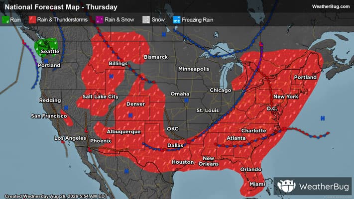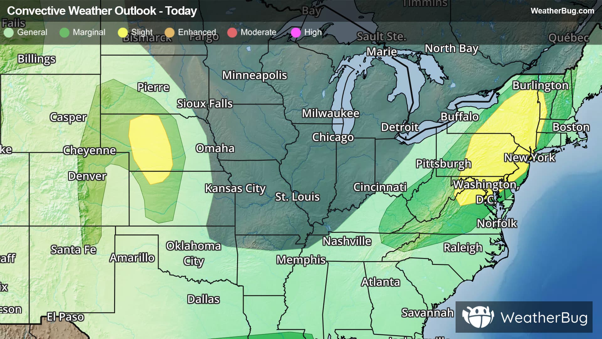
Severe Weather Targets Nebraska, Mid-Atlantic and Northeast
The Mid-Atlantic and portions of the Northeast will need eyes on the sky as severe weather shifts east. Meanwhile, central Nebraska will get a taste of the action as well.
Read More
# HEADLINE -------------------- OZONE ACTION DAY ALERT FROM 400 PM WEDNESDAY UNTIL 400 PM THURSDAY # SUMMARY -------------------- The Colorado Department of Public Health and Environment has issued the following... WHAT...Ozone Action Day Alert. # DETAILS -------------------- WHERE Douglas, Jefferson, Denver, western Arapahoe, western Adams, Broomfield, Boulder, Larimer, and Weld Counties WHEN 400 PM Wednesday August 26 to 400 PM Thursday August 27 IMPACTS Ozone Action Day Alert is now in effect for the Front Range Urban Corridor. Ozone concentrations in the Unhealthy for Sensitive Groups category are possible both Wednesday and Thursday during the afternoon and evening hours. The best chance for these elevated ozone levels will be in western parts of the Denver metro area, including the adjacent foothills. For Colorado air quality conditions, forecasts, and advisories, visit: https://www.colorado.gov/airquality/colorado\_summary.aspx If possible, please help us reduce ozone pollution by limiting driving gas and diesel-powered vehicles until at least 4 p.m. Thursday, August 27, 2026. Colorado is also addressing ozone pollution through state policies. For more information about health impacts and how ozone pollution forms in Colorado, visit: https://cdphe.colorado.gov/ozone-pollution-and-your-health HEALTH INFORMATION Increasing likelihood of respiratory symptoms and breathing discomfort in active children and adults and people with lung disease, such as asthma. Active children and adults, and people with lung disease, such as asthma, should reduce prolonged or heavy outdoor exertion during the afternoons and evenings both Wednesday and Thursday. ISSUED AT Wednesday, August 26, 2026 at 4:10 PM MDT ISSUED BY Relayed by National Weather Service Boulder CO HEADER Air Quality Alert Message | Colorado Department of Public Health and Environment # AREAS AFFECTED -------------------- Larimer, Adams, Arapahoe, Boulder, Broomfield, Denver, Douglas, Jefferson, Weld
There is a Slight Severe Storm Risk for your location. Continue reading for today's outlook from the National Weather Service's Storm Prediction Center. -------------------- National Severe Storm Outlook THERE IS A SLIGHT RISK OF SEVERE THUNDERSTORMS FOR PARTS OF THE CENTRAL HIGH PLAINS...AND ALSO FROM THE ARKLATEX TO THE ARKLAMISS REGIONS SUMMARY Isolated to widely scattered strong to severe thunderstorms remain possible tonight across parts of the central and southern High Plains, parts of Arkansas into the lower Mississippi Valley, and parts of the Midwest and Ohio Valley. Central/southern High Plains Widely scattered strong to severe storms are ongoing this evening across parts of the central/southern High Plains. The most favorable environment resides from eastern CO into western KS, with moderate buoyancy and effective shear of 30-40 kt within a northwesterly flow regime. The strongest discrete cells in this area will continue to pose a threat of hail and localized severe gusts. Some modest clustering remains possible with time, which could result in at least an isolated severe-wind threat as convection spreads into western KS later tonight. Deep-layer flow/shear is generally weaker across the southern High Plains, but localized strong to severe gusts will remain possible within the well-mixed environment through at least dusk. AR into the Lower MS Valley Widespread deep convection from southeastern OK into central/southern AR may eventually evolve into a loosely organized, outflow-driven cluster with time this evening. This could result in a threat for scattered wind damage spreading into northern LA through the evening, with an isolated threat possible later tonight as storms approach the LA/MS Gulf Coasts. Midwest/Ohio Valley Scattered storms are ongoing from parts of Lower MI into parts of the Midwest/Ohio Valley. The combination of moderate buoyancy and marginal deep-layer shear (generally 25-35 kt of effective shear) has only been supportive of an isolated severe threat thus far. No substantial improvement in the environment is expected through the evening, but ongoing storms may continue to pose an isolated severe threat before convection generally subsides later tonight.
Pollen Index: 10 Pollen Level: high Predominant Pollen: Ragweed, Chenopods and Sagebrush/Sage. Pollen concentrations for Thursday will be falling but will remain in the high range. The cause for the falling pollen levels is lack of winds and expected precipitation in the morning and evening which tends to wash pollen out of the air.