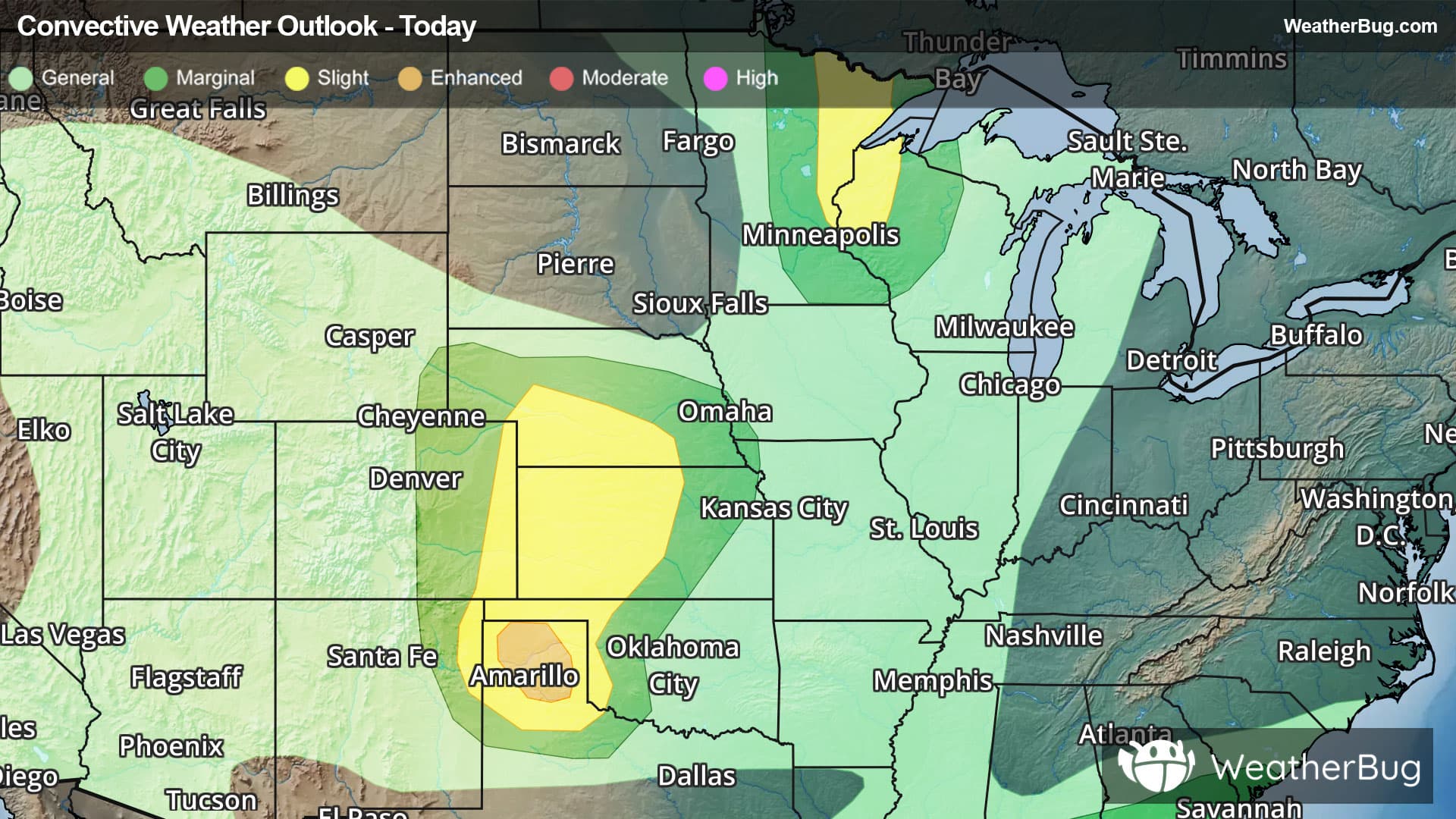
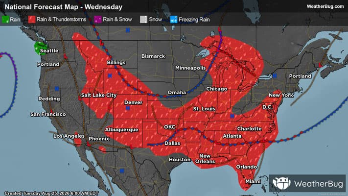
There is a Slight Severe Storm Risk for your location. Continue reading for today's outlook from the National Weather Service's Storm Prediction Center.
--------------------
National Severe Storm Outlook
THERE IS AN ENHANCED RISK OF SEVERE THUNDERSTORMS FOR PARTS OF THE TEXAS PANHANDLE
THERE IS A SLIGHT RISK OF SEVERE THUNDERSTORMS OVER NORTHWEST WISCONSIN
SUMMARY
Severe thunderstorms remain possible this evening across parts of the central/southern Plains, and also across portions of the Upper Midwest. Severe wind gusts and isolated large hail are the primary hazards.
Southern/central High Plains
A storm cluster is moving southeastward across the TX/OK Panhandles this evening. A short-term threat for strong to severe gusts will persist through the evening with this cluster. The evolution of this cluster as it moves into a region influenced by westward-moving outflow is unclear. Cooler temperatures and weaker low-level lapse rates are observed within this outflow, though richer low-level moisture and stronger MUCAPE also noted, which may help to sustain the ongoing cluster and an attendant severe-wind threat through the evening.
Farther north, widely scattered strong to severe storms are ongoing across parts of the central High Plains. Moderate buoyancy and effective shear of 30-40 kt will continue to support a threat of isolated hail and localized strong to severe gusts through dusk. Increasing CINH should eventually lead to a weakening trend later tonight, though any storm clustering this evening could lead to a longer duration of localized severe-wind potential. See MCD 2132 for more information regarding the short-term threat in this area.
Parts of WI/Upper MI
Occasional strong to severe storms have been noted within a storm cluster across northwest WI this evening. MLCAPE of 1000-2000 J/kg and 30-40 kt of effective shear largely orthogonal to the surface front/trough will continue to support supercell potential through dusk, before a gradual weakening trend is expected. See MCD 2133 and WW 626 for more information.