Severe Thunderstorms Take Aim At Northern New England
Northern New England and adjacent New York state near Lake Champlain will see the potential for severe thunderstorms today.
# HEADLINE -------------------- HEAT ADVISORY REMAINS IN EFFECT UNTIL 9 PM MDT /10 PM CDT/ THURSDAY # DETAILS -------------------- WHAT Heat index values between 95 and 105. WHERE Portions of northwestern, south central, and southwestern South Dakota and northeast Wyoming. WHEN Until 9 PM MDT /10 PM CDT/ Thursday. IMPACTS Hot temperatures and high humidity may cause heat illnesses. ISSUED AT Tuesday, July 14, 2026 at 3:04 AM MDT ISSUED BY National Weather Service Rapid City SD HEADER URGENT - WEATHER MESSAGE # PRECAUTIONARY/PREPAREDNESS ACTIONS -------------------- Take extra precautions when outside. Wear lightweight and loose fitting clothing. Try to limit strenuous activities to early morning or evening. Take action when you see symptoms of heat exhaustion and heat stroke. # AREAS AFFECTED -------------------- Northern Foothills, Pennington Co Plains, Sturgis/Piedmont Foothills, Western Crook, Bennett, Butte, Custer Co Plains, Eastern Fall River, Haakon, Harding, Hermosa Foothills, Mellette, Newcastle, Northeastern Crook, Northern Campbell, Northern Jackson, Northern Meade Co Plains, Northern Oglala Lakota, Northern Perkins, Rapid City, Southern Campbell, Southern Foothills, Southern Jackson, Southern Meade Co Plains, Southern Oglala Lakota, Southern Perkins, Todd, Tripp, Western Fall River, Weston County Plains, Ziebach Including the cities of Colony, Newcastle, Saint Onge, Cedar Butte, Angostura Reservoir, Edgemont, Scenic, Milesville, White River, Elm Springs, Rapid City, Long Valley, Provo, Kyle, Kadoka, Zeona, New Underwood, Allen, Red Owl, Fairburn, Wall, Shadehill, Tilford, Upton, Ellsworth AFB, Ardmore, Bison, Rozet, Piedmont, Interior, Ladner, White Owl, Osage, Dupree, Mud Butte, Enning, Beulah, Potato Creek, Gillette, Midland, Usta, Manderson, Rumford, Howes, Oglala, Sorum, Caputa, Union Center, Ludlow, Aladdin, Belle Fourche Reservoir, Meadow, Winner, Spearfish, Vale, Batesland, Pine Haven, South Eagle Butte, Colome, Norris, Sturgis, Fruitdale, Hot Springs, Summerset, Weston, Clareton, Buffalo, Keyhole Reservoir, Opal, Witten, Buffalo Gap, Hermosa, Wounded Knee, Wanblee, Hoover, Belvidere, Black Hawk, Faith, Cottonwood, Rosebud, Box Elder, Newell, Quinn, Belle Fourche, Cherry Creek, Ideal, Wright, Rochelle, Recluse, Reva, Tuthill, Porcupine, Wood, Rockyford, Camp Crook, Glad Valley, Lemmon, Hamill, Harrington, Whitewood, Moorcroft, Prairie City, Pine Ridge, Redig, Mission, Folsom, Saint Francis, Martin, Oral, Oelrichs, Devils Tower, Smithwick, Parmelee, Philip, Hulett, Wasta, and Sharps Corner
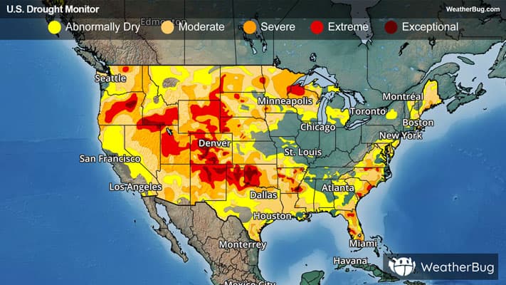
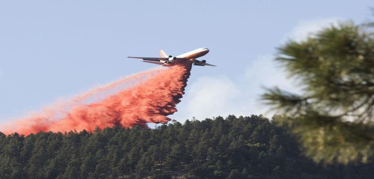
# HEADLINE -------------------- RED FLAG WARNING IN EFFECT UNTIL 9 PM MDT THIS EVENING DUE TO GUSTY WINDS AND LOW RELATIVE HUMIDITY FOR NORTHERN CAMPBELL, SOUTHERN CAMPBELL, CROOK COUNTY PLAINS, AND WESTON COUNTY PLAINS RED FLAG WARNING REMAINS IN EFFECT UNTIL 9 PM MDT THIS EVENING DUE TO GUSTY WINDS AND LOW RELATIVE HUMIDITY FOR FALL RIVER COUNTY AREA, NORTHERN FOOT HILLS, EASTERN FOOT HILLS, CUSTER COUNTY PLAINS, PINE RIDGE AREA, BUTTE COUNTY AREA, PERKINS COUNTY, WEST CENTRAL PLAINS, ZIEBACH COUNTY, HAAKON COUNTY AREA, AND BADLANDS AREA RED FLAG WARNING REMAINS IN EFFECT UNTIL 9 PM MDT TUESDAY DUE TO GUSTY WINDS AND LOW RELATIVE HUMIDITY FOR FALL RIVER COUNTY AREA, NORTHERN FOOT HILLS, EASTERN FOOT HILLS, CUSTER COUNTY PLAINS, PINE RIDGE AREA, BUTTE COUNTY AREA, PERKINS COUNTY, WEST CENTRAL PLAINS,ZIEBACH COUNTY, HAAKON COUNTY AREA, NORTHEAST WYOMING PLAINS, AND BADLANDS AREA RED FLAG WARNING REMAINS IN EFFECT UNTIL 9 PM MDT THIS EVENING # DETAILS -------------------- AFFECTED AREA Fire Weather Zones 322, 323, 324, 325, 326, 327, 328, 329, 330, 331, and 332. TIMING Until 9 PM MDT this evening. WINDS Southeast winds 10 to 20 mph with gusts up to 35 mph. RELATIVE HUMIDITY Relative Humidity between 12 to 22 percent. IMPACTS Any fires that develop will spread rapidly. Outdoor burning is not recommended. ISSUED AT Tuesday, July 14, 2026 at 3:02 AM MDT ISSUED BY National Weather Service Rapid City SD HEADER URGENT - FIRE WEATHER MESSAGE # PRECAUTIONARY/PREPAREDNESS ACTIONS -------------------- A Red Flag Warning means that critical fire weather conditions are either occurring now, or will shortly. A combination of strong winds, low relative humidity, and warm temperatures can contribute to extreme fire behavior. # AREAS AFFECTED -------------------- Badlands Area, Custer County Plains, Butte County Area, Eastern Foot Hills, Fall River County Area, Haakon County Area, Northern Foot Hills, Perkins County, Pine Ridge Area, West Central Plains, Ziebach County