# HEADLINE
--------------------
The Flood Warning is extended for the following rivers in Florida
FLOOD WARNING NOW IN EFFECT FROM WEDNESDAY MORNING UNTIL FURTHER NOTICE
# SUMMARY
--------------------
St Johns River Near Sanford affecting Seminole County.
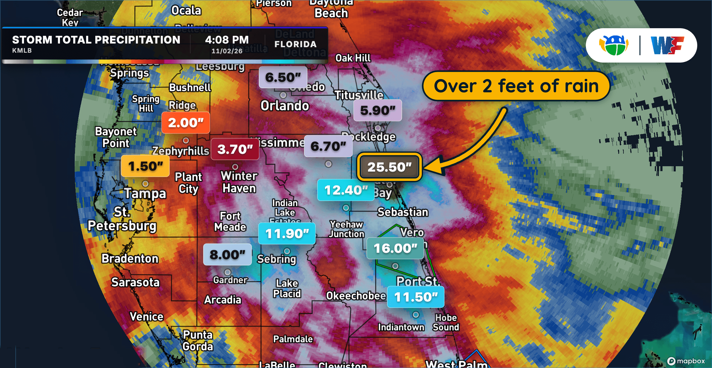
.Heavy rainfall has caused river levels on the St. Johns near Sanford to rise. The river is forecast to climb into Minor flood stage in the next couple days, with a continued rise into through late week, approaching Moderate Flood Stage by the weekend.
For the St. Johns River...including Sanford...Moderate flooding is forecast.
# DETAILS
--------------------
WHAT
Minor flooding is forecast.
WHERE
St Johns River near Sanford.
WHEN
From Wednesday morning until further notice.
IMPACTS
At 7.0 feet, Water begins to move over sea wall around Lake Monroe and rises into grassy areas around the sea wall. Water begins to encroach on Seminole Boulevard.
ADDITIONAL DETAILS
- At 9:30 AM EST Tuesday the stage was 5.0 feet.
- Bankfull stage is 4.2 feet.
- FORECAST
- The river is expected to rise above flood stage tomorrow morning and continue rising to 6.8 feet early Sunday morning. Additional rises are possible thereafter.
- Flood stage is 5.5 feet.
- http://www.weather.gov/safety/flood
ISSUED AT
Tuesday, November 3, 2026 at 10:39 AM EST
ISSUED BY
National Weather Service Melbourne FL
HEADER
Flood Statement
# PRECAUTIONARY/PREPAREDNESS ACTIONS
--------------------
Motorists should not attempt to drive around barricades or drive cars through flooded areas.
Caution is urged when walking near riverbanks.
Additional information is available at www.weather.gov.
The next statement will be issued late tonight at midnight EST.