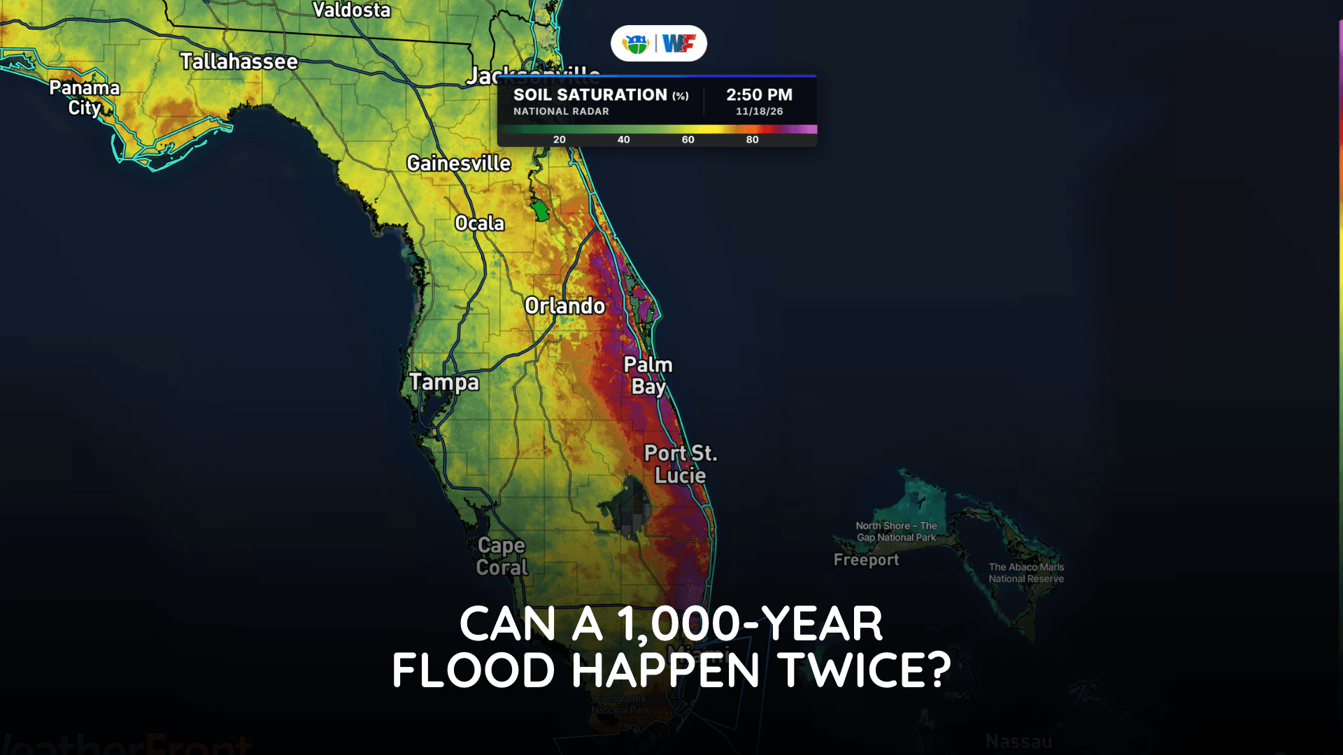
What Is a 1,000-Year Flood? And Can It Happen Twice?
The name sounds like a once-in-a-millennium event, but that is not what the number means
Read More
# HEADLINE -------------------- WIND ADVISORY IN EFFECT FROM 3 AM TO 8 AM PST THURSDAY # DETAILS -------------------- WHAT Northwest to north winds 20 to 30 mph with gusts up to 45 mph expected. WHERE Southern Santa Barbara County and Ventura County WHEN From 3 AM to 8 AM PST Thursday. IMPACTS Gusty winds will blow around unsecured objects. Tree limbs could be blown down and a few power outages may result. ISSUED AT Wednesday, November 18, 2026 at 8:10 AM PST ISSUED BY National Weather Service Los Angeles/Oxnard CA HEADER URGENT - WEATHER MESSAGE # PRECAUTIONARY/PREPAREDNESS ACTIONS -------------------- Winds this strong can make driving difficult, especially for high profile vehicles. Use extra caution. # AREAS AFFECTED -------------------- Central Ventura County Valleys, Calabasas and Agoura Hills, Lake Casitas, Northern Ventura County Mountains, Ojai Valley, Santa Barbara County Southeastern Coast, Santa Susana Mountains, Santa Ynez Mountains Eastern Range, Santa Ynez Mountains Western Range, Southeastern Ventura County Valleys, Southern Ventura County Mountains, Ventura County Beaches, Ventura County Inland Coast, Western Santa Monica Mountains Recreational Area Including the cities of Piru, Goleta, Santa Paula, Malibu Bowl, Oat Mountain, Thousand Oaks, East Ventura, Mount Pinos, Rose Valley, Westlake Village, Santa Barbara, Port Hueneme, Ozena, Fillmore, Newbury Park, Malibu Lake, Camarillo, Carpinteria, Montecito Hills, Lockwood Valley, Ojai, Simi Valley, Point Mugu, San Marcos Pass, Ventura, Montecito, Oak View, Topatopa Mountains, Matilija, Moorpark, Oxnard, and Meiners Oaks
# HEADLINE -------------------- HIGH SURF ADVISORY REMAINS IN EFFECT UNTIL 3 AM PST FRIDAY # DETAILS -------------------- WHAT Large breaking waves of 4 to 7 feet with dangerous rip currents. WHERE Santa Barbara County Southwestern Coast and Santa Barbara County Southeastern Coast. WHEN Until 3 AM PST Friday. IMPACTS There is an increased risk for ocean drowning. Rip currents can pull swimmers and surfers out to sea. Large breaking waves can cause injury, wash people off beaches and rocks, and capsize small boats near shore. Pooling of sea water is possible around high tide at beach and harbor areas that is uncommon with normal tidal ranges. Enhanced beach erosion is also possible. No significant damage is expected. ADDITIONAL DETAILS Minor coastal flooding may occur near early morning high tide. Additional hazardous surf and coastal flooding issues are expected next week. ISSUED AT Wednesday, November 18, 2026 at 7:01 PM PST ISSUED BY National Weather Service Los Angeles/Oxnard CA HEADER Coastal Hazard Message # PRECAUTIONARY/PREPAREDNESS ACTIONS -------------------- Remain out of the water due to dangerous surf conditions, or stay near occupied lifeguard towers. Rock jetties can be deadly in such conditions, stay off the rocks. # AREAS AFFECTED -------------------- Santa Barbara County Southeastern Coast, Santa Barbara County Southwestern Coast
# HEADLINE -------------------- FLOOD WATCH REMAINS IN EFFECT FROM 8 PM PST THIS EVENING THROUGH THURSDAY AFTERNOON # DETAILS -------------------- WHAT Flooding caused by excessive rainfall continues to be possible. WHERE Santa Barbara County. WHEN From 8 PM PST this evening through Thursday afternoon. IMPACTS Excessive rainfall may result in significant flooding of roads and other low-lying areas, heavy flows in creeks and canyons, rockslides, mudslides, and debris flows in recent burn scars. ADDITIONAL DETAILS - Rain rates up to 1 inch per hour are expected, especially in the mountains. - http://www.weather.gov/safety/flood ISSUED AT Wednesday, November 18, 2026 at 1:53 PM PST ISSUED BY National Weather Service Los Angeles/Oxnard CA HEADER Flood Watch # PRECAUTIONARY/PREPAREDNESS ACTIONS -------------------- You should monitor later forecasts and be alert for possible Flood Warnings. Those living in areas prone to flooding should be prepared to take action should flooding develop. # AREAS AFFECTED -------------------- San Miguel and Santa Rosa Islands, Cuyama Valley, Santa Barbara County Central Coast Beaches, Santa Barbara County Inland Central Coast, Santa Barbara County Interior Mountains, Santa Barbara County Southeastern Coast, Santa Barbara County Southwestern Coast, Santa Cruz and Anacapa Islands, Santa Ynez Mountains Eastern Range, Santa Ynez Mountains Western Range, Santa Ynez Valley Including the cities of Solvang, Montecito Hills, Lompoc, Gaviota, Jalama Beach, San Marcos Pass, Figueroa Mountain, Vandenberg Space Force Base, Santa Barbara, Goleta, New Cuyama, Carpinteria, Lake Cachuma, Santa Maria, Los Olivos, Santa Ynez, El Capitan State Beach, Refugio State Beach, Big Pine Mountain, Cuyler Harbor, Smugglers Cove, Buellton, Montecito, and San Rafael Mountain
The name sounds like a once-in-a-millennium event, but that is not what the number means