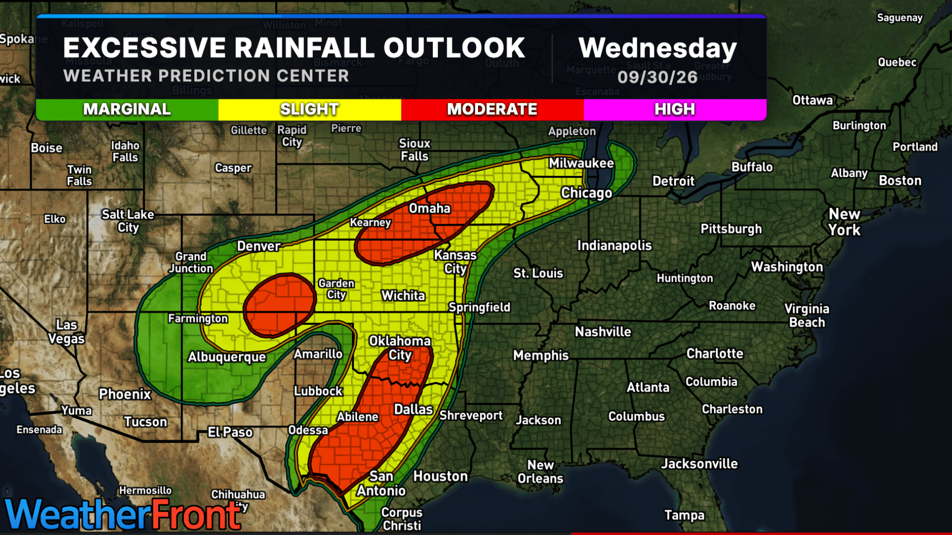
There is a Slight Severe Storm Risk for your location. Continue reading for today's outlook from the National Weather Service's Storm Prediction Center.
--------------------
National Severe Storm Outlook
THERE IS A SLIGHT RISK OF SEVERE THUNDERSTORMS ACROSS THE FRONT RANGE/CENTRAL HIGH PLAINS AND MIDDLE OHIO VALLEY
SUMMARY
Thunderstorms with severe wind gusts and isolated large hail are possible from late afternoon into the evening across the central High Plains. Severe wind gusts may also occur this afternoon through early evening across parts of the Ohio Valley and Southeast.
Front Range/Central High Plains
Modestly strong southwesterly flow aloft coupled with strong daytime heating, low-level upslope flow, and orographic lift will support another day of thunderstorms regionally. These thunderstorms should gradually move off the higher terrain into the central High Plains later this afternoon, where a moderately buoyant airmass will be in place. Around 30-35 kt of effective bulk shear is expected over the region, which will support a mixed mode with supercells and multicell line segments. Isolated large hail is possible with any supercells, while severe wind gusts will be possible with both supercells and line segments. The severe threat should persist into the evening as this complex of storms moves eastward through the central High Plains including west/southwest Kansas.
Midwest/Middle Ohio Valley
Thunderstorms have generally weakened since the overnight, although scattered showers/some thunderstorms and plentiful cloud cover continue in areas progressively north of the Ohio River. An MCV is readily apparent in observational data as it continues to move into northwest Indiana, with an enhanced belt (40+ kt) of westerly winds associated with the MCV per regional WSR-88D VWP data.
As clouds thin/abate, a gradual increase in renewed thunderstorm coverage and intensity is expected later this afternoon. Mid-level lapse rates will be poor, but dewpoints in the 70s F will support moderate buoyancy, particularly in areas where cloud cover does not overly inhibit diurnal heating, which will tend to generally be southward toward the Ohio River. Strong updrafts and high precipitable water will support the potential for wet microbursts capable of producing damaging gusts, and some enhancement to the low-level winds could also yield a brief tornado.
Central Appalachians/Carolinas/Georgia
A very moist airmass, characterized by dewpoints in the low to mid 70s, is in place regionally. Strong heating will destabilize the airmass by the early afternoon, resulting in a large reservoir of moderate buoyancy. Thunderstorm development is anticipated within this destabilized airmass across the higher terrain of the central Appalachians as well as any area of low-level convergence across the remainder of the region. Vertical shear will be weak, and limited storm organization is anticipated. Even so, the moderate buoyancy could still support updrafts/downdrafts strong enough to produce occasional damaging gusts.
Central Plains/Mid Missouri Valley to Mid Mississippi Valley
Elevated thunderstorms are expected again tonight, initiated by both an approaching cold front and warm-air advection. Ample low-level moisture and moderate buoyancy will be in place, but vertical shear will be marginal. Isolated strong to severe storms are expected, but a predominantly elevated and clustered storm mode should limit the overall severe potential.