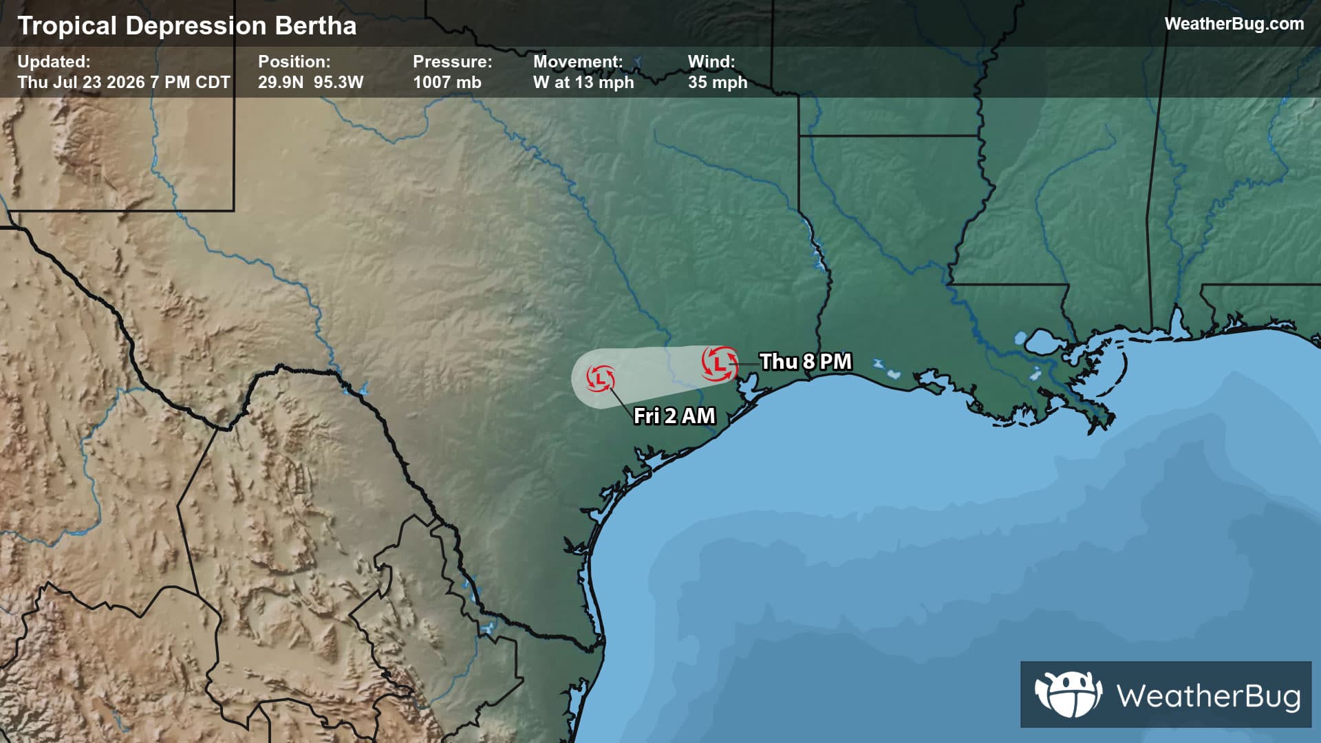
Severe Storm Risk - Bloomington, IN
Severe Storm Risk
-There is a Marginal Severe Storm Risk for your location. Continue reading for today's outlook from the National Weather Service's Storm Prediction Center. -------------------- National Severe Storm Outlook THERE IS AN ENHANCED RISK OF SEVERE THUNDERSTORMS OVER PARTS OF EASTERN IOWA...NORTHERN ILLINOIS...AND SOUTHERN WISCONSIN SUMMARY Severe thunderstorms capable of producing a few tornadoes remain probable across parts of eastern Iowa, northern Illinois, and southern Wisconsin this afternoon and evening. Additionally, damaging thunderstorm winds will be possible from eastern Iowa northeast into Michigan. 20z Update IA, IL, MO and southern WI Rapid air mass modification is underway to the south of a warm front lifting northward across the western Great Lakes and upper Midwest. Clearing beneath the advancing mid-level dry slot may allow temperatures to warm into the low 70s, with surface dewpoints near 60 F. This will support weak buoyancy amid very strong shear profiles (0-1 km SRH >300 m2/s2) from observed VADs and regional RAOBs. Scattered thunderstorms and supercells ongoing over northern MO and southern IA should mature and present a severe hazard over much of the ENH area as they spread northeastward through this evening. A few tornadoes (some strong and fast moving), hail and damaging gusts are expected. Additional storms may develop within the warm conveyor belt farther east across IL this afternoon/evening. Upscale growth into one or more clusters with damaging gusts and a couple tornadoes is the primary concern. The main change with the 20z update was to trim thunderstorm and severe probabilities to the west of the advancing cold front. See the prior discussion for more information.