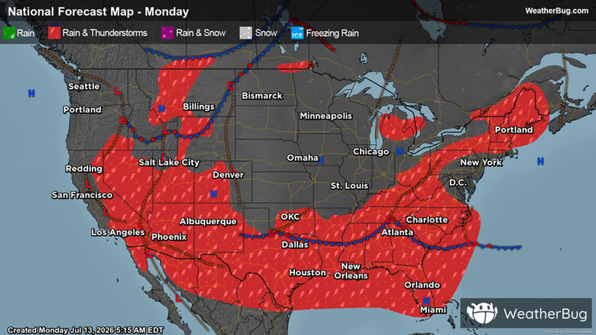
There is a Marginal Severe Storm Risk for your location. Continue reading for today's outlook from the National Weather Service's Storm Prediction Center.
--------------------
National Severe Storm Outlook
THERE IS A SLIGHT RISK OF SEVERE THUNDERSTORMS ACROSS THE NORTHERN PLAINS AND PARTS OF THE SOUTHEAST AND MID-ATLANTIC
SUMMARY
Scattered damaging wind gusts are possible this afternoon over portions of the Southeast. Scattered severe thunderstorms capable of severe wind gusts and large hail are possible late this afternoon through tonight from the Dakotas into Minnesota.
20z Update
The previous forecast largely remains on track with only minor adjustments made based on recent convective trends and latest high-res ensemble guidance.
Georgia and Mid-Atlantic
Across northern Georgia, convection has thus far exhibited mostly pulse-like behavior with transient and weak updrafts. Regional velocity imagery shows occasional swaths of strong winds embedded within downbursts, so some localized damaging wind threat will likely persist across the region through early evening given hot low-level conditions surrounding ongoing storms. However, based on these observed trends, limited clustering, and weak convective signals in latest guidance, the 15% wind probabilities have been trimmed eastward to align with more favorable thermodynamic conditions (particularly steeper low-level lapse rates) and where guidance continues to show some thunderstorm potential through late afternoon. See MCD #1660 for additional near-term forecast information.
Further east, a mix of thunderstorm clusters and loosely organized cells has been observed with occasional reports of wind damage noted over the past few hours. Based on recent mesoanalyses, the best thermodynamic and kinematic environment remain across eastern VA/NC, and consideration was made for introducing 5% hail probabilities. However, MRMS VIL/MESH trends show relatively transient and weak hail cores, suggesting that damaging winds will remain the predominant threat through early evening.
Northern High Plains
Latest HRRR/RRFS time-lagged ensembles continue to show a strong signal for severe wind across south-central ND and far northern SD later this evening as thunderstorms develop along the approaching cold front. Observational trends seem to support this as low 70 dewpoints continue to spread north into ND and pre-frontal cumulus begins to develop along the western SD/ND border. Aside from minor adjustments of probability/intensity lines to better align with recent guidance and satellite trends, forecast thoughts outlined in the previous discussion (below) remain on track.