There is a Slight Severe Storm Risk for your location. Continue reading for today's outlook from the National Weather Service's Storm Prediction Center.
--------------------
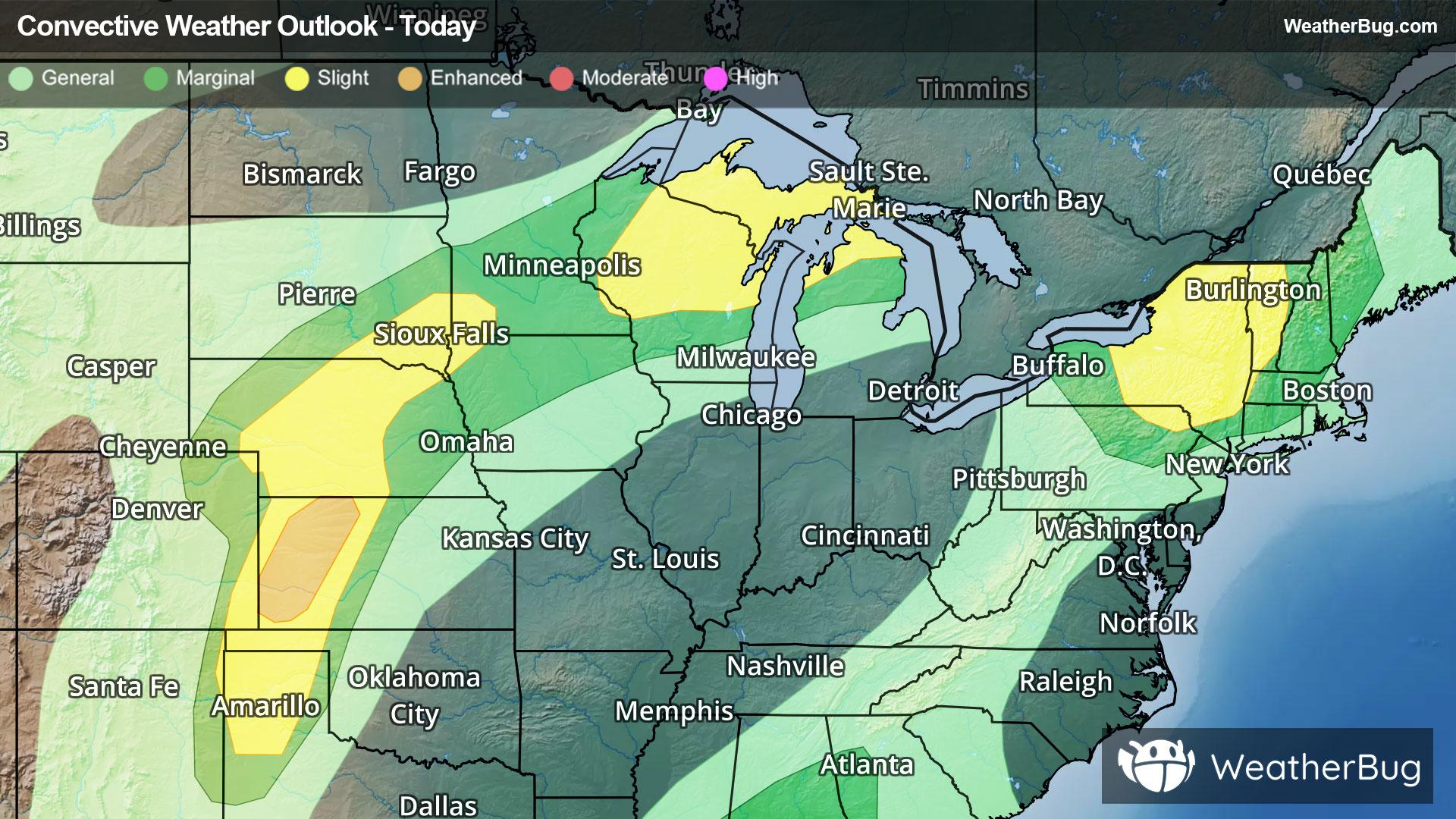
National Severe Storm Outlook
THERE IS AN ENHANCED RISK OF SEVERE THUNDERSTORMS ACROSS PORTIONS OF WESTERN KANSAS
THERE IS A SLIGHT RISK OF SEVERE THUNDERSTORMS FROM THE SOUTHERN HIGH PLAINS TO THE GREAT LAKES AND PARTS OF NEW ENGLAND
SUMMARY
Scattered severe thunderstorms are still expected across parts of the central High Plains, with severe wind gusts (60 to 85 mph) being the primary hazard during the late afternoon and evening. Other severe thunderstorms are still expected across the Great Lakes and Northeast, as well as broader parts of the central Plains to middle Missouri Valley.
20Z Update
The most noteworthy change made to the Day 1 Outlook for the 20Z update was to join the two Slight Risk areas, driven by wind probabilities, across the Plains to the Great Lakes. Furthermore, the CIG1 area was expanded northeast into the Upper MS Valley. Guidance consensus has consistently depicted a persistent region of likely cold-pool-driven convection propagating around the upper ridge periphery, from the central Plains this evening, toward the Great Lakes through 12Z tomorrow morning. Uncertainty remains regarding the overall morphology and evolution of this convection, hence the constraining of severe wind probabilities to Category 2/Slight risk. However, overnight storms will traverse an elongated axis of strong buoyancy, characterized by 8-9 C/km 700-500 mb lapse rates atop 70+ F surface dewpoints (per 18Z OAX and GRB observed soundings), along with forecast 30-40 kts of effective bulk shear. As such, if more organized storm modes (particularly bow echoes) can develop tonight, a couple of 75+ mph gusts could occur.
Otherwise, the previous forecast remains on track, with mainly minor changes made to thunder and severe probabilities to reflect the consensus among the latest observations and numerical guidance.