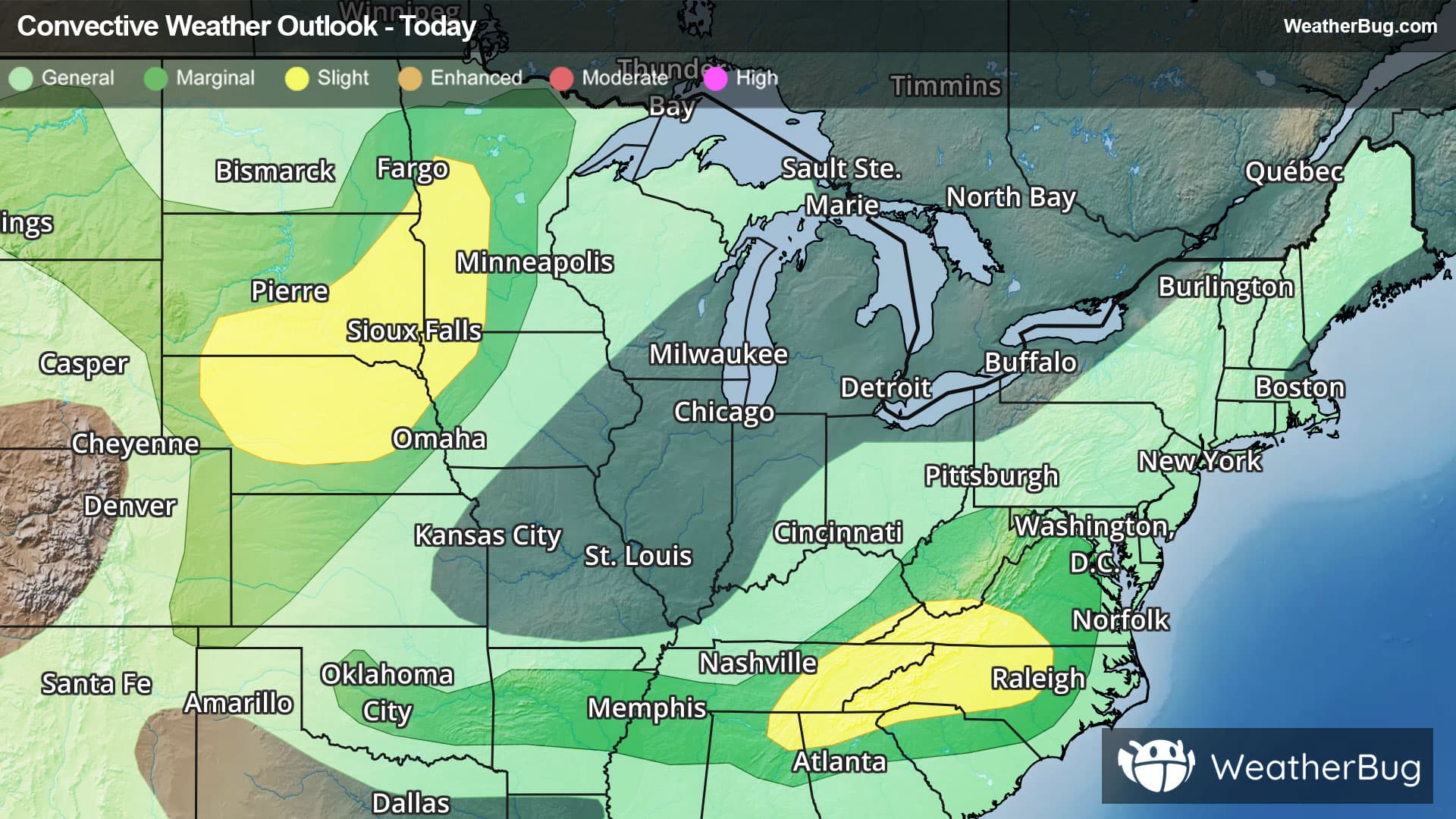
There is a Marginal Severe Storm Risk for your location. Continue reading for today's outlook from the National Weather Service's Storm Prediction Center.
--------------------
National Severe Storm Outlook
THERE IS A SLIGHT RISK OF SEVERE THUNDERSTORMS WITHIN PARTS OF THE NORTH-CENTRAL PLAINS/UPPER MIDWEST...AND SOUTHERN APPALACHIANS
SUMMARY
Thunderstorms with severe wind gusts and large hail are expected this afternoon and evening across parts of the central and northern Plains. Damaging gusts will also be possible in parts of the southern Appalachians to the North Carolina Piedmont, and possibly across portions of the Mid-South and southern Plains.
20Z Update
Given the earlier than expected development within western South Dakota/eastern Wyoming, the Slight Risk has been expanded northwestward. See MD 2012 for additional information. One or more organized clusters may eventually develop out of this activity as the low-level jet increases into northern Nebraska/southern South Dakota. Confidence on where a greater corridor of wind risk exists is still too low for a categorical upgrade. Elsewhere, the forecast remains on track.