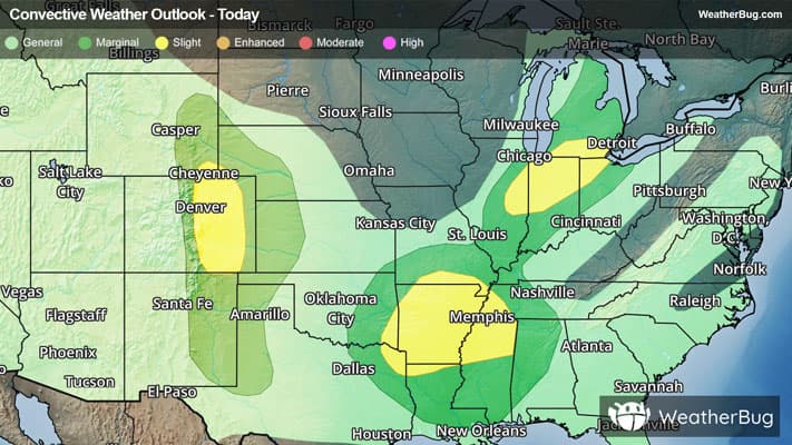
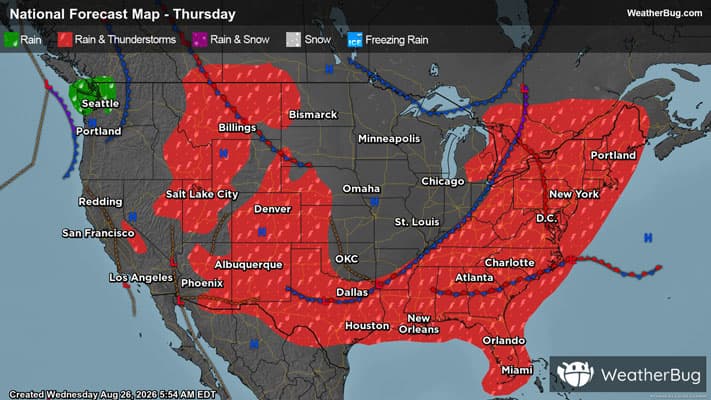
There is a Slight Severe Storm Risk for your location. Continue reading for today's outlook from the National Weather Service's Storm Prediction Center.
--------------------
National Severe Storm Outlook
THERE IS A SLIGHT RISK OF SEVERE THUNDERSTORMS ACROSS PARTS OF THE SOUTHERN GREAT LAKES/MIDWEST...CENTRAL HIGH PLAINS...AND OZARKS/MID SOUTH INTO THE LOWER MISSISSIPPI VALLEY
SUMMARY
Isolated to widely scattered severe thunderstorms are forecast today across parts of the southern Great Lakes into the Midwest, central/southern High Plains, and the Ozarks into the Mid-South and Lower Mississippi Valley. Severe/damaging winds should be the main threat across these regions, though large hail is also possible, particularly across the central High Plains.
Central Great Plains
Visible satellite imagery depicts an area of agitated cumulus developing in close proximity to a weak surface boundary across eastern Colorado. Recent HRRR/RRFS runs are split on the evolution of this convection, with the HRRR suggesting minimal thunderstorm development and the RRFS depicting the development of a southeastward-propagating cluster. This scenario remains uncertain; however, the 5% wind probabilities have been expanded southeastward to account for the potential for a cluster of thunderstorms to evolve from this region. See MCD 2139 for additional short-term information.
Mid-South and Lower Great Lakes
Severe probabilities were trimmed slightly across portions of northeastern IL, northwestern IN, and southwestern MI in the wake of ongoing convection and the passage of a surface cold front. Severe probabilities were also trimmed across portions of the Mid South where increased low-level static stability owing to outflow from prior convection casts uncertainty on additional convective development this afternoon/evening.
Elsewhere, the forecast remains largely on track with only minor changes made to the existing outlook. See the text below for additional information.