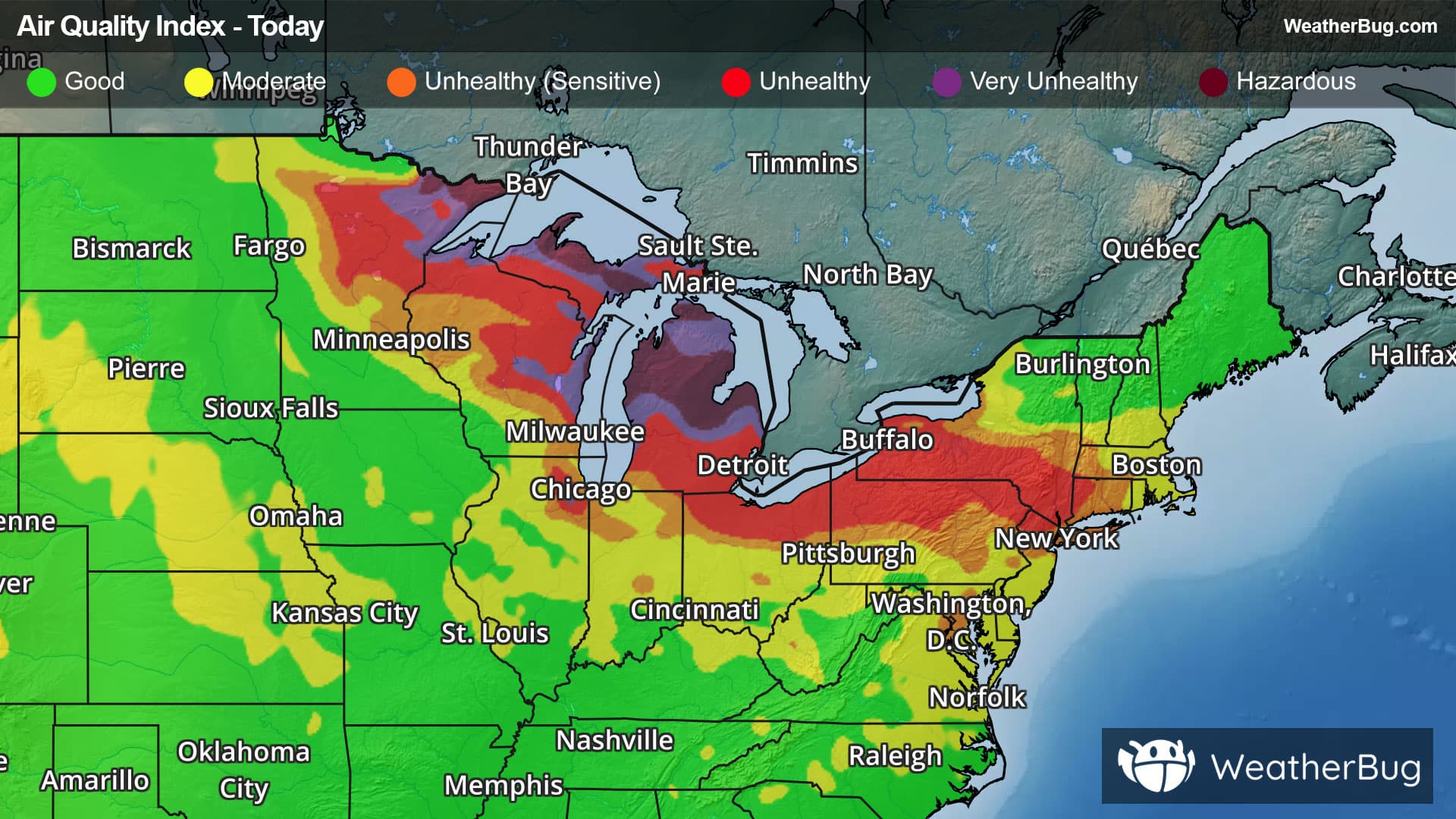
Severe Storm Risk - Maynard, IA
Severe Storm Risk
-There is a Marginal Severe Storm Risk for your location. Continue reading for today's outlook from the National Weather Service's Storm Prediction Center. -------------------- National Severe Storm Outlook THERE IS A MARGINAL RISK OF SEVERE THUNDERSTORMS BY LATE TONIGHT ACROSS PARTS OF CENTRAL AND EASTERN IOWA SUMMARY A couple of strong thunderstorms capable of producing small to marginally severe hail are possible overnight across parts of central and eastern Iowa. 01Z Update The categorical thunderstorm area across the Midwest has been shifted southward a bit to account for the current position of the low-level baroclinic zone, and its motion downstream of a surface cyclone overnight. The center of the cyclone is forecast to migrate from eastern Colorado into central Kansas through late this evening, before reforming northeastward toward the St. Joseph MO vicinity by early Sunday. Latest Rapid Refresh forecast soundings indicate that moisture return to the immediate cool side of the developing warm frontal zone may contribute to 500-1000 J/kg of most unstable CAPE, near the nose of an intensifying south-southwesterly low-level jet (including 50-70 kt around 850 mb) across the southern Great Plains through lower Missouri Valley by 15/09-12Z. Strongest thunderstorm development seems likely to focus along a tightening mid-level thermal gradient (centered around 700 mb) to the north of the Missouri/Iowa state border vicinity, as warming (and capping) elevated mixed-layer air advects northeast of the central Great Plains through lower Missouri Valley. Given the generally cool overall profiles, storms may, at least initially, become capable of producing small to marginally severe hail, before this risk perhaps diminishes as convection becomes more widespread.