Severe Weather Targets Nebraska, Mid-Atlantic and Northeast
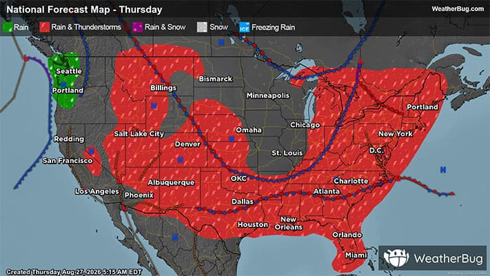
The Mid-Atlantic and portions of the Northeast will need eyes on the sky as severe weather shifts east. Meanwhile, central Nebraska will get a taste of the action as well.
Read More
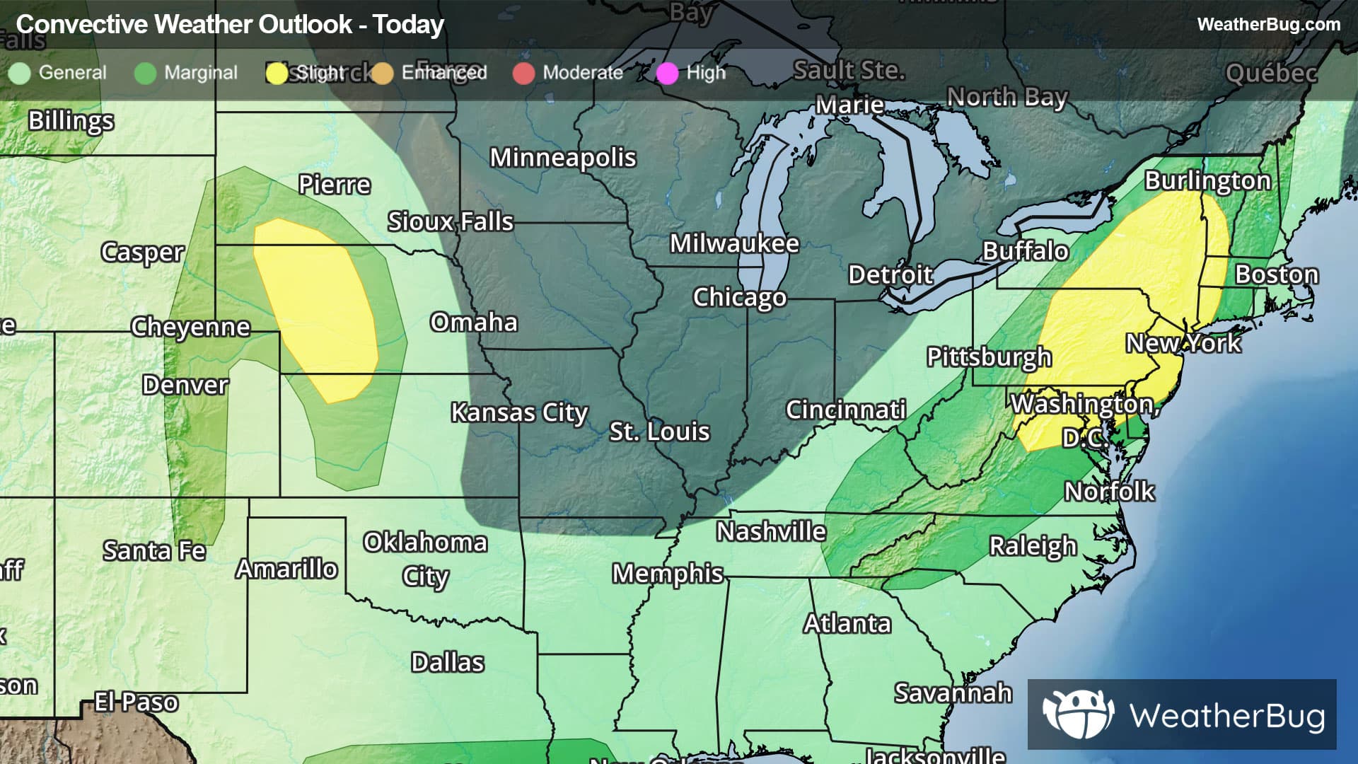
There is a Marginal Severe Storm Risk for your location. Continue reading for today's outlook from the National Weather Service's Storm Prediction Center. -------------------- National Severe Storm Outlook THERE IS A SLIGHT RISK OF SEVERE THUNDERSTORMS ACROSS PARTS OF THE MID-ATLANTIC/NORTHEAST...AND THE CENTRAL PLAINS SUMMARY Scattered strong to severe thunderstorms are possible across parts of the Northeast and Mid-Atlantic today. Damaging winds, severe hail, and a tornado or two may accompany these thunderstorms. Large to very large hail and severe gusts are also possible across parts of southwest South Dakota into western/central Nebraska and northwest Kansas. Mid-Atlantic/Northeast An elongated mid/upper-level trough with closed low over Hudson Bay will encompass much of the eastern CONUS today. Embedded within this large-scale troughing, a mid-level shortwave trough with modestly enhanced southwesterly winds (around 25-35 kt) will advance northeastward through the day across the Mid-Atlantic and Northeast. At the surface, a weak low over eastern Ontario will develop into Quebec this afternoon, with a trailing cold front advancing southeastward across the Mid-Atlantic/Northeast through the period. Stronger daytime heating is forecast with southward extent across the Mid-Atlantic ahead of the cold front, with cloud cover potentially limiting heating somewhat across the Northeast. Even so, a zone of moderate instability should develop by this afternoon across these regions, with sufficient deep-layer shear for some updraft organization. Current expectations are for thunderstorms to gradually increase in coverage and intensity by 17-20Z ahead of the surface front and a lee trough along/east of the Appalachians. A mix of multicells and supercells should pose a threat for both severe hail and damaging winds, especially from the northern Mid-Atlantic northward into NY and vicinity. A tornado or two may also occur, with modest hodograph curvature noted in various NAM/RAP forecast soundings from northern MD northeastward to western New England. Central Plains The central Plains will be sandwiched between upper ridging over the Southwest and upper troughing over eastern Canada today, with modest northwesterly flow aloft persisting through the period. Large-scale ascent is forecast to remain rather weak/nebulous, with some guidance suggesting a weak mid-level impulse will crest the ridge and aid convective initiation across parts of southwest SD into western/central NE this afternoon. A corridor of greater low-level moisture (generally 60s surface dewpoints) will be in place across this region. Daytime heating of this moist airmass coupled with the presence of steep mid-level lapse rates will help foster moderate to locally strong instability and erode lingering MLCIN by 19-21Z. While robust convective development and overall coverage still remains somewhat uncertain given the weak forcing, a rather favorable environment for supercells will exist. Any sustained supercells will be capable of producing large hail (some 2+ inches) as they track south-southeastward through the late afternoon into the evening. The potential for severe/damaging gusts is also uncertain, as most guidance does not show a cluster developing this evening. An isolated threat for severe hail/gusts may also exist farther west/south across the CO Front Range to Raton Mesa vicinity, although deep-layer shear should be weaker across these areas. Northern Rockies/High Plains A mid-level jet on the southeast periphery of upper troughing over the eastern Pacific and western Canada will translate northeastward across the northern Rockies today. Enhanced west-southwesterly flow and lift associated with this jet will likely aid isolated to scattered thunderstorm development this afternoon across parts of the northern Rockies, with this activity spreading into the adjacent High Plains through the evening. While low-level moisture will remain limited/shallow across these regions, steep low/mid-level lapse rates amid a well-mixed boundary layer coupled with moderate to strong deep-layer shear should support a threat for isolated severe gusts with the high-based convection that develops. Great Basin High-based thunderstorms should also develop this afternoon across portions of northeast NV into northwest UT and southeast ID. While low/mid-level winds and related thunderstorm organization will likely be somewhat weaker/limited compared to areas farther north, steep lapse rates and large DCAPE will support potential for strong to severe outflow gusts as this convection spreads northeastward into the early evening. South-Central/Coastal Texas into Southern Louisiana Ongoing thunderstorms across southern LA may pose a threat for gusty winds this morning before they move offshore. Additional thunderstorms may develop this afternoon from parts of south-central TX towards the upper TX Coast, with isolated severe/damaging downburst winds possible given ample moisture/instability forecast. Weak deep-layer shear should limit the overall severe threat.