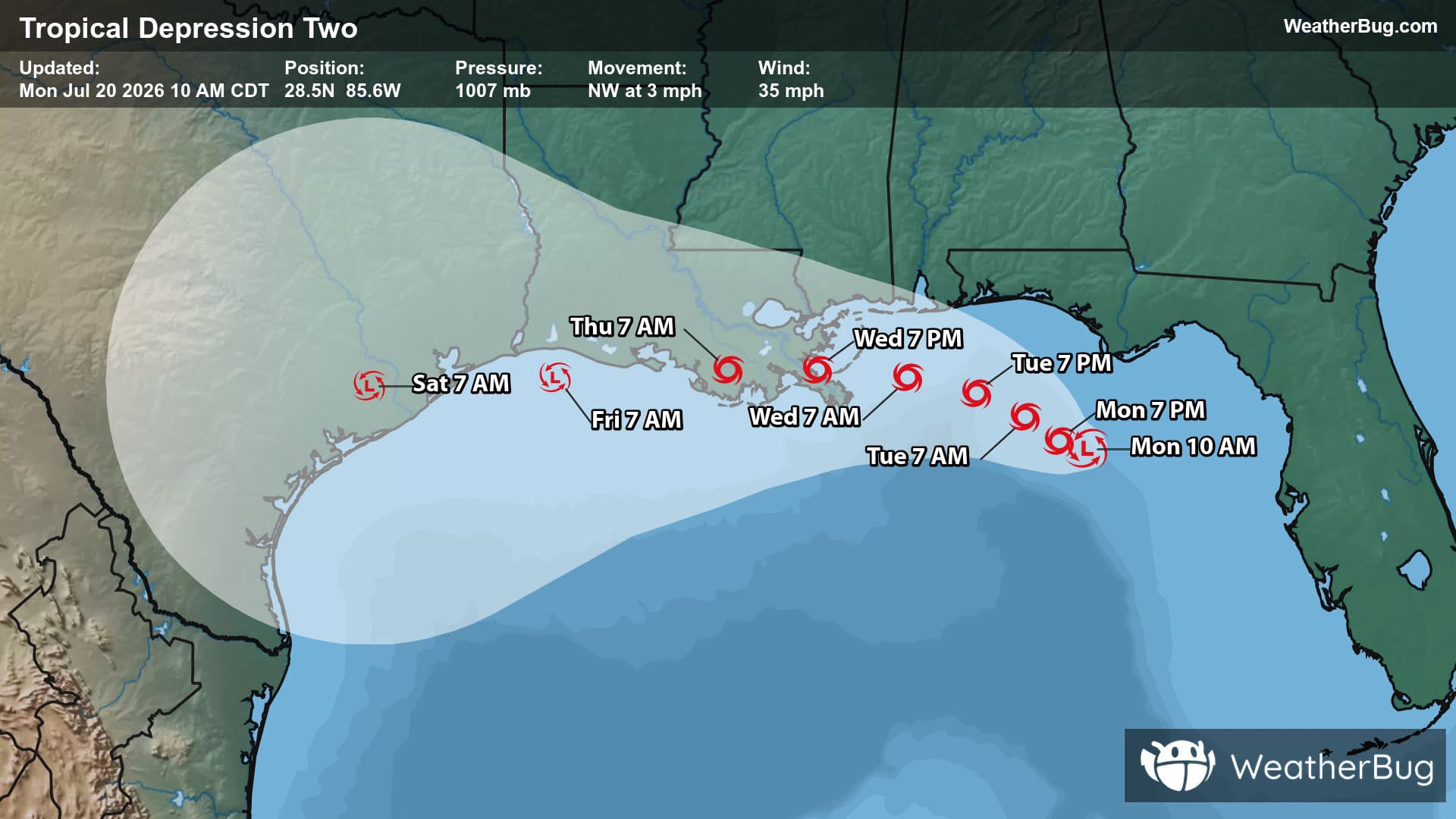
Weather Alerts For Shelby Gap, KY
Special Weather Statement
-Special Weather Statement National Weather Service Jackson KY 235 AM EST Sun Dec 7 2025 Fleming-Montgomery-Bath-Rowan-Estill-Powell-Menifee-Rockcastle- Jackson-Harlan-Elliott-Morgan-Johnson-Wolfe-Magoffin-Floyd-Lee- Breathitt-Knott-Owsley-Perry-Clay-Leslie-Letcher-Martin-Pike- Including the cities of Flemingsburg, Camargo, Jeffersonville, Mount Sterling, Owingsville, Morehead, Irvine, Ravenna, Clay City, Stanton, Frenchburg, Brodhead, Mount Vernon, McKee, Annville, Cumberland, Harlan, Sandy Hook, West Liberty, Paintsville, Campton, Salyersville, Prestonsburg, Wheelwright, Beattyville, Jackson, Hindman, Pippa Passes, Booneville, Hazard, Manchester, Hyden, Jenkins, Whitesburg, Inez, Coal Run, Elkhorn City, Pikeville, and South Williamson 235 AM EST Sun Dec 7 2025 ...Light Snow Late Tonight into Monday... Light rain will transition over to light snow late tonight before tapering off on Monday. A dusting to one half inch of snow accumulation is expected over most of the area. Isolated higher amounts of 1 to 2 inches cannot be ruled out in the higher elevations near the Virginia border. Temperatures falling back below freezing for most locations may allow slick spots to develop overnight and persist into the Monday morning commute. Those with travel plans on Monday morning are encouraged to exercise caution and allow extra time to reach their destination.