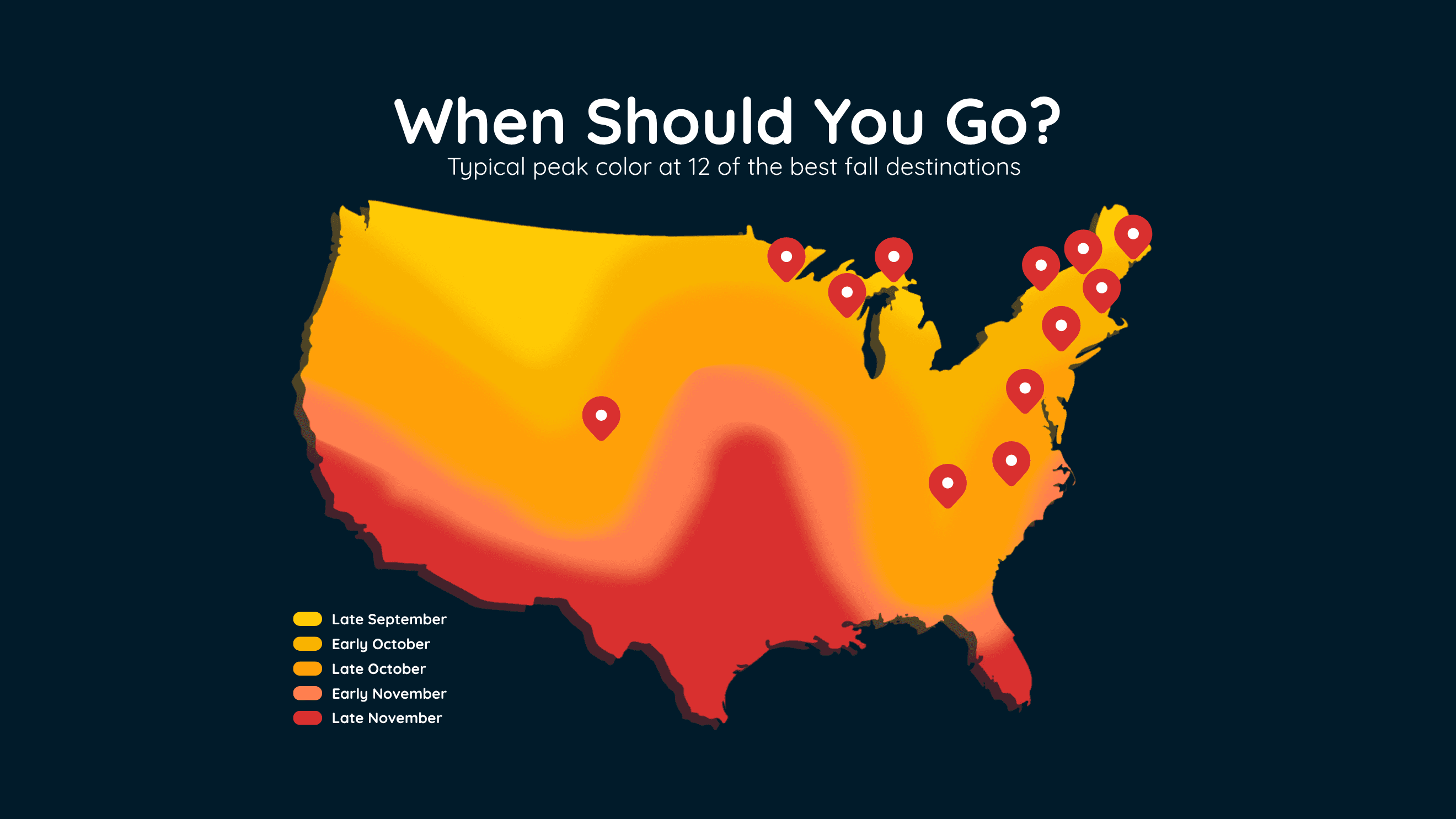
When Fall Colors Peak at 12 Top US Destinations
Find the best time to see peak fall colors at 12 popular U.S. destinations, including New England, the Smokies, Michigan and Colorado.
Read More
A Weather Alert has been issued for a nearby area. While your current location is outside of the impacted area, please stay alert and monitor weather conditions. # SUMMARY -------------------- The National Weather Service in Tucson has issued a - Flash Flood Warning for... East Central Pima County in southeastern Arizona... - Until 845 PM MST. - At 550 PM MST, Doppler radar indicated thunderstorms producing heavy rain across the warned area. Between 0.5 and 1 inch of rain has fallen. Flash flooding is ongoing or expected to begin shortly. # DETAILS -------------------- HAZARD Flash flooding caused by thunderstorms. SOURCE Radar indicated. IMPACT Flash flooding of small creeks and streams, urban areas, highways, streets and underpasses as well as other poor drainage and low-lying areas. SOME LOCATIONS THAT WILL EXPERIENCE FLASH FLOODING INCLUDE Drexel Heights, Pascua Pueblo Yaqui Reservation, San Xavier Community, Valencia West, Tucson Estates, San Xavier Mission and Ryan AirField. THIS INCLUDES THE FOLLOWING HIGHWAYS Interstate 19 between mile markers 56 and 61. Route 86 between mile markers 160 and 171. THIS INCLUDES THE FOLLOWING FLASH FLOOD PRONE LOCATIONS Santa Clara Ave at El Vado Wash, Mark Rd from Jeffery Rd to Los Reales Rd, Mission Rd from Valencia Rd to San Xavier Rd and Black Wash at S Camino de Oeste. ISSUED AT Monday, September 14, 2026 at 5:50 PM MST ISSUED BY National Weather Service Tucson AZ HEADER BULLETIN - EAS ACTIVATION REQUESTED | Flash Flood Warning # PRECAUTIONARY/PREPAREDNESS ACTIONS -------------------- Turn around, don't drown when encountering flooded roads. Most flood deaths occur in vehicles. Be aware of your surroundings and do not drive on flooded roads.
A Weather Alert has been issued for a nearby area. While your current location is outside of the impacted area, please stay alert and monitor weather conditions. # SUMMARY -------------------- The National Weather Service in Tucson has issued a - Severe Thunderstorm Warning for... Northeastern Pima County in southeastern Arizona... - Until 630 PM MST. - At 545 PM MST, severe thunderstorms were located along a line from over Casas Adobes to over Drexel Heights, moving northeast at 15 mph. # DETAILS -------------------- HAZARD 60 mph wind gusts and small hail. SOURCE Radar indicated. IMPACT Expect damage to roofs, siding, and trees. LOCATIONS IMPACTED INCLUDE Tucson, Catalina, Oro Valley, Marana, Davis-Monthan Air Force Base, Casas Adobes, Drexel Heights, Flowing Wells, South Tucson, Pascua Pueblo Yaqui Reservation, Tortolita, San Xavier Community, Catalina Foothills, Tucson Mountain Park, Catalina State Park, Saguaro National Park West, Tucson International Airport and Sabino Canyon Recreation Area. THIS INCLUDES THE FOLLOWING HIGHWAYS Interstate 19 between mile markers 54 and 63. Route 86 between mile markers 158 and 171. Route 77 between mile markers 70 and 85. Interstate 10 between mile markers 244 and 265. ISSUED AT Monday, September 14, 2026 at 5:45 PM MST ISSUED BY National Weather Service Tucson AZ HEADER BULLETIN - IMMEDIATE BROADCAST REQUESTED | Severe Thunderstorm Warning # PRECAUTIONARY/PREPAREDNESS ACTIONS -------------------- Seek shelter inside a well-built structure and stay away from windows. These storms are capable of producing damaging winds. Torrential rainfall is also occurring with these storms and may lead to flash flooding. Do not drive your vehicle through flooded roadways.
Closest strike: 7.63 miles Stay Alert! Remain in a safe area until there has been no lightning within 10 miles of this location for 30 minutes. Please be aware that lightning activity can remain high even when a storm is moving away from your location. Even if rain has stopped, do not leave your safe area until WeatherBug indicates that lightning is more than 10 miles away from this selected location. IF OUTDOORS Avoid water, high ground, and open spaces. Avoid all metal objects including electric wires, fences, and machinery. Find a safe area in a building or in a fully enclosed vehicle with the windows completely shut. Unsafe places include underneath canopies, small picnic or rain shelters, convertibles, or near trees. IF INDOORS Avoid water and stay away from doors and windows. Avoid using a hard line telephone. Take off headphones. Turn off, unplug, and stay away from appliances, computers, power tools, and TV sets. Lightning may strike exterior electric and phone lines, inducing shocks to inside equipment.