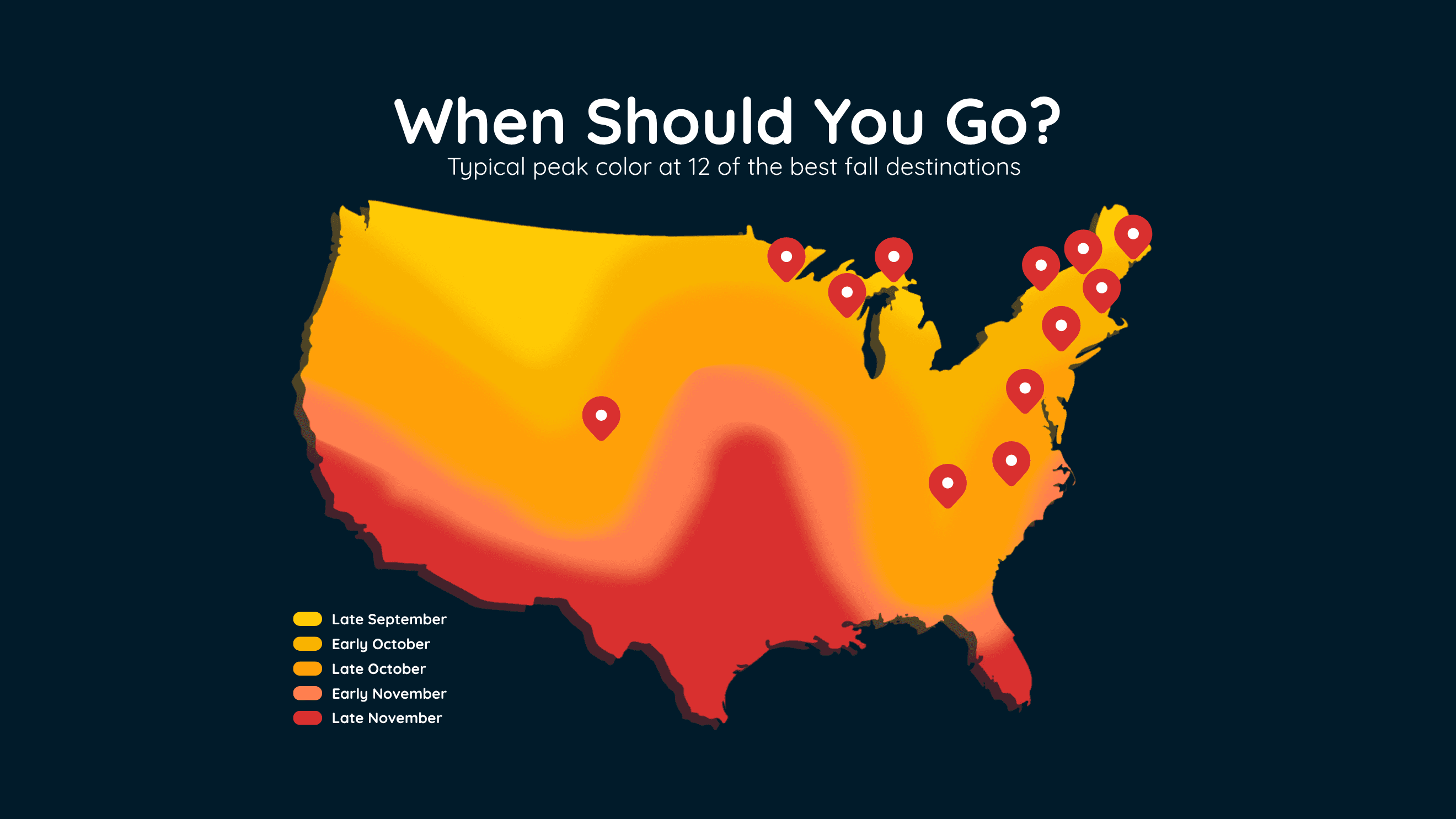
When Fall Colors Peak at 12 Top US Destinations
Find the best time to see peak fall colors at 12 popular U.S. destinations, including New England, the Smokies, Michigan and Colorado.
Read More
A Weather Alert has been issued for a nearby area. While your current location is outside of the impacted area, please stay alert and monitor weather conditions. # SUMMARY -------------------- The National Weather Service in Tucson has extended the - Flash Flood Warning for... North Central Pima County in southeastern Arizona... - Until 930 PM MST. - At 753 PM MST, Doppler radar and automated rain gauges indicated thunderstorms producing heavy rain in Brawley Wash at Manville Road. Between 1.6 and 1.8 inches of rain have fallen. Additional rainfall amounts up to 1 inch are possible in the warned area. Flash flooding is ongoing or expected to begin shortly. # DETAILS -------------------- HAZARD Life threatening flash flooding. Thunderstorms producing flash flooding. SOURCE Radar and automated gauges. IMPACT Life threatening flash flooding of creeks and streams, urban areas, highways, streets and underpasses. SOME LOCATIONS THAT WILL EXPERIENCE FLASH FLOODING INCLUDE Avra Valley, Saguaro National Park West and Picture Rocks. THIS INCLUDES THE FOLLOWING FLASH FLOOD PRONE LOCATIONS Manville Rd at Brawley Wash and Twin Peaks Rd between Sanders and Sandario. ISSUED AT Monday, September 14, 2026 at 7:53 PM MST ISSUED BY National Weather Service Tucson AZ HEADER BULLETIN - EAS ACTIVATION REQUESTED | Flash Flood Warning # PRECAUTIONARY/PREPAREDNESS ACTIONS -------------------- Turn around, don't drown when encountering flooded roads. Most flood deaths occur in vehicles. Be aware of your surroundings and do not drive on flooded roads. Stay away or be swept away. River banks and culverts can become unstable and unsafe.
# SUMMARY -------------------- The National Weather Service in Tucson has extended the - Flash Flood Warning for... East Central Pima County in southeastern Arizona... - Until 845 PM MST. - At 732 PM MST, Doppler radar indicated thunderstorms producing heavy rain across the warned area. Between 1 and 1.5 inches of rain have fallen. Flash flooding is ongoing or expected to begin shortly. # DETAILS -------------------- HAZARD Flash flooding caused by thunderstorms. SOURCE Radar indicated. IMPACT Flash flooding of small creeks and streams, urban areas, highways, streets and underpasses as well as other poor drainage and low-lying areas. SOME LOCATIONS THAT WILL EXPERIENCE FLASH FLOODING INCLUDE - Vail and Corona De Tucson. - This includes Route 83 between mile markers 55 and 58. THIS INCLUDES THE FOLLOWING FLASH FLOOD PRONE LOCATIONS Houghton Rd from I-10 & Sahuarita Rd, Sahuarita Rd west of Wilmot Rd, Andrada Rd east of Wentworth Rd and Calle Rinconada Rd from Andrada Rd to Sahuarita Rd. ISSUED AT Monday, September 14, 2026 at 7:32 PM MST ISSUED BY National Weather Service Tucson AZ HEADER BULLETIN - EAS ACTIVATION REQUESTED | Flash Flood Warning # PRECAUTIONARY/PREPAREDNESS ACTIONS -------------------- Turn around, don't drown when encountering flooded roads. Most flood deaths occur in vehicles. Be aware of your surroundings and do not drive on flooded roads.
# HEADLINE -------------------- FLOOD WATCH REMAINS IN EFFECT UNTIL 11 PM MST THIS EVENING # DETAILS -------------------- WHAT Flash flooding caused by excessive rainfall is possible. WHERE A portion of Southeast Arizona, including the following areas, Catalina and Rincon Mountains, Chiricahua Mountains, Dragoon and Mule and Huachuca and Santa Rita Mountains, Eastern Cochise County below 5000 feet, Galiuro and Pinaleno Mountains, South Central Pinal County, Southeast Pinal County, Tucson Metro Area, Upper Gila River Valley, Upper San Pedro River Valley and Upper Santa Cruz River Valley/Altar Valley. WHEN Until 11 PM MST this evening. IMPACTS Excessive runoff may result in flooding of rivers, creeks, streams, and other low-lying and flood-prone locations. Creeks and streams may rise out of their banks. Low-water crossings may be flooded. ADDITIONAL DETAILS - Well above normal moisture levels for September are expected to result in scattered to numerous showers and thunderstorms capable of producing heavy rainfall today. Rain totals of 1 to 2 inches are expected with the stronger storms with isolated amounts over 2 inches possible. Areas that received substantial rainfall over the past 72 hours will be more susceptible to flash flooding. This rainfall will result in faster response in washes, creeks, and storm drainages. - http://www.weather.gov/safety/flood ISSUED AT Monday, September 14, 2026 at 12:50 PM MST ISSUED BY National Weather Service Tucson AZ HEADER Flood Watch # PRECAUTIONARY/PREPAREDNESS ACTIONS -------------------- You should monitor later forecasts and be prepared to take action should Flash Flood Warnings be issued. # AREAS AFFECTED -------------------- Dragoon and Mule and Huachuca and Santa Rita Mountains, South Central Pinal County, Catalina and Rincon Mountains, Chiricahua Mountains, Eastern Cochise County below 5000 feet, Galiuro and Pinaleno Mountains, Southeast Pinal County, Tucson Metro Area, Upper Gila River Valley, Upper San Pedro River Valley, Upper Santa Cruz River Valley/Altar Valley Including the cities of Marana, Benson, Chiricahua N.M., Mammoth, Green Valley, Sierra Vista, Nogales, Mount Graham, Picacho Peak State Park, Canelo Hills, Mount Lemmon, Oracle, Vail, Clifton, Madera Canyon, Safford, Summerhaven, Bisbee, Tucson, Willcox, and Douglas
Closest strike: 22.96 miles Monitor Storms You are not at immediate risk, but frequently check WeatherBug to see if storms are moving towards you. Be aware that new storms can also form with little notice.