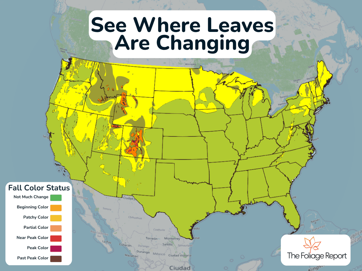
See Where Fall Colors Are Starting
The first signs of fall color are appearing in northern New England, the Upper Midwest and parts of the Rockies, but most of the country is still green.
Read More
Closest strike: 4.19 miles Stay Alert! Remain in a safe area until there has been no lightning within 10 miles of this location for 30 minutes. Please be aware that lightning activity can remain high even when a storm is moving away from your location. Even if rain has stopped, do not leave your safe area until WeatherBug indicates that lightning is more than 10 miles away from this selected location. IF OUTDOORS Avoid water, high ground, and open spaces. Avoid all metal objects including electric wires, fences, and machinery. Find a safe area in a building or in a fully enclosed vehicle with the windows completely shut. Unsafe places include underneath canopies, small picnic or rain shelters, convertibles, or near trees. IF INDOORS Avoid water and stay away from doors and windows. Avoid using a hard line telephone. Take off headphones. Turn off, unplug, and stay away from appliances, computers, power tools, and TV sets. Lightning may strike exterior electric and phone lines, inducing shocks to inside equipment.
There is a Marginal Severe Storm Risk for your location. Continue reading for today's outlook from the National Weather Service's Storm Prediction Center. -------------------- National Severe Storm Outlook THERE IS A MARGINAL RISK OF SEVERE THUNDERSTORMS FOR MUCH OF UTAH INTO ADJACENT PARTS OF WYOMING AND COLORADO...AND ACROSS A PORTION OF THE SOUTHEAST SUMMARY An isolated threat for severe wind gusts is expected today in Utah into southwest Wyoming and western Colorado. Thunderstorms capable of strong to locally severe damaging gusts are also possible across parts of the Southeast. Utah into southwest Wyoming and western Colorado Recent water-vapor imagery shows a potent shortwave trough over the western Great Basin. Recent mesoanalysis estimates a belt of stronger mid-level flow extends throughout the eastern periphery of this wave from northern AZ into central UT. This shortwave is forecast to continue slowly northeastward today, with the accompanying belt of stronger flow extending through northern UT into western WY. Scattered to numerous thunderstorms are expected this afternoon and evening across the region as lift attendant to this wave interacts with the modestly moist and buoyant airmass across the region. Buoyancy will likely remain modest (i.e. MLCAPE less than 1000 J/kg. Even so, moderate to strong vertical shear associated with the stronger mid-level flow will support organized storm structures. This shear combined with cold mid-level temperatures will support the potential for large hail. Additionally, high cloud bases and steep low-level lapse rates suggest strong gusts are possible with any of the more robust storms. This activity will eventually move into western CO and southwest WY towards the late afternoon/early evening with isolated severe gusts and/or large hail remaining possible within the stronger cores and associated outflows. Southeast Recent surface analysis places a diffuse cold front from the Arklatex northeast into far western VA where it intersects the wedge front over the Mid-Atlantic. This front is expected to gradually shift southward today, interacting with the moist airmass across the Southeast to support thunderstorm development. The strongest buoyancy (i.e. 1500 to 2000 J/kg of MLCAPE) is expected from western/central SC into central AL, where afternoon temperatures will likely reach the 90s amid low 70s dewpoints. Weak low to mid tropospheric flow was sampled by regional soundings, with the very weak vertical shear limiting the overall storm strength and persistence. Some of the stronger water-loaded downdrafts could produce strong gusts with pockets of wind damage into the early evening. Low wind probabilities were trimmed out of southwest VA and adjacent western NC/northeast TN where temperatures will remain cool, limiting buoyancy. Low wind probabilities were also trimmed across central MS where only isolated storm coverage is anticipated.
Pollen Index: 8.1 Pollen Level: medium-high Predominant Pollen: Ragweed, Chenopods and Sagebrush/Sage. Based on past pollen counts and expected weather conditions, pollen levels for Wednesday will be rising in the high range. This increase is due to seasonally normal weather conditions which are favorable for the production and dispersal of pollen.