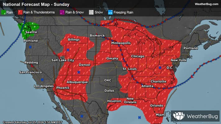
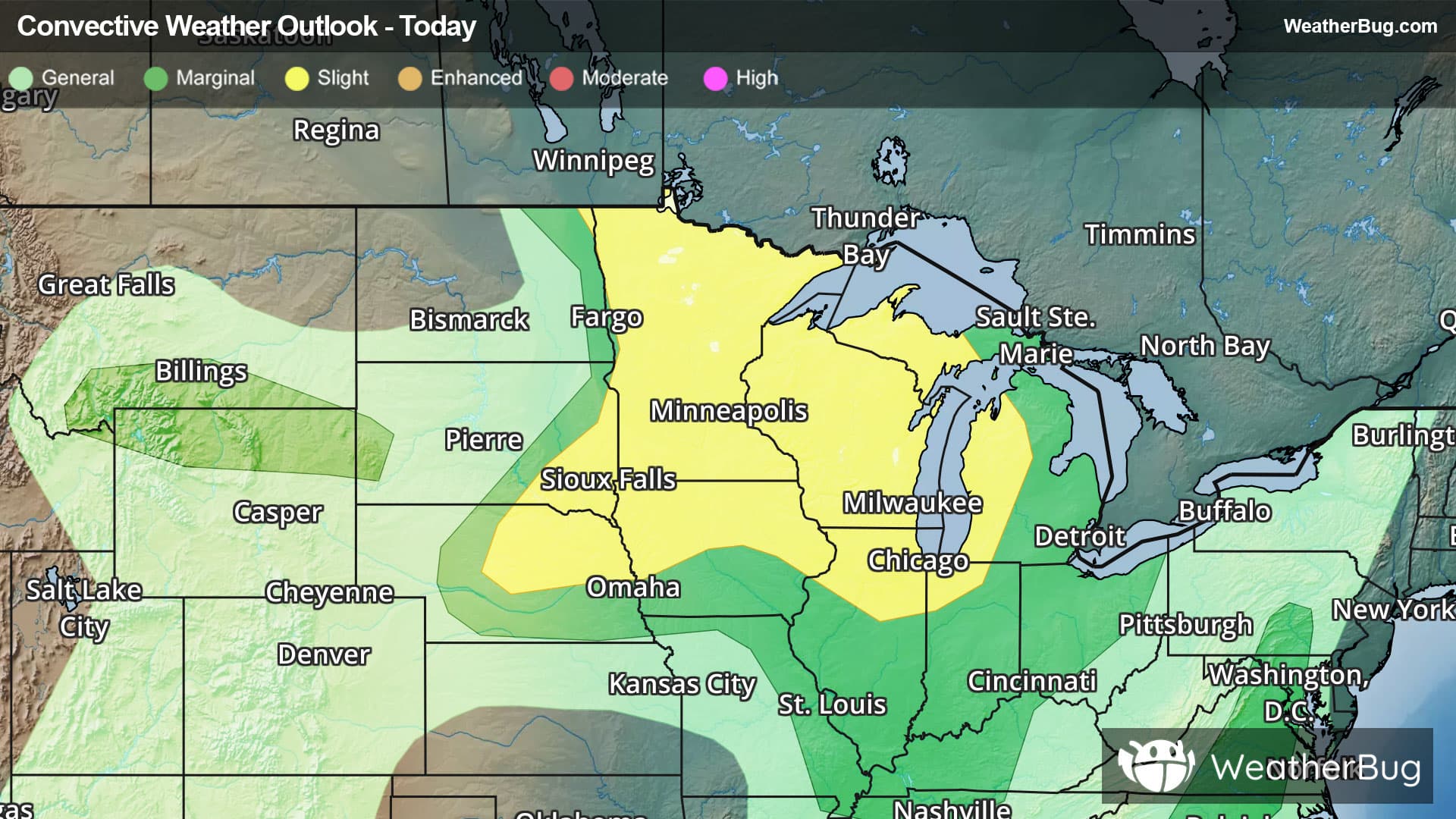
Weather Alerts For Weather, PA
Severe Storm Risk
-There is a Marginal Severe Storm Risk for your location. Continue reading for today's outlook from the National Weather Service's Storm Prediction Center. -------------------- National Severe Storm Outlook THERE IS A SLIGHT RISK OF SEVERE THUNDERSTORMS FROM PARTS OF THE SOUTHERN PLAINS INTO THE MID MISSISSIPPI VALLEY...AND LOWER GREAT LAKES SUMMARY Widely scattered severe thunderstorms will be possible today from the southern Plains northeastward into the mid Mississippi Valley and lower Great Lakes. Damaging winds and hail will be the primary threats. A greater threat for large hail is expected in the southern High Plains. Ozarks/Mid Mississippi and Ohio Valleys/Lower Great Lakes At mid-levels today, a shortwave trough and an associated 75 to 90 knot jet streak will move northeastward into the upper Mississippi Valley. At the surface, a cold front will advance southeastward through the lower Missouri Valley and Great Lakes. Along and ahead of the front, surface dewpoints will mostly be in the mid to upper 60s F. This will contribute to the development of moderate instability over much of the pre-frontal airmass. Increasing low-level convergence near the front and warming surface temperatures will support scattered thunderstorm development by afternoon. Along much of the front, 0-6 km shear is forecast to be between 25 to 35 knots, suggesting that enough shear will be present for organized storms. The potential for severe wind gusts will be greatest along the leading edge of line segments that form in areas that heat up the most. The severe threat is expected to persist into the evening. Southern Plains A mid-level shortwave trough will move northeastward into the southern High Plains today. Ahead of the trough, a moist and unstable airmass will be located over much of the southern Plains with surface dewpoints the upper 60s and lower 70s F. In response to surface heating, moderate instability will develop over much of the moist sector, with MLCAPE likely peaking in the 3000 to 4000 J/kg range in many areas. Increasing low-level convergence near the front will lead to thunderstorm development during the afternoon. The greatest convective coverage is forecast across west-central and north-central Texas, where low-level flow will be maximized. Ahead of the developing storms, forecast soundings by late afternoon show moderate deep-layer shear and steep mid-level lapse rates. This environment will support a potential for supercells with large hail, mainly with cells in the stronger instability that can remain discrete. A threat for severe wind gusts is also expected, with this threat increasing if a cold pool can organize during the late afternoon or evening. The severe threat could impact parts of the Texas Hill Country and east Texas later in the evening, before the threat becomes more isolated.
Pollen Alert
-Pollen Index: 9.3 Pollen Level: medium-high Predominant Pollen: Oak, Birch and Maple. Pollen concentrations for Wednesday will be falling but will remain in the high range. This forecast of lower pollen concentration is based on falling temperatures, lack of strong winds and expected precipitation in the evening which tends to wash pollen out of the air.