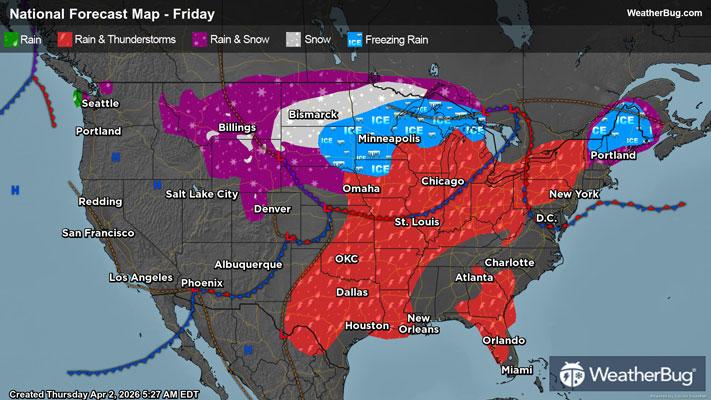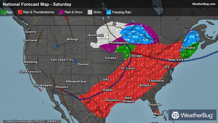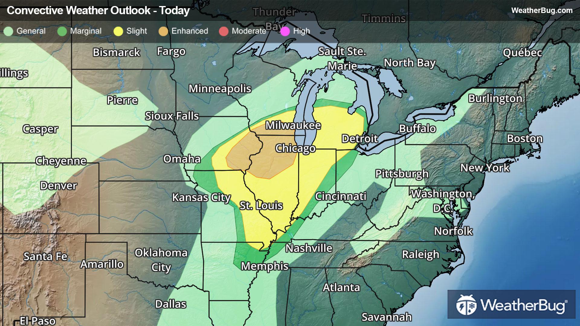
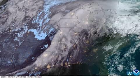
Severe Weather Heads for Midwest & Great Lakes
A potent low pressure system tracking into The Midwest and Great Lakes will provide ample energy for severe thunderstorms today.
Read More
Weather Station:Fort Benton Fort Benton
33degrees Fahrenheit
Feels like:22°F
Hi: 49Lo: 30
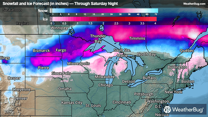
80% Chance of Heavy Snow
Lo30°F
Breezy. Patchy blowing snow in the evening. Snow in the evening then snow likely after midnight. New snow accumulation of 1 to 6 inches. Total snow accumulation 1 to 8 inches. Near steady temperature around 30. Northwest winds 10 to 25 mph with gusts to around 45 mph. Chance of snow near 100 percent.
Hi47°F
Not as cool. Cloudy with a 50 percent chance of snow in the morning then mostly sunny in the afternoon. Highs in the upper 40s. Northwest winds 5 to 15 mph. Gusts up to 35 mph decreasing to 25 mph in the afternoon.
26 | Fair
1.8 Low
Closest strike in the last 30 minutes:307.0 miles
No Lightning Nearby