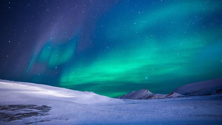
What is the Aurora Borealis?
The aurora borealis is one of the most fascinating, magnificent light displays on Earth.
Read More
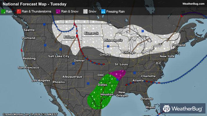
Weather Station:GAYLORD
9degrees Fahrenheit
Feels like:-8°F
Hi: 13Lo: 3
70% Chance of Heavy Snow
Hi13°F
Partly cloudy with probable snow. Chance of precipitation 75%. High temperature around 13F. Dew point will be around 4F with an average humidity of 82%. Winds will be 14 mph from the NW.
Lo3°F
Light snow early then snow likely after midnight. Total nighttime snow accumulation of 1 to 3 inches. Lows around 2. West winds 10 to 15 mph with gusts to around 30 mph. Wind chill readings 6 below to 16 below zero.
19 | Excellent
0.1 Low
Closest strike in the last 30 minutes:2027.3 miles
No Lightning Nearby