
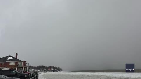
Series of Weather Systems Cover Great Lakes, East in Snow
Two main areas of low pressure will produce snow in the Upper Midwest, Great Lakes and Eastern U.S.
Read More
Weather Station:WeatherBug
21degrees Fahrenheit
Feels like:5°F
Hi: 23Lo: 12
70% Chance of Snow
Hi24°F
Lake effect snow showers and blowing snow. Snow may be heavy at times. Visibility one quarter mile or less at times. Additional accumulation 1 to 3 inches in the most persistent snows. Very windy. Temperatures falling to between 15 and 20. West winds 20 to 30 mph increasing to 25 to 35 mph with gusts up to 45 mph. Chance of snow near 100 percent.
Lo11°F
Lake effect snow showers and blowing snow. Snow may be heavy at times with visibility one quarter mile or less at times. Additional accumulation 5 to 9 inches in the most persistent snows. Windy with lows 5 to 10 above. West winds 15 to 30 mph with gusts up to 45 mph in the evening diminishing to 10 to 15 mph. Chance of snow near 100 percent.
28 | Fair
0.1 Low
Closest strike in the last 30 minutes:1125.2 miles
No Lightning Nearby


