Big Thunderstorms Move Through the Southeast
An advancing cold front will bring threats for severe weather to parts of the Gulf Coast and Southeast states today.
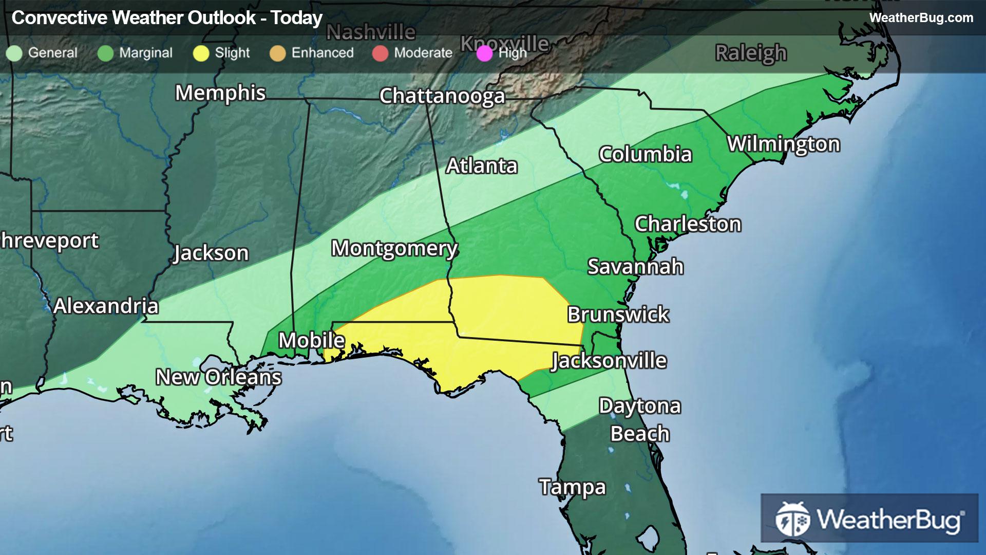
Plenty of warm and unstable air will remain in place ahead of this front across northern Florida, southeastern Alabama, and southern Georgia today. This is where the government's Storm Prediction Center has issued a Slight Risk, or a 2 out of 5 on the severe weather probability scale, for today.
Some cities at risk for damaging winds, large hail, and even an isolated tornado today include Tallahassee and Pensacola, Fla., Dothan, Ala., and Valdosta, Ga.
A Tornado Watch is in effect this morning across portions of southern Alabama, northern Florida, and southwestern Georgia.
A few gusty thunderstorms may also cross portions of eastern Georgia to eastern North Carolina as this cold front continues to slide eastward. Cities such as Savannah, Ga., Columbia and Charleston, S.C., and Wilmington, N.C. could experience one of these gusty thunderstorms.
Make sure to know the difference between a watch and a warning should they be issued. A "watch" means that conditions are favorable for severe weather to occur, and to be on alert for any rapidly changing conditions. A "warning" means that severe weather is imminent, and you should act fast to remain safe.
The best way to remain safe is to stay prepared and informed about your local weather. Have a severe weather kit packed with a battery-operated radio, water, and non-perishable food items. Also, check the WeatherBug app frequently for any updates on today's severe weather. Remember, "When Thunder Roars, Go Indoors!"