


Hail Filled Storms to Pummel North-Central U.S.
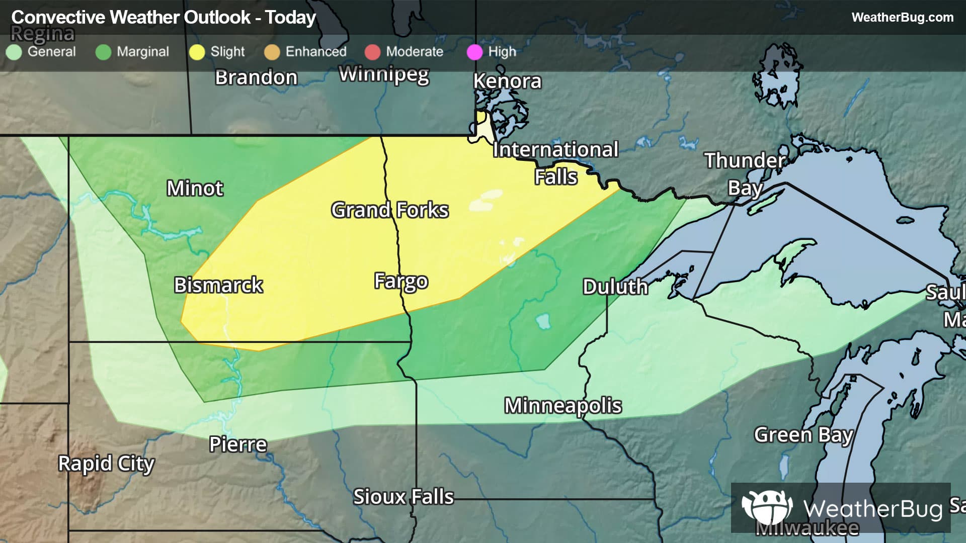
Severe thunderstorms with plenty of hail will target eastern North Dakota and northwestern Minnesota this afternoon and evening.
A low pressure system moving through Manitoba and western Ontario will push a cold front through the north-central U.S. today. Combined with plenty of upper-level energy and instability, severe thunderstorms are anticipated to fire, particularly in eastern North Dakota and northwestern Minnesota. Hail as large as golf balls will be the biggest concern along with damaging wind gusts exceeding 60 mph. An isolated tornado will even be possible.
The government's Storm Prediction Center has issued a Slight Risk (level 2 out of 5) in eastern North Dakota and northwestern Minnesota. This includes Fargo and Bismarck, N.D. and Bemidji and Moorhead, Minn.
Make sure to know the difference between a watch and a warning should they be issued. A "watch" means that conditions are favorable for severe weather to occur, and to be on alert for any rapidly changing conditions. A "warning" means that severe weather is imminent, and you should act fast to remain safe.
The best way to remain safe is to stay prepared and informed about your local weather. Have a severe weather kit packed with a battery-operated radio, water, and non-perishable food items. Also, check the WeatherBug app frequently for any updates on today's severe weather. Remember, "When Thunder Roars, Go Indoors!"