
Heightened Severe Storm Risk for the Central Plains
A low pressure system will trigger severe thunderstorms this afternoon and evening across the Central Plains.
The ingredients will come together to produce all severe weather hazards over the Central Plains today, with flash flooding a big concern tonight into tomorrow over the Lower Midwest.
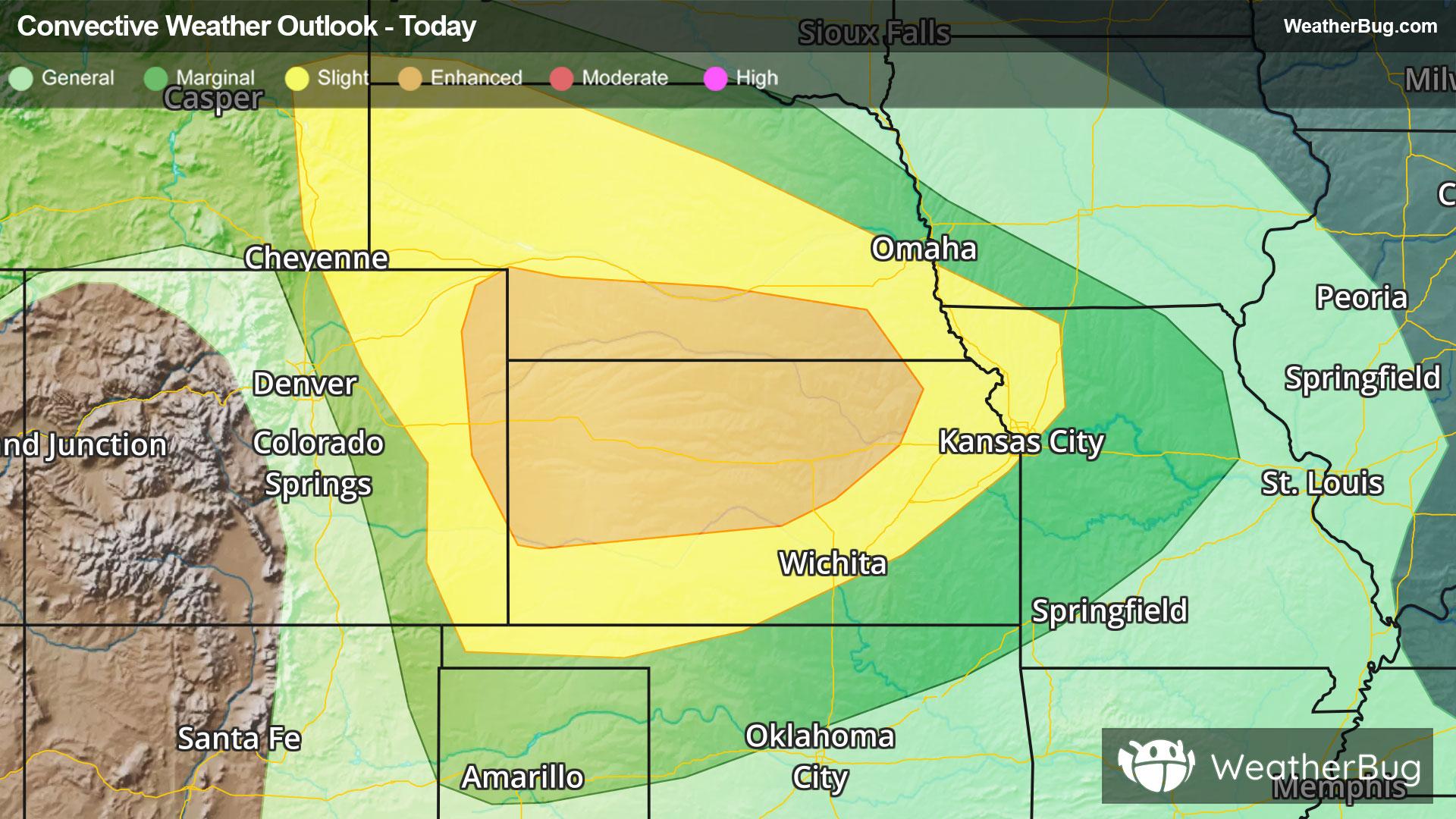
The Storm Prediction Center currently outlines an Enhanced Risk (level 3 of 5) over northeastern Colorado, southern Nebraska, and northwestern and central Kansas. A Slight Risk (level 2 of 5) extends from southeastern Wyoming to the Oklahoma Panhandle to northwestern Missouri. Cities included are Garden City and Wichita in Kansas, Cheyenne, Wyo., and Kansas City, Missouri.
Clusters of thunderstorms will develop east of the Front Range this afternoon before morphing into a large storm complex later this evening. Severe hazards include very large hail, wind gusts in excess of 75 mph and tornadoes.
Flooding will also become a major issue in the Lower Midwest tonight into Sunday where 2-6” of heavy rain could cause widespread flooding. Flash Flood Watches have been posted from southeastern Nebraska and eastern Kansas to central Indiana. Additional Flood Watches are up for a separate weather system over the Gulf Coast states where 1-3", locally 4-5" of rain could fall.
Make sure to know the difference between a watch and a warning should they be issued. A "watch" means that conditions are favorable for severe weather to occur, and to be on alert for any rapidly changing conditions. A "warning" means that severe weather is imminent, and you should act fast to remain safe.
The best way to remain safe is to stay prepared and informed about your local weather. Have a severe weather kit packed with a battery-operated radio, water, and non-perishable food items. Also, check the WeatherBug app frequently for any updates on today's severe weather. Remember, "When Thunder Roars, Go Indoors!"