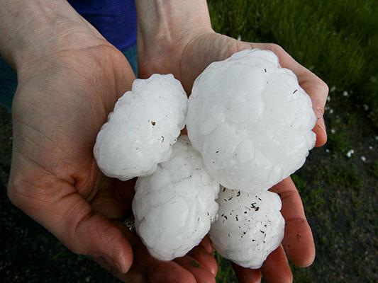
Intermountain West, High Plains Targeted by Severe Thunderstorms
The High Plains and a portion of the Intermountain West are locations to watch for severe thunderstorms today
Read MoreThe High Plains and a portion of the Intermountain West are locations to watch for severe thunderstorms today
Read More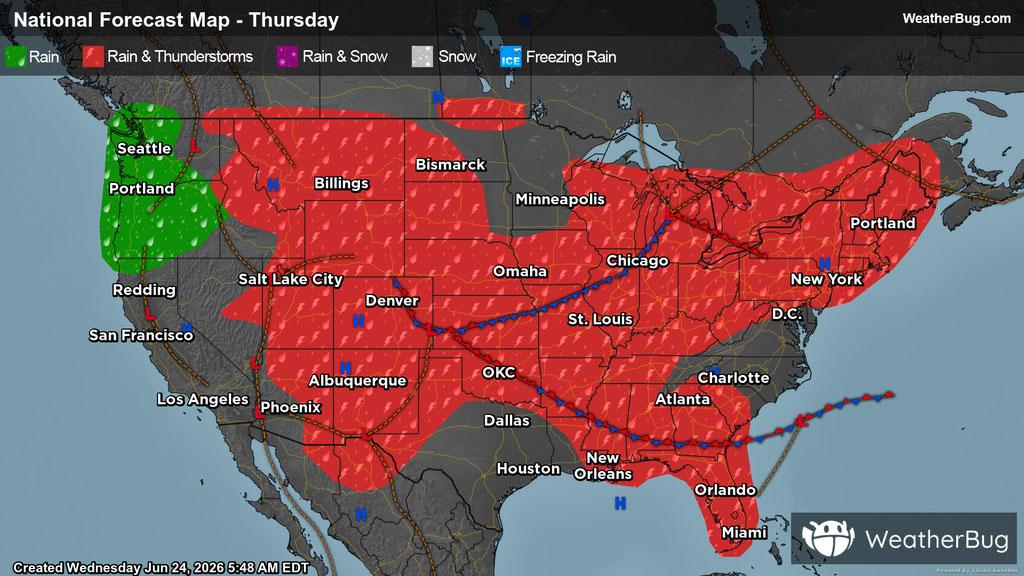
Showers and thunderstorms will continue to be in the forecast for much of the country, as multiple disturbances will spark storms.
Read More
As this year’s meteorological summer swings in, many folks wonder what might be in store.
Read More
The heaviest precipitation this week occurred across the Midwest and in parts of the southern Plains
Read More