Scattered Severe Storms Threaten North-Central U.S.
A sagging cold front in the northern Plains will be the focal point for storms to develop along this afternoon and evening.
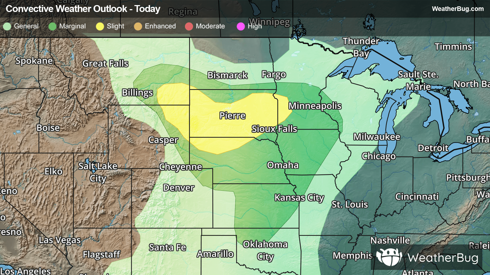
The front will stick around Minnesota, South Dakota, and northern Wyoming today, eventually sliding southeastward into the central Plains and Midwest on Friday. Clusters of strong to severe thunderstorms will form near and south of this front today, which is why the Storm Prediction Center has issued a Slight Risk, a level 2 out of 5, from far southeastern Montana and northeastern Wyoming into South Dakota, northern Nebraska, and southwestern Minnesota.
Gusty winds and large hail will be the main threats with these storms, but a couple of tornadoes could also develop. Valentine, Neb. and Rapid City, Pierre, Aberdeen, and Sioux Falls, S.D. have the greatest chance for severe weather today.
More isolated severe weather is possible across the rest of Nebraska, most of Kansas and Iowa, and northwestern Missouri today. While there should be good storm coverage across most of this region, these storms may not get as organized as the activity further north, limiting their severe weather potential.
Make sure to know the difference between a watch and a warning should they be issued. A "watch" means that conditions are favorable for severe weather to occur, and to be on alert for any rapidly changing conditions. A "warning" means that severe weather is imminent, and you should act fast to remain safe.
The best way to remain safe is to stay prepared and informed about your local weather. Have a severe weather kit packed with a battery-operated radio, water, and non-perishable food items. Also, check the WeatherBug app frequently for any updates on today's severe weather. Remember, "When Thunder Roars, Go Indoors!"