


Severe Storms Erupt Across Midwest & Southwest
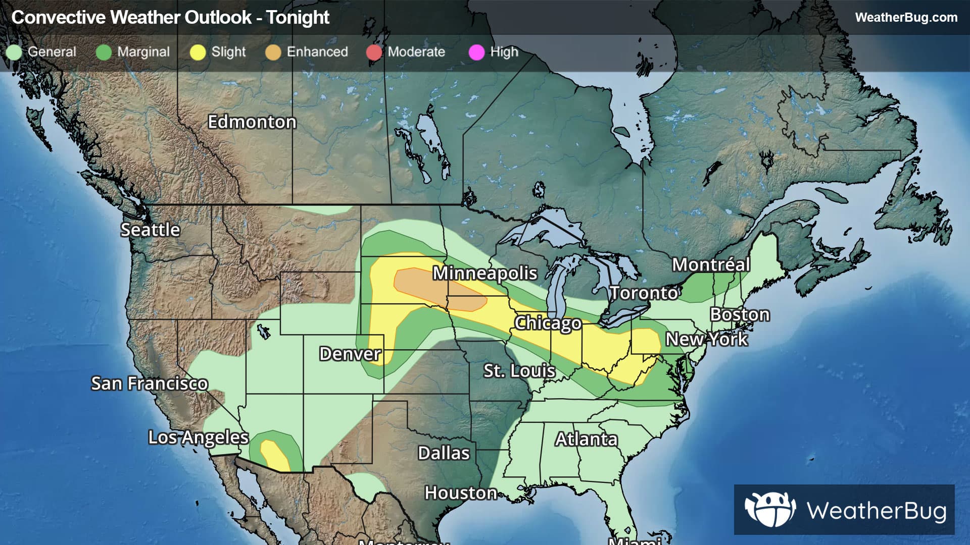
Dangerous weather will trek from parts of the northern Plains to the Midwest tonight. Parts of the Desert Southwest and central Plains could have a storm encounter also.
Waves of thunderstorms will dart along a front dividing hot, very humid air from drier air to its north from the Dakotas to the Ohio Valley. The most significant activity will occur in the Midwest tonight.
The government's Storm Prediction Center has issued an Enhanced Risk (level 3 out of 5) for severe weather tonight, which covers central/southeastern South Dakota, southwestern Minnesota, and northeastern Iowa. Cities within this risk include Sioux Falls, S.D., and Mason City, Iowa. A larger Slight Risk (level 2 out of 5) encompasses the Enhanced Risk. This includes the the High Plains into the Ohio Valley and Mid-Atlantic
A Severe Thunderstorm Watch is in in effect for far eastern Indiana and much of western Ohio. Another Severe Thunderstorm Watch is in effect for parts of South Dakota.
While an isolated tornado cannot be ruled out, the two biggest problems will be damaging wind gusts up to 70 mph and hail larger than quarter size. Cities in the path of this weather include Aberdeen, Pierre, and Sioux Falls, S.D., Chicago and Peoria, Ill., Indianapolis, Cleveland and Cincinnati.
Meanwhile, the Desert Southwest could have dangerous thunderstorms as well. A surge of monsoonal moisture combined with enough daytime heating could allow dangerous thunderstorms to bubble up this evening. Phoenix and Tucson, Arizona, are the bigger cities found in the government’s Storm Prediction Center Slight Risk.
A Severe Thunderstorm Watch is in effect across parts of south-central Arizona.
Within thunderstorms, the main concerns will be torrential downpours and destructive winds. Soils here are already saturated thanks to a soggy start to the monsoon season. Therefore, any additional rain could trigger flooding, especially near rivers, creeks, and streams along with urban, low-lying and other more flood-prone areas. If you do approach a flooded roadway, remember that it is always best to “Turn Around, Don’t Drown!”
A Flood Watch is currently in place across south-central Arizona.
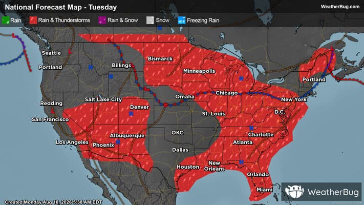
Another weather disturbance is expected to cause more severe thunderstorms on Tuesday across the Ohio Valley and even into parts of the Appalachians.
Be sure to know the difference between a watch and a warning. A watch means that the conditions are in place to possibly produce severe weather conditions, while a warning indicates that those conditions are currently occurring. Be sure to have multiple ways to receive warnings, as storms will be occurring late tonight. Also, take caution if you are outdoors during a thunderstorm. Remember, “When Thunder Roars, Go Indoors!”