


Severe Storms Fire Up Across The Northeast and Mid-Atlantic
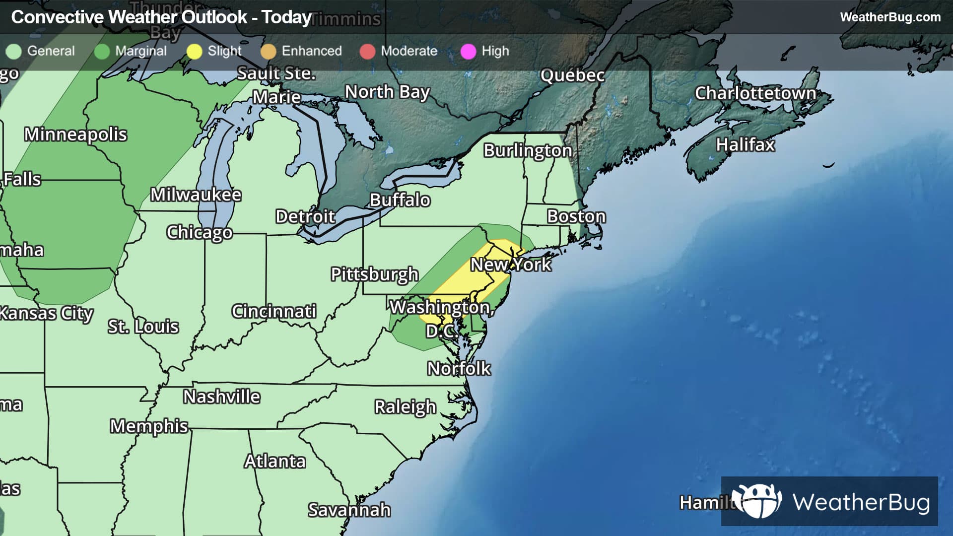
An area of strong to severe thunderstorms are expected to develop across parts of the Northeast and Mid-Atlantic this afternoon and evening.
A disturbance will move across the Northeast and Mid-Atlantic causing scattered showers and thunderstorms to form this afternoon and evening. Thunderstorms across the New York City area, northern New Jersey, parts of eastern Pennsylvania and down into the Washington D.C. area will have the potential to produce heavy downpours and strong wind gusts. Travel delays are possible this afternoon and evening due to thunderstorm activity.
The government's Storm Prediction Center has issues a Slight Risk (level 2 out of 5) across far southern New York, northern New Jersey, parts of eastern Pennsylvania, northern Delaware, parts of Maryland and far northern Virginia. Cities under this risk include New York City, Newark, N.J., Philadelphia, Baltimore and Washington.
Another area of strong to severe thunderstorms could develop across the central Plains on Saturday afternoon and evening due to a quick-moving low pressure area.
Be sure to know the difference between a watch and a warning, should they be issued. A watch means that the conditions are in place to possibly produce severe weather conditions, while a warning indicates that those conditions are currently occurring. Be sure to have multiple ways to receive warnings, as storms will be occurring late tonight.
Also, take caution if you are outdoors during a thunderstorm. Remember, “When Thunder Roars, Go Indoors!”