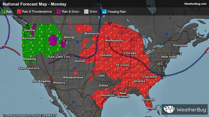
Dangerous Storm Complex Eyes E. Montana, Dakotas Through Tonight
Strong to severe thunderstorms will pepper the northern Plains through tonight, potentially leaving a swath of destructive wind across parts of Montana and North Dakota.
A potent cold front dividing summer warmth and humidity from much cooler and drier air behind it, is beginning to trigger thunderstorms this afternoon over northeastern Wyoming and southeastern Montana. This activity will multiply and intensify throughout the rest of this evening and tonight, darting into eastern Montana and the western/central Dakotas.
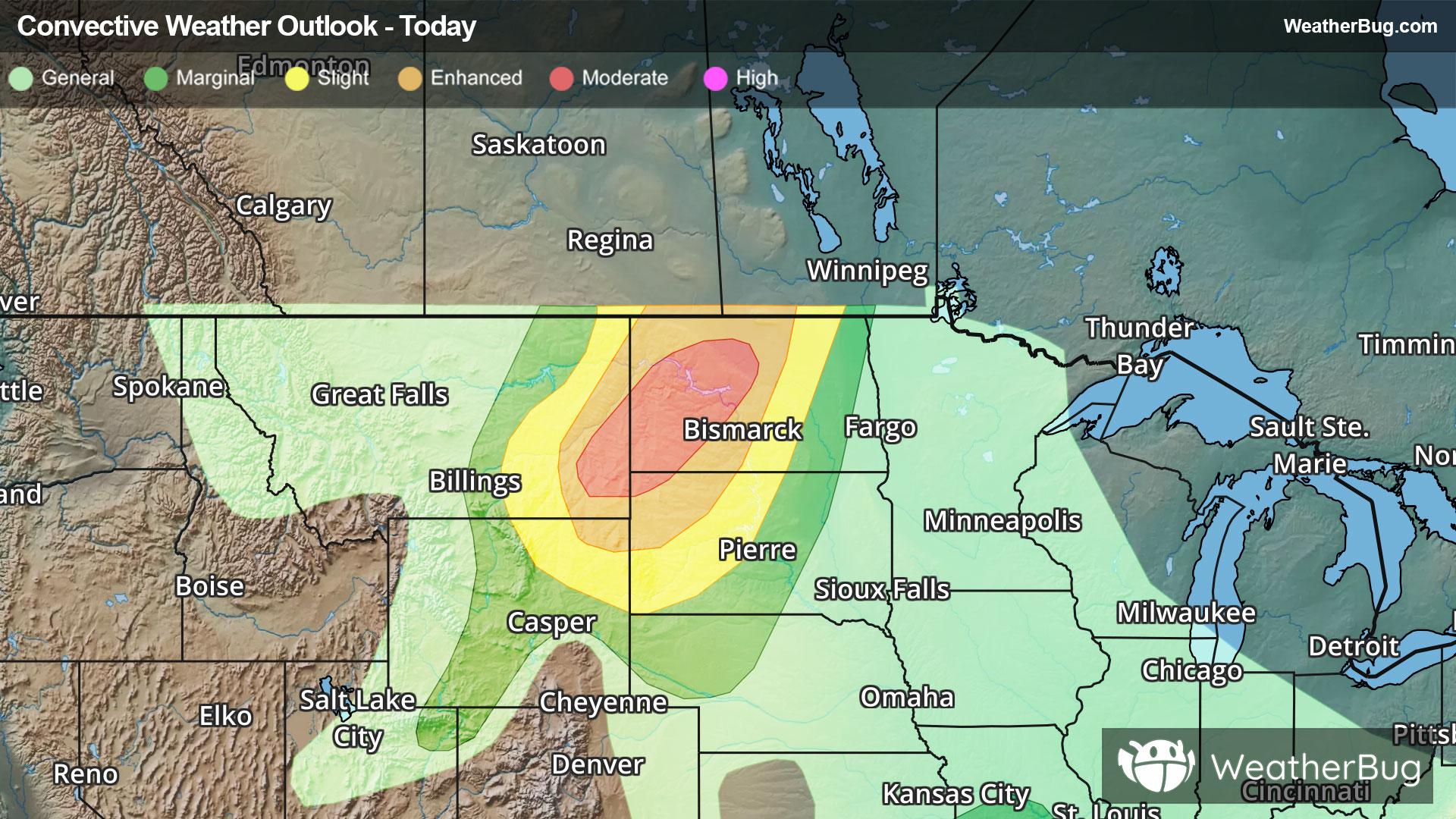
The Storm Prediction Center has issued a Severe Thunderstorm Watch for south central North Dakota. Cities include Bismarck and Jamestown, N.D. This is a particularly dangerous situation. Primary threats include widespread damaging winds and scattered significant gusts to 100 mph, scattered large hail and isolated very large hail events to 2 inches in diameter, and a tornado or two possible.
Elsewhere there is also a Severe Thunderstorm Watch in place for far southeastern Kansas, northeastern Oklahoma, southwestern Missouri and far northwestern Arkansas.
The government’s Storm Prediction Center has issued a Moderate Risk for a brief time this evening from southeastern Montana to far northwestern South Dakota and western/central North Dakota. An organized, robust thunderstorm complex packing destructive gusts of 60 to 100 mph and large, damaging hail will likely occur. Minot and Dickerson, S.D., are a few of the bigger cities that will likely be in the path.
Meanwhile, powerful thunderstorms will likely be in the forecast surrounding the Moderate Risk from northeastern Wyoming to the U.S.-Canada border. Bismarck and Williston, N.D., Miles City, Mont., and Rapid City, S.D., are included.
In addition, parts of Oklahoma, southeast Kansas, and southwest Missouri are under Flood Watches as a separate system taps into a bounty of deep tropical moisture pushing north across the southern Plains. This setup will bring the potential for heavy, slow-moving rainfall, with widespread totals of 1 to 3 inches and localized amounts reaching 3 to 5 inches or more. That raises the risk for flash flooding, especially in low-lying and flood-prone areas.
Make sure to know the difference between a watch and a warning should they be issued. A "watch" means that conditions are favorable for severe weather to occur, and to be on alert for any rapidly changing conditions. A "warning" means that severe weather is imminent, and you should act fast to remain safe.
The best way to remain safe is to stay prepared and informed about your local weather. Have a severe weather kit packed with a battery-operated radio, water, and non-perishable food items. Also, check the WeatherBug app frequently for any updates on today's severe weather. Remember, "When Thunder Roars, Go Indoors!"