
Severe Storms Revitalize in Tornado Alley
Scattered severe thunderstorms will revitalize in Tornado Alley this evening and through the weekend as a frontal clash ignites the atmosphere.
Cooler and drier continental air will brush up yet again against a muggy Gulf air mass, aided by a low pressure region forming in the southern Plains. With adequate upper-level energy as well as plenty of time for conditions to heat up at the surface, these ingredients will mix to bake up severe thunderstorms along a front this evening through the overnight hours.
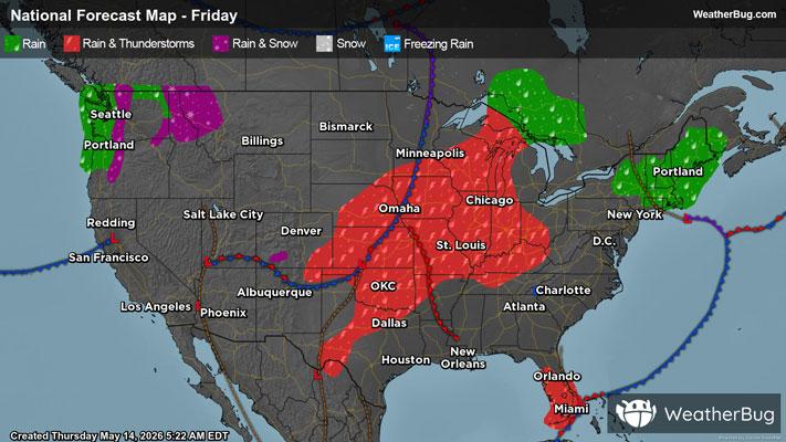
Active weather will organize from Wisconsin and Illinois into the Texas Panhandle, where isolated to scattered severe thunderstorms will embed themselves within a squall line over time.
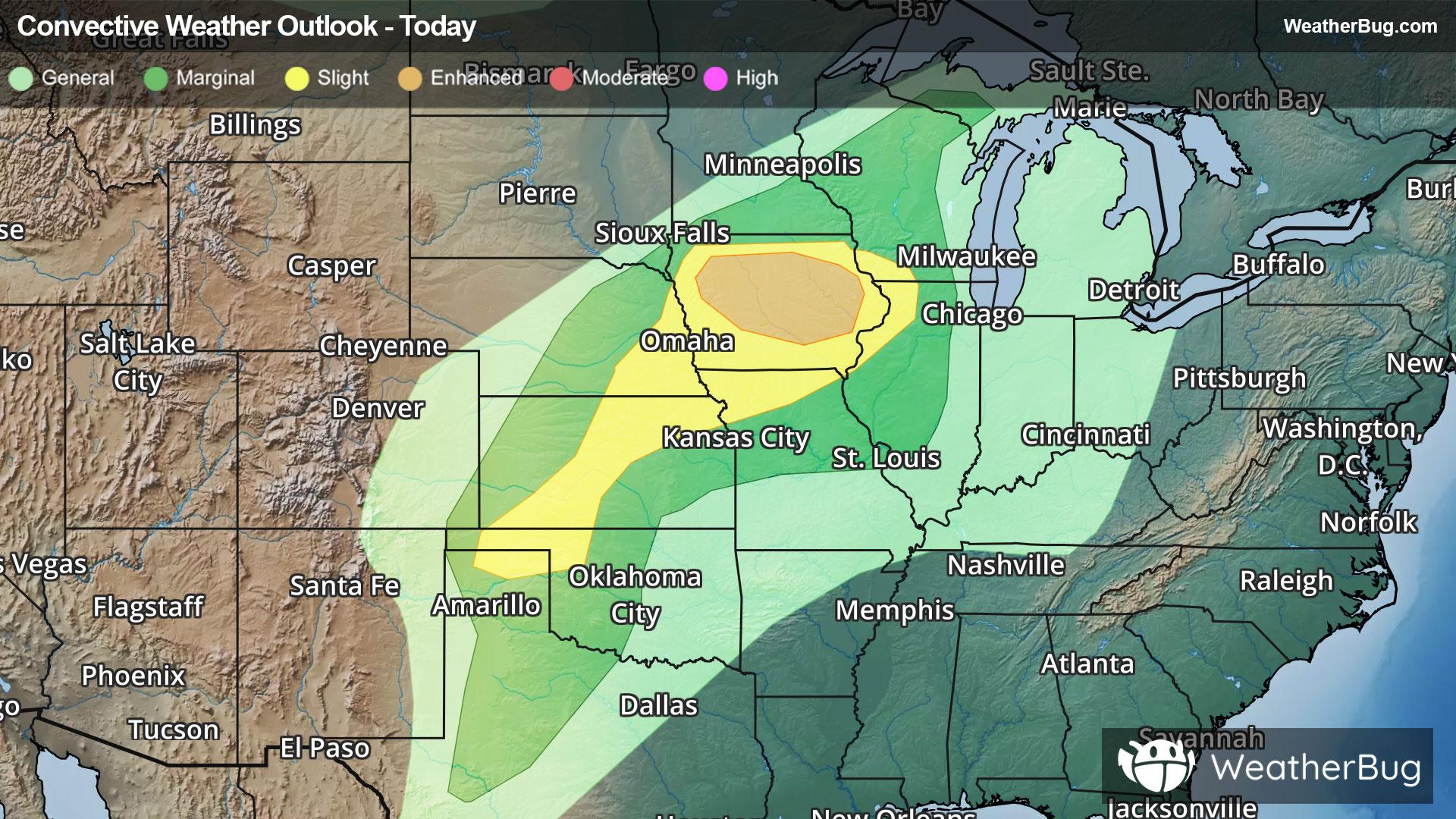
The government's Storm Prediction Center has issued an Enhanced Risk, a 3 out of 5 on the severe probability scale, within most of Iowa. Cities such as Des Moines, Cedar Rapids, Waterloo, Iowa City, and Ames are likeliest to observe a few tornadoes today beneath scattered severe thunderstorms. Damaging winds between 55 and 75 mph and hail up to and exceeding 2 inches are also possible here.
A Slight Risk, a 2 out of 5 on the severe probability scale, also covers areas from far southwestern Wisconsin to the far northeast of the Texas Panhandle, including Omaha and Lincoln, Neb., St. Joseph, Mo., and Davenport and Sioux City, Iowa. Isolated instances of damaging winds and large hail remain possible here, but tornadic activity is not expected from severe thunderstorms within this risk.
On Saturday, strengthening upper-level winds will in turn strengthen a burgeoning storm system in the southern Plains. The inflow of humid air into the region will also intensify, wrapping in increasing moisture and heat. This pattern will continue through the weekend, and as a result, severe storms will load into central Plains each day, with all severe weather hazards on the table.
Saturday currently holds a Slight Risk covering northeastern Colorado through central Iowa, affecting cities such as Omaha and Lincoln, Neb., as well as Des Moines and Sioux City, Iowa.
Sunday has also been issued a Slight Risk, spanning from Minnesota and Wisconsin southwestward into Oklahoma and containing Wichita, Kan., St. Paul and Minneapolis, Minn., Omaha, Neb., and Oklahoma City. However, Sunday also contains an already sizeable Enhanced Risk focused over eastern Nebraska through far southwestern Minnesota, threatening folks residing in Sioux Falls, S.D., Sioux City, Iowa, and Lincoln and Grand Island.
Make sure to know the difference between a watch and a warning should they be issued. A watch means that conditions are favorable for severe weather to occur, and to be on alert for any rapidly changing conditions. A warning means that severe weather is imminent, and you should act fast to remain safe.
The best way to remain safe is to stay prepared and informed about your local weather. Have a severe weather kit packed with a battery-operated radio, water, and non-perishable food items should you be without power for long periods of time. Also, check the WeatherBug app frequently for any updates on today’s severe weather. Remember, “When Thunder Roars, Go Indoors!”