


Severe Storms to Rattle the Northeastern U.S.
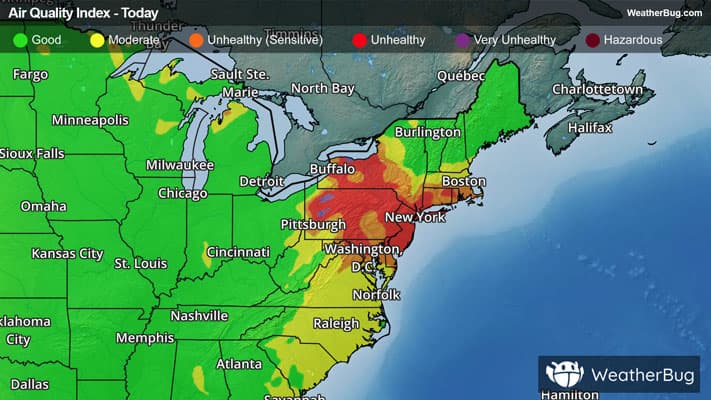
After a hazy conclusion to the workweek, scattered to numerous severe storms will impact the northeastern quadrant of the nation to start the weekend.
A burgeoning low pressure system north of the Great Lakes is pulling a particularly moist airmass up into the Northeast, creating an unstable atmosphere. With the support of upper-level disturbances and a pair of fronts, multiple rounds of scattered to numerous severe thunderstorms and intermittent rain will launch.
Severe thunderstorms today will form as thunderstorm clusters, line segments, and even supercells, bringing hazards including scattered damaging winds, hail, and even isolated tornadoes.
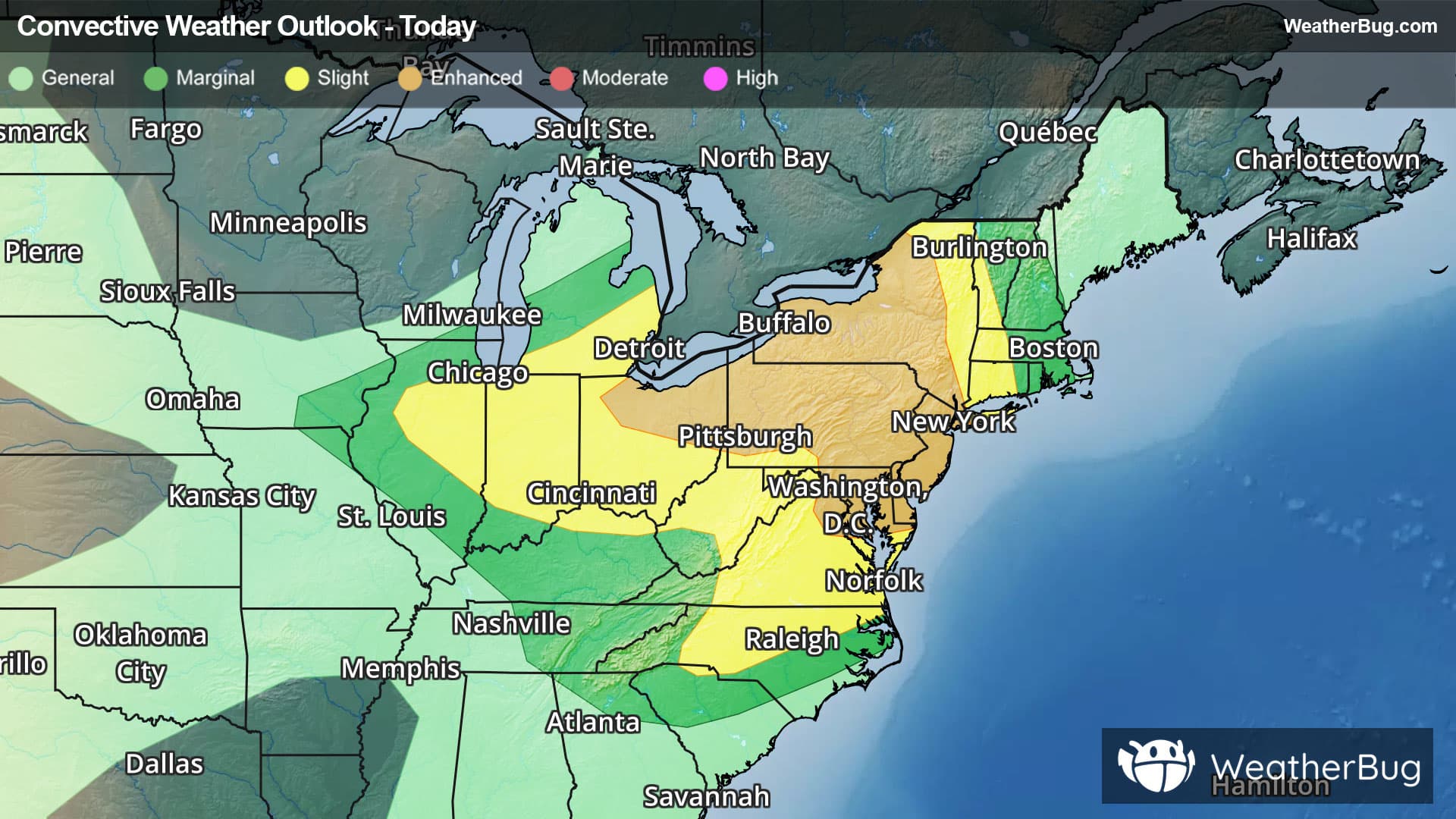
The government’s Storm Prediction Center has posted as high as an Enhanced Risk, a 3 out of 5 on the severe weather probability scale, from the Lake Erie and Lake Ontario through northern Virginia to New Jersey. Cities such as Cleveland, Ohio, New York City and Buffalo, N.Y., Trenton, N.J., Pittsburgh, Philadelphia, Baltimore, and Washington, D.C., all fall under this threat level.
A larger Slight Risk, a 2 out of 5 on the scale, also covers from east-central Illinois to western New England and central North Carolina, including Indianapolis, Ind., Cincinnati, Ohio, Charleston, W.V., Virginia Beach, Va., and Charlotte, N.C.
In addition to the threat of severe weather, heavy rain is also anticipated today beneath multiple rounds of deep thunderstorms. Rain totals of 1 to 2 inches will be common in the northern Mid-Atlantic as well as southern New England, with localized totals of up to 4" where thunderstorms repeat. Remember, when approaching floodwaters and overrun roadways, "Turn Around, Don't Drown!"
As a result of heavy expected rain amounts, Flood Watches are in effect for eastern Pennsylvania, northern Delaware, and all but far southeastern New Jersey.
Make sure to know the difference between a watch and a warning should they be issued. A "watch" means that conditions are favorable for severe weather to occur, and to be on alert for any rapidly changing conditions. A "warning" means that severe weather is imminent, and you should act fast to remain safe.
The best way to remain safe is to stay prepared and informed about your local weather. Have a severe weather kit packed with a battery-operated radio, water, and non-perishable food items. Also, check the WeatherBug app frequently for any updates on today's severe weather. Remember, "When Thunder Roars, Go Indoors!"