Severe Storms Strike Ohio Valley to Northeast, N. High Plains
A cold front is driving severe weather across the Ohio Valley and Northeast today, while a separate storm system sparks similar risks in the northern High Plains.
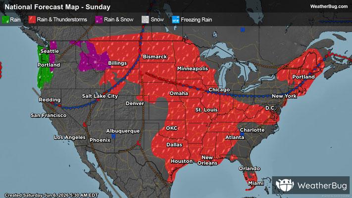
Warm, unstable, and increasingly humid air continues to surge northward ahead of a strong cold front pushing into the Ohio Valley and extending across the Great Lakes, Appalachians, Mid-Atlantic, and into New England.
Across the Mid-Atlantic, a line of strong to severe storms is racing eastward, already producing damaging winds with gusts well over 60 mph. This line is being fueled by its own surge of cooler air, allowing it to maintain both speed and intensity. To the north of the main line, additional storm clusters have been developing intermittently, at times strengthening enough to produce localized damaging wind gusts.
A Severe Thunderstorm Watch is in effect for portions of extreme southwest Connecticut, northern Delaware, New Jersey, southeast New York, and southeast Pennsylvania. Cities include Philadelphia and Allentown, Pa, Newark and Atlantic City, N.J., New York City, White Plains, and Newburgh, N.Y., and Bridgeport, Conn.
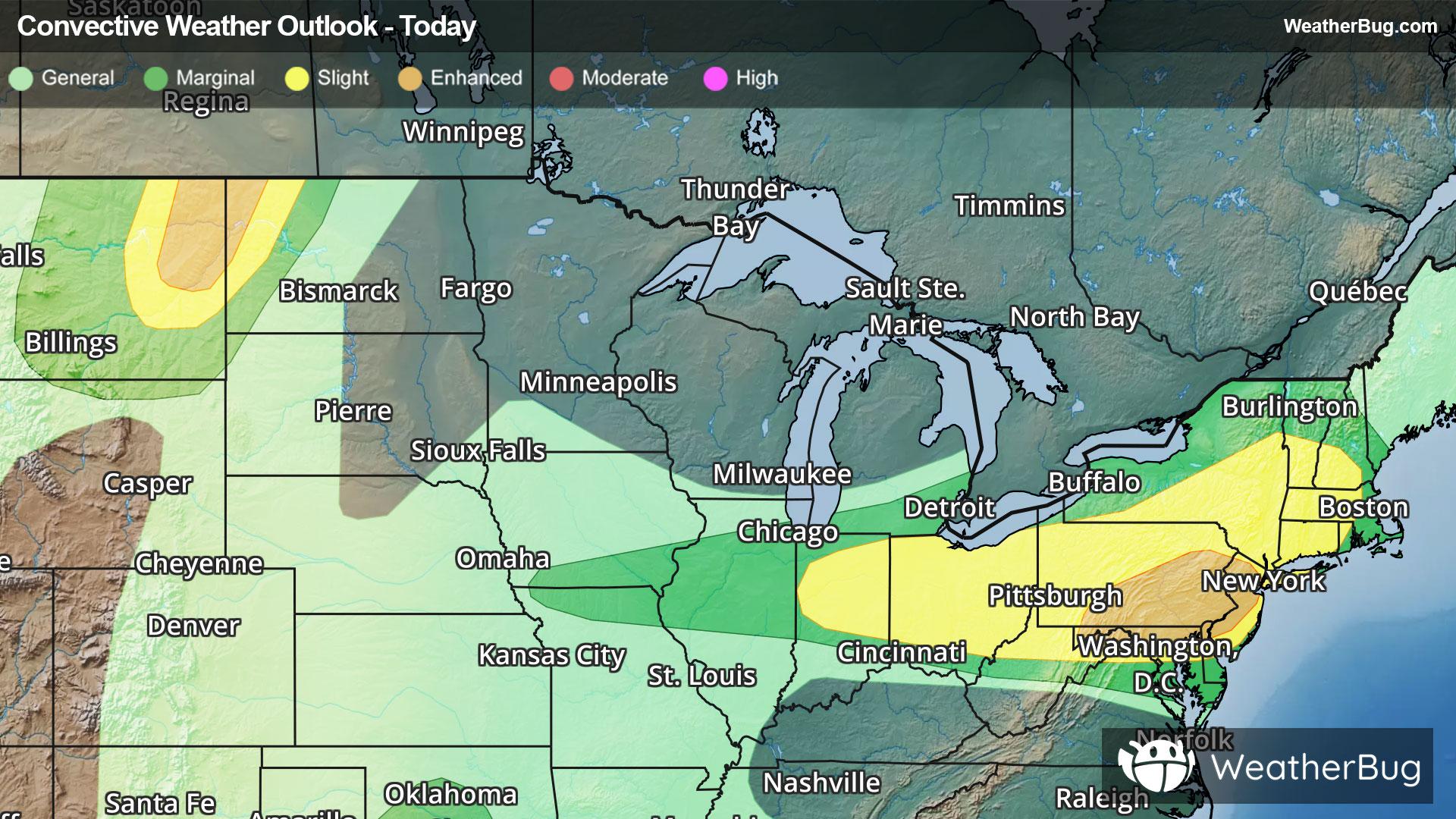
An Enhanced Risk (Level 3 out of 5) of severe weather is in place across parts of the Mid-Atlantic, including northern Maryland, eastern Pennsylvania, and central to northern New Jersey. This includes Westminster, Md., Wilmington, Del., Harrisburg, Philadelphia, and Allentown, Pa., and Trenton and Newark, N.J. A second Enhanced Risk is located farther west along the Montana and North Dakota border, including Williston, N.D., and Glendive, Mont.
A Severe Thunderstorm Watch is in effect for portions of eastern Montana and western North Dakota. Cities include Miles City, Jordan, and Glasgow, Mont., and Williston, N.D.
Surrounding these areas is a broader Slight Risk (Level 2 out of 5), extending across much of the Ohio Valley, Mid-Atlantic, and Northeast, where scattered severe storms are expected. Within both the Enhanced and Slight Risk areas, the strongest storms, whether discrete supercells or organized line segments, will be capable of damaging winds up to 70 mph, large hail over 2 inches in diameter, localized flash flooding, and a few tornadoes, with the greatest tornado potential focused from the Upper Ohio Valley into parts of the Mid-Atlantic.
A wider Marginal Risk (Level 1 out of 5) surrounds these regions, covering areas from the Lower Midwest into the Southeast, where isolated severe storms may develop along the front.
Another Severe Thunderstorm Watch is in effect for portions of northern and central Indiana, and central and west central Ohio, including Lafayette and Indianapolis, Ind., and Dayton and Columbus, Ohio.
A Severe Thunderstorm Watch is also in effect for portions of northern, Central, and eastern Ohio, and northern West Virginia. Cities include Findlay, Mansfield, Zanesville, and Akron, Ohio, and Parkersburg, W.Va.
Additionally, a separate Marginal Risk is in place across parts of central Texas and south-central Oklahoma, where a few isolated storms could produce hail and damaging winds.
In addition, Flash Flood Watches have been put up for parts of northern Texas and Oklahoma for a separate weather system. These areas could pick up 1 to 3 inches of rain with localized 3 to 5 inches today.
Make sure to know the difference between a watch and a warning should they be issued. A "watch" means that conditions are favorable for severe weather to occur, and to be on alert for any rapidly changing conditions. A "warning" means that severe weather is imminent, and you should act fast to remain safe.
The best way to remain safe is to stay prepared and informed about your local weather. Have a severe weather kit packed with a battery-operated radio, water, and non-perishable food items. Also, check the WeatherBug app frequently for any updates on today's severe weather. Remember, "When Thunder Roars, Go Indoors!"