



Severe Thunderstorms Roar Across Dakotas
Yet another round of severe weather is taking shape across the Plains this afternoon, with the storms likely to march toward the East Coast by the early to middle part of next week.
A very large area of high pressure known as a heat dome is in place across the central U.S., delivering extremely hot temperatures as far north as the Dakotas. Meanwhile, a cold front is advancing through the northern Rockies this afternoon, bringing a bit more seasonable conditions from Montana to North Dakota.
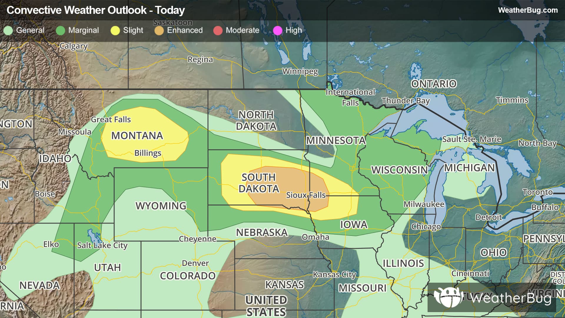
Strong to severe thunderstorms are expected to start to percolate along this front this afternoon and overnight, with the strongest ones expected across southern and eastern South Dakota as well as portions of Minnesota and Iowa. Here, the national Storm Prediction Center has highlighted an Enhanced Risk (level 3 of 5 on the severe storm scale) of severe storms. A Slight Risk exists in the area surrounding the storm bullseye, encompassing much of the rest of South Dakota, with another Slight Risk across Montana.
A Severe Thunderstorm Watch has been issued across much of South Dakota, including Aberdeen, Pierre and Sioux Falls. This watch is considered a Particularly Dangerous Situation as winds could gust beyond 80 mph. Another Severe Thunderstorm Watch is in place across southern Montana.
The temperatures soaring above 100 degrees this afternoon are likely to produce these quick-developing storms that can contain downdrafts and wind gusts of 70 to 90 mph. In addition, small hail and a few tornadoes are possible. Residents of Sioux City, Iowa, and Sioux Falls and Pierre, S.D., should be prepared for these damaging winds this evening.
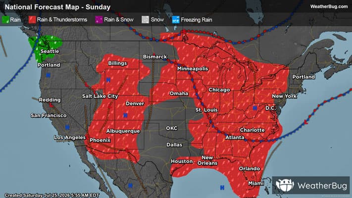
As this cold front advances eastward, much of the western Great Lakes will see severe weather on Sunday, including the Twin Cities and Green Bay and Milwaukee, Wis. The lower Great Lakes, including Chicago, Detroit and Cleveland and Cincinnati, Ohio, could all be at risk for severe weather on Monday, while Tuesday could bring these storms to the Eastern Seaboard.
Be sure to know the difference between a watch and a warning. A watch means that the conditions are in place to possibly produce severe weather conditions, while a warning indicates that those conditions are currently occurring. Also, take caution if you are outdoors during a thunderstorm. Remember, “When Thunder Roars, Go Indoors!”