


Soakers Over Eastern Carolinas
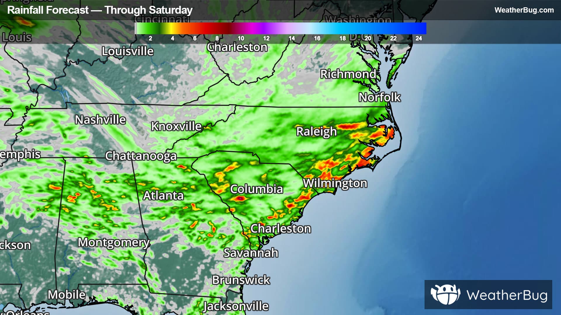
Heavy rain will continue to drench the eastern Carolinas into this weekend.
A stalled front along the eastern coast of the Carolinas combined with abundant moisture will trigger showers and thunderstorms heading into Saturday. These showers and storms will be heavy at times, soaking the eastern Carolinas. Additional rain from eastern South Carolina through eastern North Carolina will range between 2 to 4 inches with isolated totals of 4 to 7 inches possible. Flooding will be a concern thanks to slow-moving downpours coupled with saturated soils. As a result, urban flooding and flooding of local streams, creeks and rivers are possible.
Flood Watches are in place for southeastern and eastern North Carolina and eastern and portions of central South Carolina, including Fayetteville, the Outer Banks, and Wilmington, N.C. and Charleston, Columbia and Myrtle Beach, S.C.
Remember if a roadway is flooded, "Turn Around, Don't Drown!". This will likely lead to travel delays across this region of the country. Flooding is a leading cause of weather-related fatalities with more than half of flood-related casualties occurring in automobiles when attempting to cross high water. Just six inches of fast-flowing water can sweep a grown adult away while twelve inches can overtake small cars. It is never safe to drive or walk through flooded roadways.