Southern Plains to the Great Lakes on Alert for Severe Storms
A battle of clashing air masses will help fuel a new round of severe thunderstorms from the southern Plains to the lower Great Lakes today.
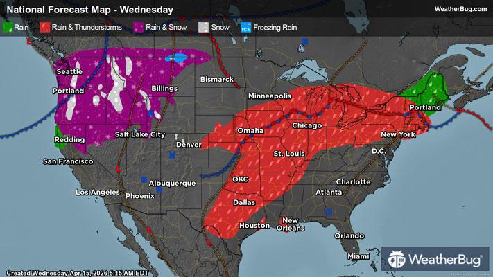
Warm and humid air continues to funnel northward across the Deep South, Mississippi Valley, and into the Ohio Valley. At the same time, a cooler and drier air mass is advancing southward from central Canada and the northern Plains.
The resulting collision of air masses, fueled in part by some strong winds aloft, will result in scattered strong to severe thunderstorms across a large portion of the nation today.
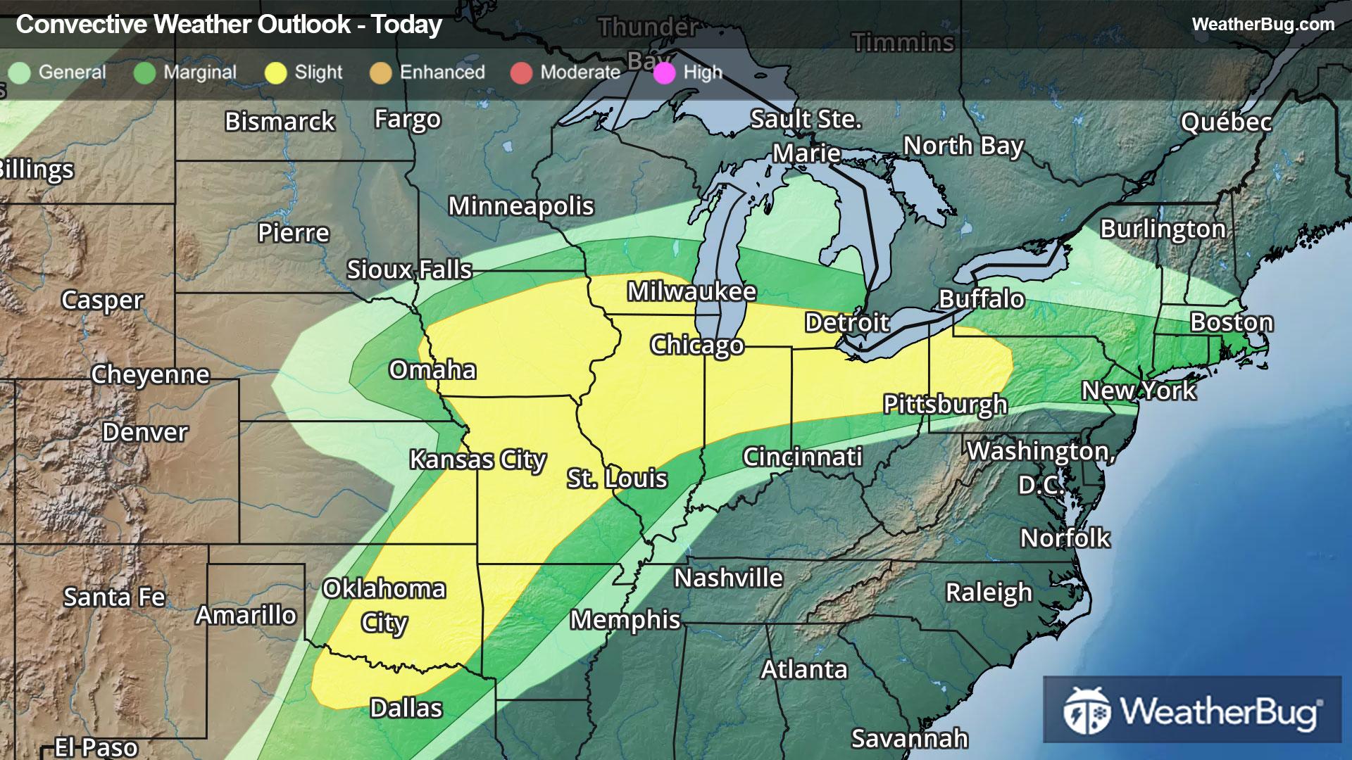
As a result, the government's Storm Prediction Center has issued a large Slight Risk, or a 2 out of 5 on the severe weather probability scale, covering areas from northern Texas to Iowa and southern Wisconsin and eastward into western Pennsylvania.
Large hail and a few tornadoes will be possible, especially across portions of northern Texas to southwestern Missouri, as well as across portions of Iowa. Damaging wind gusts and flooding downpours will be possible in any thunderstorm within the risk area today.
Some cities at risk today include Oklahoma City, Kansas City and St. Louis, Mo., Des Moines, Iowa, Chicago, Milwaukee, Indianapolis, Detroit, Cleveland, and Pittsburgh.
In addition, locally heavy rainfall will move across portions of northern Illinois, eastern Wisconsin, northern Indiana, northwestern Ohio, and Michigan where Flood Watches are in places. Rainfall amounts of 1 to 2 inches will be possible, which may result in localized flooding of creeks, streams, and low-lying areas. Remember, if you approach a flooded roadway, it is best to “Turn Around, Don’t Drown!”
A few strong to severe thunderstorms will remain possible on Thursday from portions of the Mid-South to the Northeast. This includes cities such as Nashville, Tenn., Louisville, Ky., Pittsburgh, and Rochester and Albany, N.Y.
The best thing to do is to stay prepared and weather-aware, starting with knowing the difference between a watch and a warning should they be issued this week. A watch means that conditions are favorable for severe weather to develop, and you need to have a plan in place for acting. However, a warning means that severe weather has been indicated and/or imminent, and you need to act fast to remain safe. When in doubt remember, “When Thunder Roars, Go Indoors!”