Back to 10 Day Forecast
Storm Impacts Desert Southwest
November 21, 2025 at 09:55 PM EST
By WeatherBug Meteorologist, Rob Richards
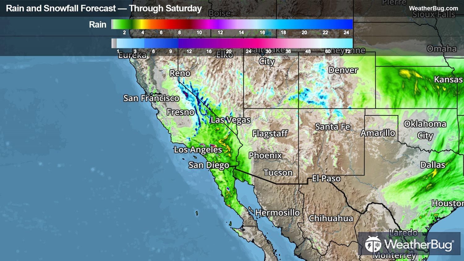
An area of low pressure will spin across parts of Southern California and into Arizona today into Saturday, bringing areas of rain and thunderstorms. Mountain snow will also be prevalent across Southern California through at least early this evening. Moisture will be brought in from the Pacific Ocean aiding in these areas of rain and snow across the Desert Southwest.
Localized flash flooding will be possible in parts of Southern California into southwestern Arizona through Saturday. Best areas to get the locally heavy rainfall will be in the deserts of Southern California into southwestern Arizona. Rain amounts of 0.5 to 1.5 inches are likely, with some local amounts approaching 2 inches in thunderstorm activity. Remember to turn around, don't drown when flooded roadways are seen.
Snow will fall across the San Bernardino County and Riverside County Mountains in Southern California through this afternoon and early evening. It will be heavy and wet making travel difficult, especially through early this afternoon. Snow totals of 4 to 8 inches are expected between 6,000 to 7,000 feet, while elevations above 7,500 feet will see 12 to 16 inches of accumulation.
Winter Weather Advisories and Winter Storm Warnings are in effect across the mountains of southern and eastern California.
It’s never too early to have a supply kit packed in case of inclement weather. A simple kit including a weather radio, water, blankets, batteries, and non-perishable food items will go a long way in the event of a power outage. It’s always best to avoid travel in rough weather as the roads will be dangerous.