Storms And Flooding Impact The Northern Plains To Tennessee
Strong to severe thunderstorms will occur across the northern Plains today bringing risks that will impact travel.
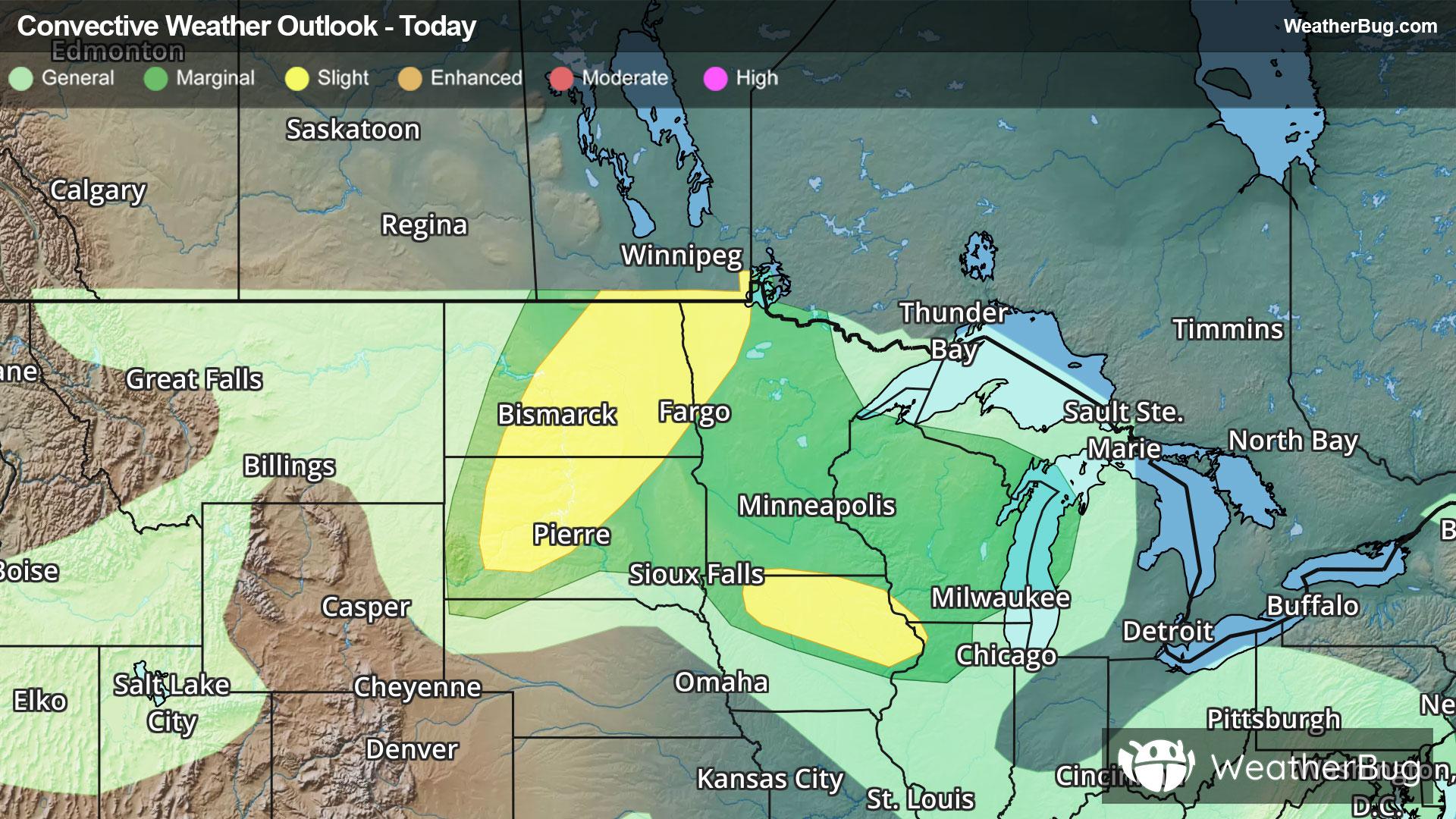
A disturbance will slowly spin across southern Canada and the northern Plains today causing showers and thunderstorms to form. Some of the thunderstorms will have the potential to produce heavy downpours, damaging wind gusts up to 60-80 mph, large hail and even a couple of tornadoes. The area of greatest concern for these thunderstorms will be across northern South Dakota, eastern North Dakota and into western parts of Minnesota.
The government's Storm Prediction Center has issued a Slight Risk (level 2 of 5) in eastern North Dakota, parts of South Dakota northwestern Minnesota and northern Iowa for today. Cities under this risk include Bismarck and Fargo, N.D., Pierre and Aberdeen, S.D. and Mason City, Iowa.
Severe Thunderstorm Watches are in effect currently for central North Dakota and southeastern South Dakota.
Locally heavy rain is likely across parts of southern Illinois, far southern Indiana, Kentucky amd Tennessee this morning. An additional 1 to 3 inches is expected with some locally higher totals possible. Flash Flood Watches remain in effect across these areas.
Make sure to know the difference between a watch and a warning should they be issued. A "watch" means that conditions are favorable for severe weather to occur, and to be on alert for any rapidly changing conditions. A "warning" means that severe weather is imminent, and you should act fast to remain safe.
The best way to remain safe is to stay prepared and informed about your local weather. Have a severe weather kit packed with a battery-operated radio, water, and non-perishable food items. Also, check the WeatherBug app frequently for any updates on today's severe weather. Remember, "When Thunder Roars, Go Indoors!"