
Weekend Weather Preview
Not one… not two… but three weather systems will disrupt the U.S. for the first weekend in “meteorological” summer. Outdoor plans may be in jeopardy thanks to widespread rain and thunderstorms.
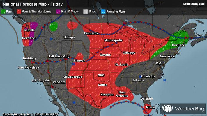
Saturday
One low pressure system will move from the Great Lakes into the Northeast. This low pressure will also force a cold front to push through the Midwest, Northeast and Mid-Atlantic. At the same time, an upper-level weather system will drift across the south-central U.S. A third disturbance and associated cold front will also come barreling into the Western U.S. All three of these weather systems will result in precipitation chances throughout much of the nation for the start of the weekend.
Rain and thunderstorms will be found throughout the Northeast, Mid-Atlantic, Lower Midwest, the southern half of the Plains and Mississippi Valley, the Rockies and Northwest. While possible throughout the day, the best chance of rain and thunderstorms will occur in the afternoon and evening. Temperatures could even be cold enough for wet snow or a rain/snow mix in the tallest parts of the northern Cascades.
There will be two areas that could see strong to severe thunderstorms on Saturday. One area will be the Ohio Valley into the Northeast, while the other spot will be the northern High Plains. With both regions, the main threats will be damaging winds and large hail. There could also be some gusty thunderstorms in the southern Plains.
Torrential downpours could also develop in the Ohio River Valley into the south-central U.S. Rainfall amounts of 1 to 3 inches will be common, with some locally higher amounts possible. This much rain combined with already very saturated soils could lead to some flooding concerns, especially near rivers, creeks and streams as well as urban and low-lying areas. If you do approach a flooded roadway, remember that it is always best to “Turn Around, Don’t Drown!”
Despite all this soggy, active weather, there will be several areas that remain free of precipitation for the start of the weekend. This includes the Southeast, the Upper Midwest and the Great Basin into California and the Desert Southwest.
Chilly temperatures are in store across the Northwest and northern Rockies, with highs generally in the 50s and 60s. Though, the higher elevations could only see temperatures peak in the 30s and 40s. The lowest elevations could report a few highs in the 70s. The interior Northeast will also experience highs in the upper 50s, 60s and lower 70s. Otherwise, most of the nation will report highs in the upper 70s, 80s and lower 90s. Highs in the mid to upper 90s will be scattered across the Mid-Atlantic, much of the High Plains and California’s Central Valley. Expect 90s and 100s throughout the Desert Southwest.
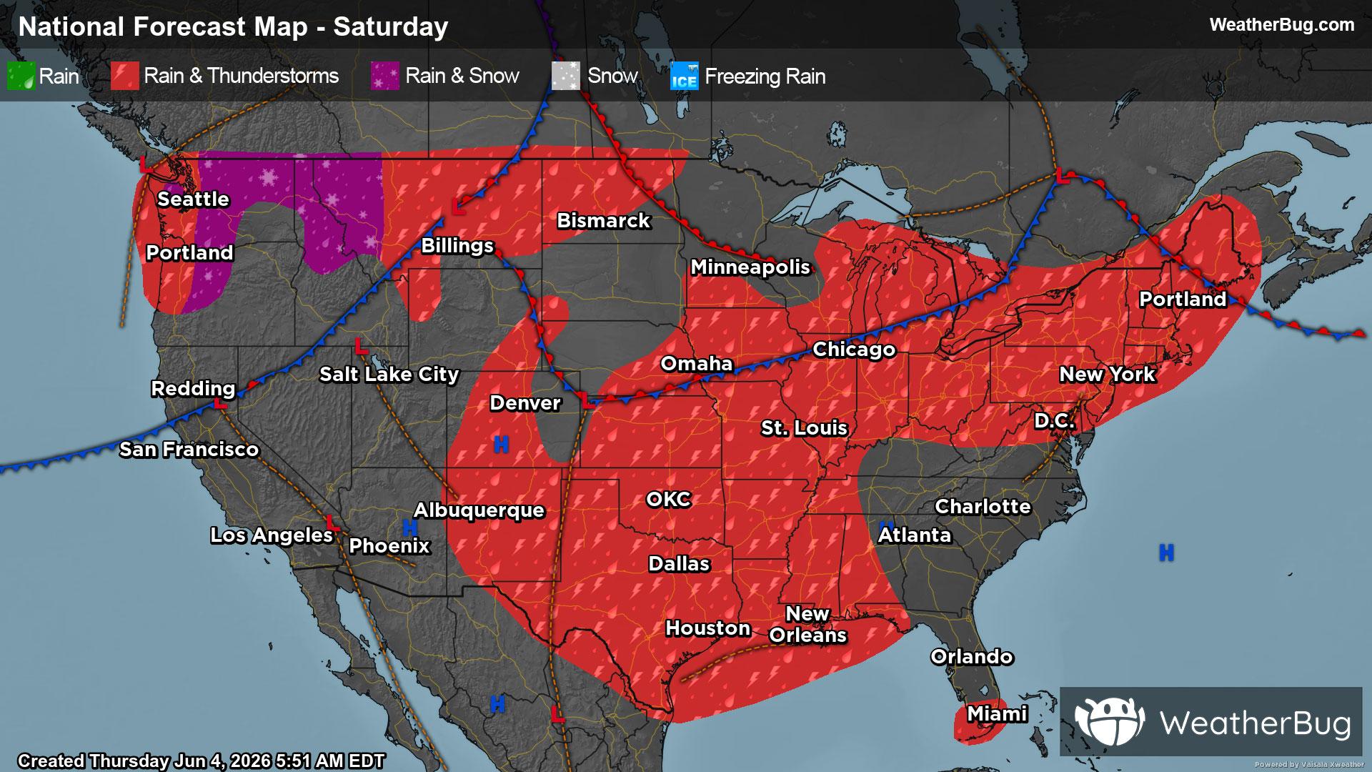
Sunday
The same three weather systems will remain in play on Sunday. The low pressure system in the Northeast will inch towards Atlantic Canada, while the disturbance in the nation’s midsection advances northeast towards the Lower Midwest. The large system and cold front in the West will advance eastward into the Rockies and High Plains.
Like Saturday, much of the nation will see rain and thunderstorms for the conclusion of the weekend. This includes the Northeast, Mid-Atlantic, Lower Midwest, most of the Plains and Mississippi Valley and Rocky Mountains. There could also be some spotty showers along the U.S.-Canada border in northern Washington and northern Idaho. There could be showers and thunderstorms at any point in the day, but the best timing will continue to be the afternoon and evening.
Severe weather and heavy downpours will be a possibility again on Sunday, mainly throughout the Plains and Mississippi Valley. High winds, large hail and localized flooding will be the main concerns, but an isolated tornado or two cannot be ruled out.
Besides a few showers or storms in south Florida, much of the Southeast will remain largely dry on Sunday. The Great Lakes and most areas west of the Rockies will also experience a quiet end to the weekend.
Temperatures will generally range from the 50s to lower 70s across the Northwest, but a few of the tallest peaks could only have highs in the 40s. The interior Northeast will also have highs in the 50s, 60s and lower 70s. Seventies and 80s will be common throughout much of the nation, with 90s being limited to the High Plains, Mid-Atlantic and Southeast. Triple-digit heat continues to bake the Desert Southwest.