



Weekend Weather Preview
A cold front moving through the Northeast will be the trigger for the soggiest weather of the weekend, while a Pacific storm starts to move into the parched Northwest.
Saturday
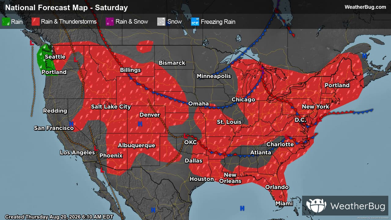
The weekend will start off on a bit of a stormy note, as a cold front slowly advances through the Great Lakes and Northeast. At the same time, low pressure will slide along the Eastern Seaboard, expanding the rainy weather. The Carolinas, Mid-Atlantic and western Great Lakes will be under the gun for rainfall in the morning, with the eastern Great Lakes, Northeast and Mid-Atlantic likely to see heavy rain in the afternoon. After a series of drenching storms, flooding is likely in some areas, so remember “Turn Around, Don’t Drown!”
A Pacific storm will start to move from British Columbia into the Pacific Northwest, bringing rain to the Olympic Peninsula and the rest of northwestern Washington. A few of the higher peaks could even see a little snow. Other than scattered showers in the Rockies and the typical daytime thunderstorms in Florida, the rest of the country will enjoy fair weather on Saturday.
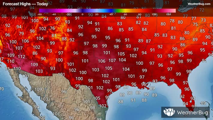
The Northeast, Great Lakes and Upper Midwest will be the coolest spots in the country, with highs in the 70s to lower 80s. Likewise, the coastal Northwest will see upper 60s and 70s under cloud-cover. For residents of the Rockies, interior West central Plains and into the Mid-Atlantic and Southeast, highs will reach the middle to upper 80s and even the lower 90s. The hottest weather is saved for the Southwest, Texas and Oklahoma, where triple-digit readings will be widespread.
Sunday
The end of the weekend will see a slow movement forward of Saturday’s weather systems. A disturbance trailing behind the Northeast cold front will bring scattered showers from eastern Ohio to New England and the northern Mid-Atlantic, while the tail end of the cold front will produce showers and thunderstorms in the eastern Carolinas and Florida.
Meanwhile, a low pressure system moving across western Canada will team up with monsoonal moisture to bring showers and a few thunderstorms from Montana to Arizona. The fringes of this system will also be responsible for scattered showers across northwestern Washington and the northern Plains.
Sunday’s temperatures will be a near carbon-copy of Saturday, with 70s and lower 80s spreading from the Dakotas to New England. Cool 60s and 70s will be found in the Pacific Northwest. While 80s to lower 90s will be found from Montana to Kansas and in a ribbon stretching across the Tennessee Valley and Mid-Atlantic, the hottest readings will once again be found from southern California and Arizona to Texas and across the Deep South. Here, upper 90s and 100s will be commonplace, with the humidity in the Southeast making it feel even warmer.