

What is Virga?
Have you ever heard of virga? Let’s take a look at this weird phenomenon and explain how it occurs.
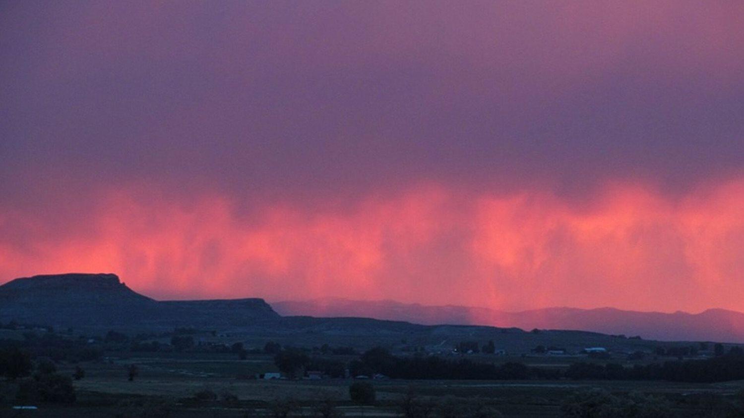
Simply put, virga is precipitation that does not make it to the ground. The word ‘virga’ has Latin roots and means “twig” or “branch". This is fitting because, as virga falls to the ground, it often looks like dark twigs or branches extending downward from a cloud’s base. If virga is present, it is most vibrant around sunrise or sunset. Its dark streaks through the air can contrast with the fiery red sky at dusk or dawn.
Virga can bring a stunning scene, so how exactly does virga develop? It has to deal with the distribution of moisture within the atmosphere.
Precipitation falls from clouds well above Earth’s surface, often thousands of feet in altitude. That means precipitation has a long way to fall before reaching the ground. Sometimes, there is a deep or particularly arid layer of dry, stable air in between the clouds and the ground.
Drier, more stable air leads to increased rates of evaporation. Precipitation may start falling in a moist environment near the cloud’s base, but then hit a large layer of dry air farther down in altitude. This dry air can lead the precipitation to evaporate on its descent toward the ground.
Since virga often forms where there is dry, stable air above the ground, it is no surprise that virga is often found in the desert, including the U.S. Desert Southwest. The dry air and often warm temperatures of deserts allow precipitation to quickly evaporate on the way to the ground, forming virga.
Virga can often appear rather dark and eerie. Occasionally, this scary-looking feature can be linked to a dangerous type of weather called microbursts.
Microbursts are small downbursts of wind from clouds. This wind is often strong and can be found at or above the surface. This strong wind can cause danger to flights as well as on the ground, often causing damage. Virga forms from microbursts as the strong winds carry precipitation down from the cloud, but the precipitation evaporates. If you see virga, you may need to prepare for gusty winds!
In addition to virga possibly being a sign of danger, it can cause a headache for weather forecasters. Although this precipitation does not reach the ground, virga can still often show up on weather radars. Weather forecasters may believe one area is receiving precipitation based on radar observations, but on the ground, it could be totally dry.
Without ground-based observations, weather forecasters take a risk in believing the radar. Looking at the atmospheric profile and amount of dry air can provide insight to forecasters, but weather is never a sure thing! Virga can cause meteorologists to catch the blame for a wrong prediction.
Virga can be a stunning scene, cause stunning weather, and stun meteorologists. Next time you see dark twig-like features reaching for the ground, remember this weather phenomenon and how it is a central part of the world of weather. It may affect you more than you think!
----
Sources: weather.gov, earthsky.org, epod.usra.edu
Story Image: Virga at sunset. (NOAA Photo Library/Meteorologist Kelly Allen)