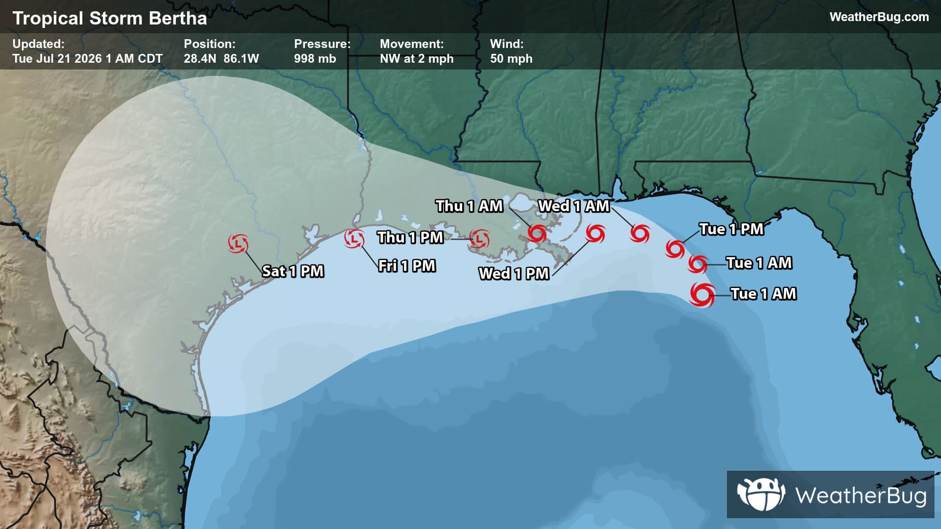
10-Day Weather Forecast - Daniels, WV
- |72°F
 80% Chance of RainHourly details
Tonight
72°FPartly cloudy with probable rain. Chance of precipitation 75%. Low temperature around 72F. Dew point will be around 68F with an average humidity of 85%. Winds will be 5 mph from the SW.
- 80|66°F
 70% Chance of StormsHourly details
Day
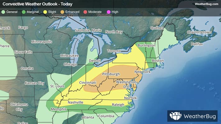
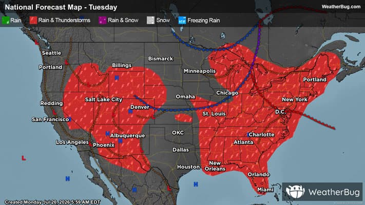
80°FMostly cloudy with a chance of thunderstorms. A chance of showers this morning then showers likely this afternoon. Some thunderstorms may produce small hail. Highs in the lower 80s. Southwest winds 10 to 15 mph with gusts up to 30 mph. Chance of rain 70 percent.
Night
66°F
Showers. A chance of thunderstorms. Some thunderstorms may produce damaging winds and small hail in the evening. Some thunderstorms may produce small hail after midnight. Lows in the mid 60s. Southwest winds 10 to 15 mph with gusts up to 25 mph. Chance of rain near 100 percent.
- 76|58°F50% Chance of StormsHourly details
Day
76°FMostly cloudy in the morning then becoming partly sunny. A chance of showers. A slight chance of thunderstorms in the afternoon. Highs in the mid 70s. Northwest winds 5 to 10 mph. Chance of rain 50 percent.
Night
58°FMostly cloudy with a chance of showers with a slight chance of thunderstorms in the evening then partly cloudy after midnight. Lows in the mid 50s. North winds 5 to 10 mph. Chance of rain 50 percent.
- 76|60°F
 Mostly SunnyHourly details
Day
76°FMostly sunny. Highs in the mid 70s. Northeast winds around 5 mph.
Night
60°F
Mostly clear in the evening then becoming partly cloudy. Lows in the upper 50s.
- 75|62°F
 Partly SunnyHourly details
Day
75°FPartly sunny. Highs in the mid 70s.
Night
62°F
Mostly cloudy with a chance of showers. Lows in the lower 60s. Chance of rain 50 percent.
Weekend Weather
- 75|62°F50% Chance of StormsHourly details
Day
75°FMostly cloudy with a chance of showers and thunderstorms. Highs in the mid 70s. Lows in the lower 60s. Chance of rain 50 percent.
Night
62°FMostly cloudy with a chance of showers and thunderstorms. Highs in the mid 70s. Lows in the lower 60s. Chance of rain 50 percent.
- 78|63°F
 40% Chance Rain ShowersHourly details
Day
78°FPartly sunny with a chance of showers. Highs around 80. Chance of rain 40 percent.
Night
63°FMostly cloudy with a chance of showers. Lows in the lower 60s. Chance of rain 50 percent.
- 82|68°F50% Chance of Storms
Day
82°FPartly sunny with a chance of showers. A chance of thunderstorms in the afternoon. Highs in the upper 70s. Chance of rain 50 percent.
Night
68°FMostly clear with a 60% chance for rain and thunderstorms. Low temperature around 68F. Dew point will be around 67F with an average humidity of 91%. Winds will be 4 mph from the SW.
- 80|64°F60% Chance of Storms
Day
80°FSunny with a 55% chance for rain and thunderstorms. High temperature around 80F. Dew point will be around 69F with an average humidity of 83%. Winds will be 7 mph from the W.
Night
64°FClear with a 50% chance for rain and thunderstorms. Low temperature around 64F. Dew point will be around 64F with an average humidity of 92%. Winds will be 3 mph from the W.
- 78|63°F
 40% Chance of Rain
Day
78°FSunny with a chance of rain. Chance of precipitation 35%. High temperature around 78F. Dew point will be around 66F with an average humidity of 82%. Winds will be 4 mph from the W.
Night
63°FClear with a slight chance of rain. Chance of precipitation 30%. Low temperature around 63F. Dew point will be around 63F with an average humidity of 90%. Winds will be 2 mph from the S.