10-Day Weather Forecast - Epworth, IA
- |66°F
 Mostly CloudyHourly details
Tonight
66°FMostly cloudy. Lows in the mid 60s. East winds around 5 mph.
Weekend Weather
- 84|65°F
 Mostly SunnyHourly details
Day
84°FMostly sunny. Highs in the mid 80s. Northeast winds 5 to 10 mph.
Night
65°F
Mostly clear. Lows in the mid 60s. East winds around 5 mph.
- 85|67°F
 SunnyHourly details
Day
85°FSunny. Highs in the mid 80s. East winds around 5 mph.
Night
67°F
Clear. Lows in the mid 60s. East winds around 5 mph in the evening becoming light and variable.
- 87|68°FSunnyHourly details
Day
87°FClear. Highs in the upper 80s. Lows in the upper 60s.
Night
68°FClear. Highs in the upper 80s. Lows in the upper 60s.
- 88|71°FSunnyHourly details
Day
88°FClear. Highs in the upper 80s. Lows in the upper 60s.
Night
71°FMostly clear. Lows in the upper 60s. Highs in the upper 80s.
- 89|71°FMostly SunnyHourly details
Day
89°FMostly clear. Lows in the upper 60s. Highs in the upper 80s.
Night
71°FMostly clear. Lows in the upper 60s. Highs in the upper 80s.
- 87|69°FMostly SunnyHourly details
Day
87°FMostly clear. Lows in the upper 60s. Highs in the upper 80s.
Night
69°F
Partly cloudy in the evening then becoming mostly clear. Lows in the upper 60s.
- 86|71°FSunny
Day
86°FSunny. Highs in the mid 80s.
Night
71°F
Clear with a 45% chance for rain and thunderstorms. Low temperature around 71F. Dew point will be around 68F with an average humidity of 76%. Winds will be 5 mph from the S.
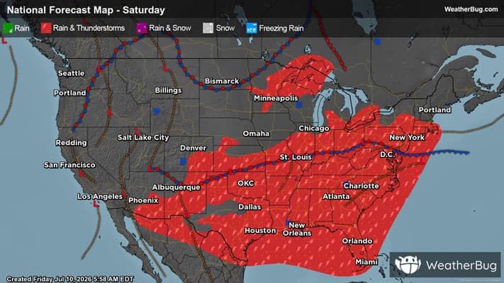
Weekend Weather
- 85|69°F
 30% Chance of Rain
Day
85°FSunny with a 35% chance for rain and thunderstorms. High temperature around 85F. Dew point will be around 70F with an average humidity of 72%. Winds will be 6 mph from the SW.
Night
69°F
Clear with a 40% chance for rain and thunderstorms. Low temperature around 69F. Dew point will be around 68F with an average humidity of 75%. Winds will be 2 mph from the W.
- 84|69°FSunny
Day
84°FSunny with widely scattered thunderstorms. Chance of storms 25%. High temperature around 84F. Dew point will be around 67F with an average humidity of 70%. Winds will be 2 mph from the NW.
Night
69°FClear with widely scattered thunderstorms. Chance of storms 25%. Low temperature around 69F. Dew point will be around 66F with an average humidity of 75%. Winds will be 1 mph from the SW.